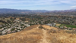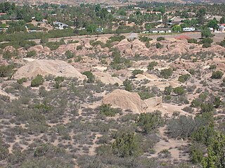
Acton is an unincorporated census-designated place in Los Angeles County, California, near the Antelope Valley. According to the 2010 census, Acton had a population of 7,596.

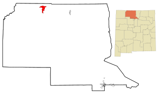
Dulce is a census-designated place (CDP) in Rio Arriba County, New Mexico, United States. The population was 2,743 at the 2010 census, almost entirely Native American. It is the largest community and tribal headquarters of the Jicarilla Apache Reservation.

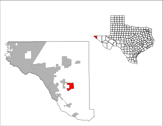
Agua Dulce is a census-designated place (CDP) in El Paso County, Texas, United States. The population was 3,014 at the 2010 census. It is part of the El Paso Metropolitan Statistical Area. The ZIP Code encompassing the CDP area is 79928.

Agua Dulce is a city in Nueces County, in the U.S. state of Texas. It is located on the Texas Mexican Railway at the intersection of Farm Road 70 and State Highway 44 in west-central Nueces County. The name, Spanish for "sweet water", refers to a nearby creek. A town in Texas, Sweetwater in Nolan County in West Texas, uses the English name.

The Antelope Valley is located in northern Los Angeles County, California, and the southeast portion of Kern County, California, and constitutes the western tip of the Mojave Desert. It is situated between the Tehachapi, Sierra Pelona, and the San Gabriel Mountains. The valley was named for the pronghorns that roamed there until they were all but eliminated in the 1880s, mostly by hunting, or resettled in other areas. The principal cities in the Antelope Valley are Palmdale and Lancaster.
Agua Dulce is Spanish for freshwater, literally meaning sweet water. Agua Dulce may refer to:

The Santa Clarita Valley (SCV) is part of the upper watershed of the Santa Clara River in Southern California. The valley was part of the 48,612-acre (19,673 ha) Rancho San Francisco Mexican land grant. Located in Los Angeles County, its main population center is the city of Santa Clarita which includes the communities of Canyon Country, Newhall, Saugus, and Valencia. Adjacent unincorporated communities include Castaic, Stevenson Ranch, Val Verde, and the unincorporated parts of Valencia.

Agua Dulce is a census-designated place in Los Angeles County, California, United States. It lies at an elevation of 2,526 feet (770 m), northeast of Santa Clarita. The community had a population of 3,342 at the 2010 census and covers a geographic area of about 23 square miles (59 km2). The ZIP code is 91390, and the area code is 661.

Soledad Canyon is a long narrow canyon/valley located in Los Angeles County, California between the cities of Palmdale and Santa Clarita. It is a part of the Santa Clara River Valley, and extends from the top of Soledad Pass to the open plain of the Valley in Valencia. The upstream section of the Santa Clara River runs through it.

Area code 661 is a California telephone area code that covers the majority of California's Kern County, as well as part of Los Angeles County, Santa Barbara County, and Tulare County. It was split from area code 805 on February 13, 1999.
Agua Dulce Independent School District is a public school district based in the community of Agua Dulce, Texas (USA). The district serves students in west central Nueces and east central Jim Wells counties.

Clint Independent School District is a public school district in eastern El Paso County, Texas (US).

Newhall is a rail station in the city of Santa Clarita, California. The station is served by Metrolink's Antelope Valley Line operating between Los Angeles Union Station and Lancaster and Amtrak Thruway Motorcoach buses to/from Bakersfield.

Agua Dulce Airpark, also known as Agua Dulce Airport, is a public-use airport located 2 miles (3.2 km) east of the central business district of Agua Dulce, in Los Angeles County, California, United States.
Agua Dulce Municipality is a municipality in Veracruz, Mexico. It is located about 330 kilometres (210 mi) southeast from the state capital Xalapa. It has an area of 259.25 square kilometres (100.10 sq mi).

The Agua Dulce Mountains are a mountain range in the north-central Sonoran Desert of southwestern Arizona. The range is located in the extreme southwestern portion of Pima County, Arizona, immediately north of the international boundary with Mexico and about 30 miles southwest of Ajo, Arizona. The range has three main sections that total about 15 miles in length and about nine miles in width. The range is located entirely within the Cabeza Prieta National Wildlife Refuge. The highpoint of the range is 2,852 feet above sea level and is located at 32°01'32"N, 113°08'44"W. The summit is unnamed, but is marked on U.S. Geological Survey (USGS) maps for the "Quitovaquita" benchmark that was placed on the summit in 1920. The original surveyed height was 2,850 feet above sea level, but recent datum adjustments calculate the summit to be two feet higher.
Agua Dulce High School is a public high school located in the city of Agua Dulce, Texas and classified as a 2A school by the UIL. It is a part of the Agua Dulce Independent School District located in western Nueces County and eastern Jim Wells County. In 2015, the school was rated "Met Standard" by the Texas Education Agency.
The Western Maricopa Education Center (West-MEC) is a joint technological education district based in Maricopa County, Arizona, United States. It provides career and technical education services to ten school districts in the West Valley of Phoenix.

"Agua Dulce, Agua Salá" is a song from Spanish singer Julio Iglesias's studio album La Carretera (1995). The song was written by Estéfano, Donato Poveda, and Hal Batt and produced by Ramón Arcusa. It was released as the lead single from the album in 1995. A rumba flamenca, the song deals with the theme of life. The song received positive reactions from music critics, mostly being found catchy by them. It was a recipient of the ASCAP Latin Award in 1996. Commercially, the song peaked at number three on the Hot Latin Songs chart and number one on the Latin Pop Airplay chart in the United States. A music video for the song was filmed in Spain and features Fabiola Martinez. Iglesias also recorded it in Portuguese as "Água Doce, Água do Mar" for his studio album Ao Meu Brasil (2000).


