Acuera

Last updated

Acuera was the name of both an indigenous town and a province or region in central Florida during the 16th and 17th centuries. The indigenous people of Acuera spoke a dialect of the Timucua language. In 1539 the town first encountered Europeans when it was raided by soldiers of Hernando de Soto's expedition. French colonists also knew this town during their brief tenure (1564–1565) in northern Florida.

Contents

Late in the 16th century, Acuera came under Spanish influence as it expanded its settlements. Two or three Spanish missions were founded in the Acuera province in the 17th century.

Location

Based on distances between indigenous towns reported by Spanish explorers, anthropologists Jerald T. Milanich and Charles Hudson locate the town of Acuera in central Florida near Lake Weir and Lake Griffin, near the headwaters of the Oklawaha River, a tributary of the St. Johns River. A map produced by Jacques le Moyne, who was part of the late 16th-century French attempt to colonize Florida at Fort Caroline, shows a town called Aquouena (Acuera?) east of Eloquale (Ocale), on a tributary of the St. Johns River. The French also recorded a chief named Acquera being a vassal of Chief Utina.

The 17th-century Spanish missions of San Luis de Acuera and Santa Lucia de Acuera were reported to be at distances from St. Augustine that are consistent with the missions being located near the Oklawaha River and Lake Weir.

In 1836 Lake Weir was identified on an Anglo-American map as "Lake Ware." Milanich and Hudson speculate that "Ware" was derived from "Acuera". Boyer has identified the Hutto/Martin Site, 8MR3447, a little to the north of Lake Weir, as being the site of the 17th-century mission of Santa Lucia de Acuera and the likely site of the town of Acuera recorded in the Ranjel account of the Hernando de Soto entrada. [1]

The territory occupied by the Acuera people in historical times was part of the St. Johns culture. It is characterized by the people's creating shell middens from their refuse, and burial mounds for their dead. They made a "chalky" pottery based on the use of freshwater sponge spicules as a temper, sometimes decorated with check-stamping. [2] [3] [4] [5] [6]

Language

"Santa Lucia de Acuera" was one of nine or ten dialects of the Timucua language named by the Franciscan missionary Francisco Pareja in the early 17th century. Pareja regarded the Santa Lucia de Acuera and Tucururu (which may have adjoined Acuera) dialects as the most divergent from what he considered the standard dialect, that of Mocama. [7] [8]

Political organization

The province of Acuera may have consisted of several small chiefdoms, including Avino, Eloquale, and Acuera. Utiaca may have been under the chief of Avino, while Piliuco, and possibly Mocoso, were towns under the chief of Acuera. Tucuru may have been under Avino, or may have been independent. The caciques (chiefs) of Tucuru and Eloquale visited St. Augustine earlier than the cacica (female chief) of Acuera did.

Eloquale, a town on the Oklawaha River, may have been a new location for the town of Ocale, which was near the Withlacoochee River when the de Soto expedition stopped there for two weeks in 1539. [9] [10] Ocale was also referred to as Cale and Etocale by Spanish chroniclers of the de Soto expedition. After the de Soto expedition stayed in 1539 at the town of Mocoso on Tampa Bay, it may have been relocated to the province of Acuera. [11] [12]

European contact

Route of the de Soto Expedition. DeSoto Map Leg 1 HRoe 2008.jpg
Route of the de Soto Expedition.

In 1539 Hernando de Soto landed in Tampa Bay with more than 600 men and 200 horses. The expedition intended to live off the land, taking food stored in the towns along their path. De Soto received a report of a large town named Acuera, said to have abundant maize. De Soto's main forces moved north from Tampa Bay to Ocale, where they stopped for two weeks. While at Ocale, de Soto twice sent soldiers to seize maize from Acuera. The Acuera strongly resisted the Spanish incursions. Garcilaso de la Vega, known as El Inca, in his later romanticized and somewhat less than reliable history of the de Soto expedition, portrayed the Acuera as proud and fierce warriors. [13] [14] [15] [16]

With the establishment of Fort Caroline in 1564 by French Huguenots near the mouth of the St. Johns River, the Acuera, along with most other Timucua speakers, came into continuing contact with Europeans. The Spanish drove the French out of Florida the next year and established St. Augustine. During this period the Acuera chiefdom was subject to or associated with the Utina chiefdom, but became independent of Utina as that chiefdom declined in power.

The cacica (female chief) of Acuera went to St. Augustine in 1597 to render obedience to Spain. Most of the other Timucua chiefdoms had also done so by this time, and had requested missionaries be sent to their provinces. However, a rebellion in Guale that occurred shortly before the Acuera submission to Spain resulted in almost all missionaries being withdrawn from Spanish Florida. Acuera sent laborers to St. Augustine during the period from 1597 to 1602. People from Acuera also went to St. Augustine to trade deer skins, chestnuts, and pots. [17] [18] [19]

Missions

Red dots mark archaeological sites on the Oklawaha River that may have been Acuera missions. Acueratownsites.png
Red dots mark archaeological sites on the Oklawaha River that may have been Acuera missions.

The mission of San Blas de Habino was established after 1610 to serve the towns of Avino, Tucuru and Utiaca, which were on the lower to middle Oklawaha River, at intervals of one-and-a-half to two leagues apart. [20] [21] The Spanish may have regarded this area as part of the Acuera province, or Avino may have been an alternate name for Acuera. The mission of San Blas de Habino probably was abandoned by the late 1620s.

The mission of Santa Lucia de Acuera was established by 1627, when Father Pareja named one of the dialects of the Timucua language after the mission. The mission of San Luis de Eloquale [Footnote 1] was noted in a Spanish report in 1630. Both missions may have been established by the 1620s. No missions in Acuera province appear in Spanish records after the Timucuan Rebellion of 1656, but the Acuera appear to have remained in their traditional territory throughout the rest of the seventeenth century. [22] [23]

In the late 1620s the Spanish resettled the indigenous people of Utiaca at the mission of San Diego de Helaca (or Laca) on the east side of the St. Johns River, where the route from St. Augustine to the western Timucuan missions crossed the river. [Footnote 2] They were probably needed there to serve the river crossing, as the original inhabitants, the Agua Dulce people, were greatly reduced in numbers. Epidemics of new infectious diseases, which were endemic among the Europeans, caused high mortality rates and severely affected Timucua mission communities in the 1650s. Following the Timucua rebellion of 1656, the Spanish consolidated missions closer to the road connecting St. Augustine to the Apalachee Province. Their efforts to maintain missions in Acuera province stopped after the 1656 rebellion.

Even at the height of the Spanish founding missions in Acuera province, the Acuera were virtually unique among the Timucua peoples in that they appear to have created a "parallel" system of religious authority to that of the missionaries. Their traditional religious leaders, who had substantial followings, openly practiced their beliefs. [24] [25] Historical and recent archaeological evidence suggests that conversion to Catholicism may have been limited to either the chiefly class or to refugees from other Timucuan groups forced into missions. [26] [27] [28]

After the Timucuan Rebellion in 1656, the Acuera seem to have either defied or not been subject to the order of Spanish governor Diego de Rebolledo to consolidate along the Camino Real. [29] [30] During the latter half of the seventeenth century, Spanish records indicate the Acuera maintained a traditional religious and political system, with multiple towns and villages. [31] Calesa, nephew of the Acuera chief Jabahica, was tried in 1678 by the Governor of Florida for multiple murders (he was accused of six, and admitted in court to three). Boyer has argued that these killings had a religious and social significance to the Acuera. [32] The Acuera last appeared in Spanish records in 1697, in a report that (non-Christian) Acuera living in a village with the Ayapaja, under a single chief, had left the village to "live in the woods". [33] [34] [35] [36]

The indigenous people living in mission villages along the road between St. Augustine and the western Timucuan provinces, and later, Apalachee Province, were subject to labor drafts. Workers were required to carry produce from the western Timucuam provinces and Apalachee to St. Augustine, and also to work in the town of St. Augustine. Residents of those villages, escaping such labor duties, fled southward into the Acuera, Agua Dulce and Mayaca provinces (by the 1640s the Spanish referred to those provinces as a group as the Diminiyuti or Ibiniyuti Province [ibiniuti was Timucuan for "water land"]). In 1648, the cacique of the Utiaca fled with part of his people from San Diege de Helaca and returned to Acuera Province. [37] [38]

Footnotes

  1. "Eloquale" may be an alternate form of "Ocale" or "Etocale". The town of Ocale was located near the Withlacoochee River when it was visited by Hernando de Soto in 1539, but may have been moved to the Oklawaha River by the early 17th century. It was located about two leagues from the mission of Santa Lucia de Acuera. The town of Mocoso, located on Tampa Bay when it was visited by de Soto in 1539, may have also been relocated to Acuera Territory.(Hann: 135. Worth 1: 71, 95.)
  2. The mission village of San Diego was apparently moved sometime before 1689 to the nearby site of Salamototo. The mission village of San Diego, both at Helaca and at Salamototo, was populated with people moved from abandoned missions in Acuera, Agua Dulce and Mayaca provinces.(Worth 2: 100)

See also

Related Research Articles

Tocobaga was the name of a chiefdom, its chief, and its principal town during the 16th century. The chiefdom was centered around the northern end of Old Tampa Bay, the arm of Tampa Bay that extends between the present-day city of Tampa and northern Pinellas County. The exact location of the principal town is believed to be the archeological Safety Harbor site, which gives its name to the Safety Harbor culture, of which the Tocobaga are the most well-known group.
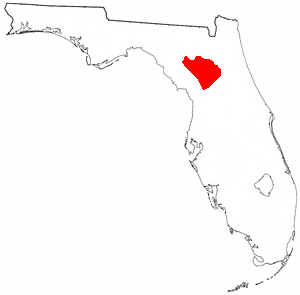
<span class="mw-page-title-main">Potano</span> Native American chiefdom in Florida, US

The Potano tribe lived in north-central Florida at the time of first European contact. Their territory included what is now Alachua County, the northern half of Marion County and the western part of Putnam County. This territory corresponds to that of the Alachua culture, which lasted from about 700 until 1700. The Potano were among the many tribes of the Timucua people, and spoke a dialect of the Timucua language.

Utinahica was a town that was the site of a Spanish mission, Santa Isabel de Utinahica. It may have been the chief town of a Timucua tribe and chiefdom in the 17th century, but Hann says there is not enough known about it to be sure. The name means "lord's village". Utinahica, was called a "province" in one Spanish report. It was 30 leagues east of Arapaha, and 50 leagues northeast of the town of Tarihica in the Northern Utina Province. It was at or near where the Oconee and Ocmulgee rivers join to form the Altamaha River. The people of Utinahica apparently practiced a regional variant of the Lamar regional culture, unusual for a Timucuan-speaking people. Worth identifies the province of Utinahica with archaeological sites, including the Lind Landing site, Coffee Bluff site, and Bloodroot site, that have yielded artifacts of the Square Ground Lamar culture from before the 15th century until the middle of the 17th century. The Square Ground Lamar culture is otherwise associated with sites occupied by speakers of Muskogean languages. Archaeological sites identified with all other known Timucuan-speakers, with the possible exception of Guadalquini, do not have affinities with the Square Ground Lamar culture.

<span class="mw-page-title-main">Mocama</span> Indigenous people of Florida and Georgia, US

The Mocama were a Native American people who lived in the coastal areas of what are now northern Florida and southeastern Georgia. A Timucua group, they spoke the dialect known as Mocama, the best-attested dialect of the Timucua language. Their heartland extended from about the Altamaha River in Georgia to south of the mouth of the St. John's River, covering the Sea Islands and the inland waterways, Intracoastal. and much of present-day Jacksonville. At the time of contact with Europeans, there were two major chiefdoms among the Mocama, the Saturiwa and the Tacatacuru, each of which evidently had authority over multiple villages. The Saturiwa controlled chiefdoms stretching to modern day St. Augustine, but the native peoples of these chiefdoms have been identified by Pareja as speaking Agua Salada, which may have been a distinct dialect.

<span class="mw-page-title-main">Spanish missions in Florida</span> Catholic religious outposts

Beginning in the second half of the 16th century, the Kingdom of Spain established a number of missions throughout La Florida in order to convert the Native Americans to Christianity, to facilitate control of the area, and to prevent its colonization by other countries, in particular, England and France. Spanish Florida originally included much of what is now the Southeastern United States, although Spain never exercised long-term effective control over more than the northern part of what is now the State of Florida from present-day St. Augustine to the area around Tallahassee, southeastern Georgia, and some coastal settlements, such as Pensacola, Florida. A few short-lived missions were established in other locations, including Mission Santa Elena in present-day South Carolina, around the Florida peninsula, and in the interior of Georgia and Alabama.

<span class="mw-page-title-main">Timucua</span> Native American people

The Timucua were a Native American people who lived in Northeast and North Central Florida and southeast Georgia. They were the largest indigenous group in that area and consisted of about 35 chiefdoms, many leading thousands of people. The various groups of Timucua spoke several dialects of the Timucua language. At the time of European contact, Timucuan speakers occupied about 19,200 square miles (50,000 km2) in the present-day states of Florida and Georgia, with an estimated population of 200,000. Milanich notes that the population density calculated from those figures, 10.4 per square mile (4.0/km2) is close to the population densities calculated by other authors for the Bahamas and for Hispaniola at the time of first European contact. The territory occupied by Timucua speakers stretched from the Altamaha River and Cumberland Island in present-day Georgia as far south as Lake George in central Florida, and from the Atlantic Ocean west to the Aucilla River in the Florida Panhandle, though it reached the Gulf of Mexico at no more than a couple of points.

The indigenous peoples of Florida lived in what is now known as Florida for more than 12,000 years before the time of first contact with Europeans. However, the indigenous Floridians living east of the Apalachicola River had largely died out by the early 18th century. Some Apalachees migrated to Louisiana, where their descendants now live; some were taken to Cuba and Mexico by the Spanish in the 18th century, and a few may have been absorbed into the Seminole and Miccosukee tribes.

<span class="mw-page-title-main">Mocoso</span> 16th-century chiefdom in Florida

Mocoso was the name of a 16th-century chiefdom located on the east side of Tampa Bay, Florida near the mouth of the Alafia River, of its chief town and of its chief. Mocoso was also the name of a 17th-century village in the province of Acuera, a branch of the Timucua. The people of both villages are believed to have been speakers of the Timucua language.

<span class="mw-page-title-main">Saturiwa</span> Timucua chiefdom in Spanish Florida

The Saturiwa were a Timucua chiefdom centered on the mouth of the St. Johns River in what is now Jacksonville, Florida. They were the largest and best attested chiefdom of the Timucua subgroup known as the Mocama, who spoke the Mocama dialect of Timucuan and lived in the coastal areas of present-day northern Florida and southeastern Georgia. They were a prominent political force in the early days of European settlement in Florida, forging friendly relations with the French Huguenot settlers at Fort Caroline in 1564 and later becoming heavily involved in the Spanish mission system.

<span class="mw-page-title-main">Agua Dulce people</span> Timucua tribe in Spanish Florida

The Agua Dulce or Agua Fresca (Freshwater) were a Timucua people of northeastern Florida. They lived in the St. Johns River watershed north of Lake George, and spoke a dialect of the Timucua language also known as Agua Dulce.

<span class="mw-page-title-main">Northern Utina</span> Extinct Native American people in Florida

The Northern Utina, also known as the Timucua or simply Utina, were a Timucua people of northern Florida. They lived north of the Santa Fe River and east of the Suwannee River, and spoke a dialect of the Timucua language known as "Timucua proper". They appear to have been closely associated with the Yustaga people, who lived on the other side of the Suwannee. The Northern Utina represented one of the most powerful tribal units in the region in the 16th and 17th centuries, and may have been organized as a loose chiefdom or confederation of smaller chiefdoms. The Fig Springs archaeological site may be the remains of their principal village, Ayacuto, and the later Spanish mission of San Martín de Timucua.

The Yustaga were a Timucua people of what is now northwestern Florida during the 16th and 17th centuries. The westernmost Timucua group, they lived between the Aucilla and Suwannee Rivers in the Florida Panhandle, just east of the Apalachee people. A dominant force in regional tribal politics, they may have been organized as a loose regional chiefdom consisting of up to eight smaller local chiefdoms.

Benito Ruíz de Salazar Vallecilla was twice governor of Spanish Florida, from 1645 to 1646 and from 1648 to 1651.

<span class="mw-page-title-main">Orange Lake (Florida)</span> Lake in Florida, United States of America

Orange Lake is in Alachua County, Florida, about 10 miles (16 km) south of Hawthorne. It has an area of about 12,550 acres (5,080 ha), and is part of the Orange Creek Basin, which is in turn part of the Oklawaha River watershed. Cross Creek flows into it from Lochloosa Lake, and Orange Creek drains it into the Rodman Reservoir. Orange Lake also receives water from Newnans Lake that has been diverted from its historic destination of Paynes Prairie. Orange Lake is noted for fishing, especially bass, with many fishing camps on its shores. The lake also has many natural floating islands, which have an "unusually high diversity", especially of amphibians.

Ocale was the name of a town in Florida visited by the Hernando de Soto expedition, and of a putative chiefdom of the Timucua people. The town was probably close to the Withlacoochee River at the time of de Soto's visit, and may have later been moved to the Oklawaha River.

San Buenaventura de Potano was a Spanish mission near Orange Lake in southern Alachua County or northern Marion County, Florida, located on the site where the town of Potano had been located when it was visited by Hernando de Soto in 1539. The Richardson/UF Village Site (8AL100), in southern Alachua County, has been proposed as the location of the town and mission.

Tomás Menéndez Márquez y Pedroso (1643–1706) was an official in the government of Spanish Florida, and owner, with his brothers, of the largest ranch in Spanish Florida. He was captured by pirates in 1682 and held for ransom, but was rescued by the Timucua.

Arapaha was a Timucua town on the Alapaha River in the 17th century. The name was also sometimes used to designate a province or sub-province in Spanish Florida.

Urriparacoxi, or Paracoxi, was the chief of a Native American group in central Florida at the time of Hernando de Soto's expedition through what is now the southeastern United States. "Urriparacoxi" was a title, meaning "war leader". There is no known name for the people he led, or for their territory.

The Hutto/Martin site is an archaeological site located in Marion County, Florida, located near the Ocklawaha River. Excavations at the site by Dr. Willet A. Boyer, III between 2006 and 2012 have led archaeologists to believe that it is the location of both a past Native American town and Spanish mission, associated with the Timucuan chiefdom of Acuera described in early contact and mission-era Spanish accounts from the sixteenth and seventeenth century.

References

  1. Boyer,III, Willet. "The Hutto/Martin Site of Marion County, Florida, 8MR3447: Studies at an Early Contact/Mission Site". The Florida Anthropologist Volume 70(3:122-139) 2017.{{cite journal}}: Cite journal requires |journal= (help) On-line as "The Hutto/Martin Site of Marion County, Florida, 8MR3447: Studies at an Early Contact/Mission Site". academia.edu. 7 December 2017. Retrieved 7 December 2017.
  2. Boyer 2009: 47
  3. Hann 1996: 12, 13
  4. Milanich and Hudson: 94, 96, 131
  5. Milanich 1995: 82, 170, 176
  6. Boyer 2010
  7. Hann 1996: 6, 12
  8. Milanich 1995: 82
  9. Boyer, Willet A. III (2009). "Missions to the Acuera: An Analysis of the Historic and Archaeological Evidence for European Interaction With a Timucuan Chiefdom". The Florida Anthropologist. 62 (1–2): 45–56. ISSN   0015-3893 . Retrieved 3 July 2012.
  10. Boyer, Willet A. III (2010). The Acuera of the Oklawaha River Valley: Keepers of Time in the Land of the Waters (PDF) (dissertation). University of Florida. Retrieved 4 July 2012.
  11. Hann 2003: 135
  12. Worth 1: 65, 66, 95
  13. Boyer 2009: 46
  14. Hann 1996: 12
  15. Milanich and Hudson: 71-73, 81-87, 96, 133
  16. Milanich 1995: 132
  17. Hann 1996: 147, 163
  18. Milanich 1995: 89
  19. Worth 1: 22, 25, 50, 52, 54
  20. Boyer 2009
  21. Boyer 2010
  22. Boyer 2009
  23. Boyer 2010
  24. Boyer 2009
  25. Boyer 2010
  26. Boyer 2009
  27. Boyer 2010
  28. Boyer 2017
  29. Worth 2
  30. Boyer 2010
  31. Boyer 2010
  32. Boyer 2010
  33. Boyer 2009: 46, 47, 49
  34. Hann 1996: 13, 174, 178, 190-91, 240-41, 244
  35. Worth 1: 63, 65, 69, 71
  36. Worth 2: 31-32
  37. Milanich 1995: 170
  38. Worth 2: 25, 31, 32, 100

Works cited