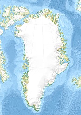
North Ice was a research station of the British North Greenland Expedition on the inland ice of Greenland. The coordinates of the station were 78°04′N38°29′W, at an altitude of 2,341 metres (7,680 ft) above sea level. The British North Greenland Expedition had its main base camp in Britannia Lake, Queen Louise Land. It was led by Commander James Simpson RN. The station recorded a temperature of −66.1 °C (−87.0 °F) on 9 January 1954, which made it the lowest temperature ever recorded in North America up until that time. It was superseded by an observation of −69.6 °C (−93.3 °F) at the Greenland Ice Sheet on 22 December 1991. The name of the station contrasts to the former British South Ice station in Antarctica.

Peary Land is a peninsula in northern Greenland, extending into the Arctic Ocean. It reaches from Victoria Fjord in the west to Independence Fjord in the south and southeast, and to the Arctic Ocean in the north, with Cape Morris Jesup, the northernmost point of Greenland's mainland, and Cape Bridgman in the northeast.

The British North Greenland expedition was a British scientific mission, led by Commander James Simpson RN, which lasted from July 1952 to August 1954. A total of 30 men took part, though not all stayed for both years.
Johan Peter Koch was a Danish captain and explorer of the Arctic dependencies of Denmark, born at Vestenskov. He was the uncle of the geologist Lauge Koch

Lindhard Island is an uninhabited island of NE Greenland.

The Watkins Range is Greenland's highest mountain range. It is located in King Christian IX Land, Sermersooq municipality.

Storstrommen, is one of the major glaciers in northeastern Greenland. The North-East Greenland Ice Stream (NEGIS) discharges into 3 main marine-terminating outlets: 79N Glacier, Zachariae Isstrøm and Storstrommen - as arranged North to South.

King Frederik VIII Land is a major geographic division of northeastern Greenland. It extends above the Arctic Circle from 76°N to 81°N in a North-South direction along the coast of the Greenland Sea.
Adolf S. Jensen Land is a peninsula in the southern limit of King Frederick VIII Land, northeastern Greenland. Administratively it belongs to the NE Greenland National Park area.
Queen Louise Land is a vast mountainous region located west of Dove Bay, King Frederik VIII Land, northeastern Greenland. Administratively it is part of the Northeast Greenland National Park zone.

Academy Glacier, is one of the major glaciers in northern Greenland.
Louise Boyd Land is an area in King Christian X Land, Eastern Greenland. Administratively it lies in the Northeast Greenland National Park zone. The area is remote and uninhabited.

Flade Isblink is an ice cap on the Crown Prince Christian Land peninsula, King Frederick VIII Land, NE Greenland.

Britannia Lake, is a lake in King Frederik VIII Land, Northeastern Greenland. The lake and its surroundings are part of the Northeast Greenland National Park zone.

Britannia Glacier is a glacier in Queen Louise Land, northeastern Greenland. Administratively it belongs to the Northeast Greenland National Park.

Admiralty Glacier is a glacier in Queen Louise Land, northeastern Greenland. Administratively it belongs to the Northeast Greenland National Park.

Eventyrfjelde is a group of nunataks in Queen Louise Land, NE Greenland. Administratively it is part of the Northeast Greenland National Park zone.

Trefork Lake, is a lake in King Frederik VIII Land, Northeastern Greenland. The lake and its surroundings are part of the Northeast Greenland National Park zone.

Carlsbergfondet Land is a group of nunataks in Queen Louise Land, NE Greenland. Administratively it is part of the Northeast Greenland National Park zone.