
Haar is a municipality in the district of Munich, in Bavaria, Germany. It is 12 km east of Munich (centre). As of 2017 it had a population of more than 20,000.

Mainburg is a town in the district of Kelheim, in Bavaria, Germany. It is situated on the river Abens, 30 km northwest of Landshut and 30 km southeast of Ingolstadt.
Gräfelfing is a municipality in the district of Munich, in Bavaria, Germany. It is located 1 km west of Munich.
Lappersdorf is a municipality in the district of Regensburg, in Bavaria, Germany. It is situated on the river Regen, 4 km north of Regensburg.
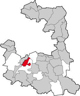
Kirchheim bei München is a municipality in the district of Munich, in Bavaria, Germany. It is located 14 km east of Munich (centre). As of 2020 it has a population of 12,787.

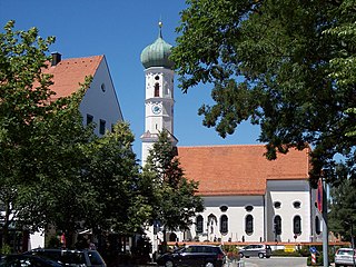
Peiting is a municipality in the Weilheim-Schongau district, in Bavaria, Germany. It is situated on the right bank of the Lech, 3 km southeast of Schongau, and 17 km west of Weilheim in Oberbayern.

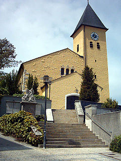
Ergolding is a municipality in the district of Landshut, in Bavaria, Germany. It is situated on the left bank of the Isar, 5 km northeast of Landshut.
Grünwald is a municipality in the district of Munich, in the state of Bavaria, Germany. It is located on the right bank of the Isar, 12 km southwest of Munich (centre). As of 31 December 2011 it had a population of 11,109.

Feldkirchen-Westerham is a municipality in the district of Rosenheim, in Bavaria, Germany. It is situated 22 km west of Rosenheim.

Merkendorf is a town and municipality in the district of Ansbach, in Bavaria, Germany. It is situated 14 km southeast of Ansbach.

Pleystein is a municipality in the district of Neustadt an der Waldnaab, in Bavaria, Germany. It is situated 18 km east of Weiden in der Oberpfalz, and 11 km west of Rozvadov.

Pressath is a municipality in the district of Neustadt an der Waldnaab, in Bavaria, Germany. Pressath was founded in 1657. It is situated 20 km northwest of Weiden in der Oberpfalz and ca. 7 km north of Grafenwöhr.

Speichersdorf is a municipality in the district of Bayreuth in Bavaria in Germany. It is situated near the Fichtelgebirge, 18 km eastern of Bayreuth. It has a population of about 6,200.

Oberau is a municipality in the district of Garmisch-Partenkirchen, in Bavaria, Germany.

Haag in Oberbayern is a municipality in the district of Mühldorf in Bavaria in Germany, in December 2013 the municipality had a population of 6359.

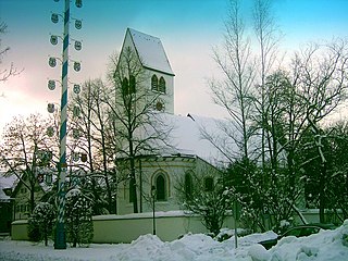
Hohenbrunn is a municipality in the district of Munich in Bavaria, Germany.

Kohlberg is a municipality in the district of Neustadt an der Waldnaab] in Bavaria, Germany. It is situated c. 17 km (11 mi) southwest of Weiden in der Oberpfalz and c. 10 km (6.2 mi) northeast of Hirschau.
Burglauer is a municipality in the district of Rhön-Grabfeld in Bavaria, Germany. It lies on the river Lauer.

Kürnach is a municipality in the district of Würzburg in Bavaria in Germany. The distance from Kürnach to the state capital of Bavaria München is about 221 km.

Chiemsee is a municipality in the district of Rosenheim in Bavaria in Germany, named after the lake Chiemsee. It is Bavaria's smallest municipality by area and the second smallest by population.


