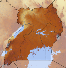
Entebbe is a major town in Central Uganda. On a Lake Victoria peninsula, approximately 37 kilometres (23 mi) southwest of the Ugandan capital, Kampala, it was once the seat of government for the Protectorate of Uganda prior to independence, in 1962. Entebbe is the location of Entebbe International Airport, Uganda's largest commercial and military airport, best known for the dramatic rescue of 100 hostages kidnapped by the resistance group of the PFLP-EO and Revolutionary Cells (RZ) organizations. Entebbe is also the location of State House, the official office and residence of the President of Uganda.

Entebbe International Airport is the principal international airport of Uganda. It is near the town of Entebbe, on the shores of Lake Victoria, and approximately 40.5 kilometres (25 mi) by road south-west of the central business district of Kampala, the capital and largest city of Uganda. The headquarters of the Civil Aviation Authority of Uganda have been relocated to a new block off the airport highway, but adjacent to the airport terminals.

Gulu Airport is a civilian and military airport in the Northern Region of Uganda. It is 3 kilometres (1.9 mi) north-west of the central business district of Gulu, the largest metropolitan area in the Northern Region. The airport is approximately 303 kilometres (188 mi) north of Entebbe International Airport, Uganda's largest civilian and military airport.

Arua Airport is a civilian airport serving the city of Arua in the Northern Region of Uganda. As of November 2016, it is one of the 47 airports in the country.

Moyo Airport is an airport in Uganda. It is one of the forty-six (46) airports in the country.

Kasese Airport is an airport in Uganda.

Masindi Airport is an airport in Uganda.

Tororo Airport is an airport serving the town of Tororo in the Eastern Region of Uganda.

Kisoro Airport is an airport serving the town of Kisoro in Uganda and nearby Bwindi Impenetrable National Park and Mgahinga Gorilla National Park. It is in extreme southwestern Uganda, approximately 343 kilometres (213 mi) by air southwest of Entebbe International Airport, the country's largest civilian and military airport. It is one of twelve upcountry airports administered by the Civil Aviation Authority of Uganda.

Kidepo Airport is an airfield in Northern Region, Uganda. The airport is at Lomej, approximately 3 kilometres (2 mi) south of the headquarters of Kidepo Valley National Park, and 456 kilometres (283 mi) northeast of Entebbe International Airport, the country’s largest civilian and military airport.

Jinja Airport is a small civilian and military airport in Uganda. It serves the town of Jinja in Jinja District, Busoga, Eastern Region. It is adjacent to the Uganda Senior Command and Staff College of the Uganda People's Defence Force at Kimaka, a suburb of Jinja. It is approximately 94 kilometres (58 mi) east of Entebbe International Airport, the country’s largest airport.

Kakira Airport is one of the 46 airports in Uganda. It is in Kakira, Jinja District, Eastern Region. The geographic coordinates of this airport are 00 degrees, 29 minutes, 56 seconds north and 33 degrees, 16 minutes, 57 seconds east. It is approximately 107 kilometres (66 mi), by air, east of Entebbe International Airport, the country’s largest civilian and military airport.

Lira Airport is an airport serving Lira, a town in the Lira District of Uganda. Lira Airport is one of twelve upcountry airports that are administered by the Civil Aviation Authority of Uganda. It is also one of the 46 airports in the country.

Nebbi Airport is an airport in Uganda. It is one of the 46 airports in the country.

Kajjansi Airfield is an airfield serving Kajjansi, a town in the Central Region of Uganda. The airfield is approximately 20 kilometres (12 mi) north-east of Entebbe International Airport, Uganda's largest airport, and 16 kilometres (9.9 mi) south of central Kampala, Uganda's capital and largest city.

Kitgum Airport is an airport in Uganda. It is one of the 46 airports in the country.

Kabale Airport is an airstrip serving Kabale, a town in the Kabale District in the Western Region of Uganda. It is one of the 46 airports in the country.
Kasenyi Airport is an airport in Uganda. It is one of the forty six airports in the country.

Bugungu Airstrip is an airport serving the Bugungu Wildlife Reserve in the Murchison Falls National Park (MFNP), in Uganda.


