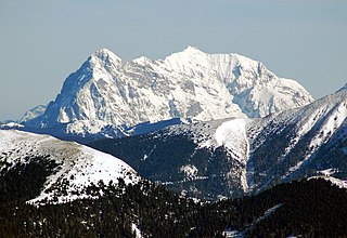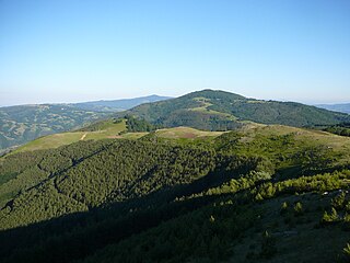
Scafell is a mountain in the Lake District region of Cumbria, England. It has a height of 964 metres, making it the second-highest mountain in England after its neighbour, Scafell Pike, from which it is separated by Mickledore col.

The Grossglockner, or just Glockner, is, at 3,798 metres above the Adriatic (12,461 ft), the highest mountain in Austria and highest mountain in the Alps east of the Brenner Pass. It is part of the larger Glockner Group of the Hohe Tauern range, situated along the main ridge of the Central Eastern Alps and the Alpine divide. The Pasterze, Austria's most extended glacier, lies on the Grossglockner's eastern slope.

Cascade Mountain is in Essex County of New York. It is one of the 46 Adirondack High Peaks (36th) and is located in the Adirondack Park. Its name comes from a series of waterfalls on a brook near the mountain's base. The lake it flows into and the pass between Cascade and Pitchoff mountains are also named Cascade.

Grays Peak is the tenth-highest summit of the Rocky Mountains of North America and the U.S. state of Colorado. The prominent 14,278-foot (4352 m) fourteener is the highest summit of the Front Range and the highest point on the Continental Divide and the Continental Divide Trail in North America. Grays Peak is located in Arapahoe National Forest, 3.9 miles (6.2 km) southeast by east of Loveland Pass on the Continental Divide between Clear Creek and Summit counties. The peak is the highest point in both counties.

Bidean nam Bian is the highest peak in a group of mountains south of Glen Coe and north of Glen Etive in the Scottish Highlands. With a height of 1,150 metres (3,770 ft), it is a Munro and the highest point in Argyll. It is a complex mountain with many ridges and subsidiary peaks, one of which, Stob Coire Sgreamhach, is classified as a separate Munro.

Monte Rosa is a mountain massif in the eastern part of the Pennine Alps, on the border between Italy and Switzerland (Valais). The highest peak of the massif, amongst several peaks of over 4,000 m (13,000 ft), is the Dufourspitze, the second highest mountain in the Alps and western Europe, after Mont Blanc. The east face of the Monte Rosa towards Italy has a height of about 2,400 metres (7,900 ft) and is the highest mountain wall of the Alps.

The Dom is a mountain of the Pennine Alps, located between Randa and Saas-Fee in the canton of Valais in Switzerland. With a height of 4,546 m (14,915 ft), it is the seventh highest summit in the Alps, overall. Based on prominence, it can be regarded as the third highest mountain in the Alps, and the second highest in Switzerland, after Monte Rosa. The Dom is the main summit of the Mischabel group, which is the highest massif lying entirely in Switzerland.

Huayna Potosí is a mountain in Bolivia, located near El Alto and about 25 km north of La Paz in the Cordillera Real.

Mweelrea is a mountain on the Atlantic coast of County Mayo, Ireland. Rising to 814 metres (2,671 ft), it is the highest mountain in the western province of Connacht, and is noted for its southeastern cliff-lined corries, and its views. Mweelrea overlooks Killary Harbour and is at the heart of a "horseshoe-shaped" massif that includes the peaks of Ben Lugmore and Ben Bury. The massif is called the Mweelrea Mountains or the Mweelrea Range.

The Stawamus Chief, officially Stawamus Chief Mountain, is a granitic dome located adjacent to the town of Squamish, British Columbia, Canada. It towers over 700 m (2,297 ft) above the waters of nearby Howe Sound. It is one of the largest granite monoliths in the world.

The Ennstal Alps, the Alps of the Enns valley, are a mountain range of the Northern Limestone Alps System. They are located primarily in the Austrian state of Styria, and also into the state of Upper Austria.

Ograzhden is a mountain range shared by southwestern Bulgaria and southeastern North Macedonia. The highest peak of the mountain is located in North Macedonia, Ograzhdenets (Огражденец) at 1,744 m, while the highest in Bulgaria is Bilska Chuka at 1,644 m.

West Spanish Peak is a high and prominent mountain summit that is the higher of the two Spanish Peaks in the Rocky Mountains of North America. The prominent 13,631-foot (4,155 m) peak is located in the Spanish Peaks Wilderness of San Isabel National Forest, 9.1 miles (14.7 km) south of the Town of La Veta, Colorado, United States, on the drainage divide between Huerfano and Las Animas counties. The summit of West Spanish Peak is the highest point in Las Animas County, Colorado.

The Allgäu Alps are a mountain range in the Northern Limestone Alps, located on the Austria–Germany border, which covers parts of the German states of Bavaria and Baden-Württemberg and the Austrian states of Tyrol and Vorarlberg. The range lies directly east of Lake Constance.

Saint Regis Mountain is a 2,838-foot-tall (865 m) mountain in the town of Santa Clara, New York, in Franklin County at the center of the Saint Regis Canoe Area in the Adirondack Park.

The Fuscherkarkopf, sometimes also written Fuscher-Kar-Kopf in German and formerly also called the Fuschereiskarkopf, is one of the twin peaks of a mountain in the Glockner Group in the centre of the main mountain chain in the High Tauern, a range in the Austrian Central Alps. The mountain lies right on the border between the Austrian states of Salzburg and Carinthia. The main peak is 3,331 metres high, but the northwest summit is only 3,252 metres high. The two peaks are about 500 metres apart and linked by a curved firn-covered ridge. Further sharp, prominent ridges run away to the northwest and west, forming the main crest of the Tauern. To the southwest the Heiligenblut Open Face branches off, a mighty side ridge that starts as the southeast ridge (Südostgrat) at the Fuscherkarkopf. The northwest summit has a great, 650-metre-high (2,130 ft) West Face (Westwand), that used to be covered with firn, but today is covered with loose rock slabs. The mountain is easy to reach from the Hofmanns Hut over the southwest ridge (Südwestgrat) and offers a good view of the Großglockner and the Pasterze. The peak was first climbed in the 1840s by the hunter, Gregor Maier, known as Badhans, from Fusch.

Two-thousanders are mountains that have a height of at least 2,000 metres above sea level, but less than 3,000 metres. The term is used in Alpine circles, especially in Europe.

Diamond Hill or Bengooria is an isolated peak overlooking the village of Letterfrack, in the northwest corner of the Twelve Bens in Connemara National Park in County Galway, Ireland. At only 442 metres (1,450 ft), it does not rank as an Arderin, or a Vandeleur-Lynam; however, it has the prominence to rank as a Marilyn.

The Simmersberg is a mountain, 780.8 m above sea level (NHN), near Schnett in the municipality of Masserberg) in the county of Hildburghausen in Germany. It is the main summit of a forked mountain chain, which runs along the boundary between the Thuringian Forest and the Thuringian Highland from Masserberg towards the southwest and is bounded by the valleys of the Schleuse and its tributary, the Biber.

Mullach Glas is one of the Maumturk Mountains of Connemara in County Galway, Ireland. At 622 metres (2,041 ft), it is the fifth-highest of the Maumturks, the 197th–highest peak in Ireland on the Arderin list, and 238th–highest on the Vandeleur-Lynam list. Mullach Glas is on a massif that includes Binn Mhór and Corcogemore ; this massif is at the far southeastern sector of the long north-west to south-east spine of the Maumturks.


