
The Bay of Quinte is a long, narrow bay shaped like the letter "Z" on the northern shore of Lake Ontario in the province of Ontario, Canada. It is just west of the head of the Saint Lawrence River that drains the Great Lakes into the Gulf of Saint Lawrence. It is located about 200 kilometres (120 mi) east of Toronto and 350 kilometres (220 mi) west of Montreal.

Belleville is a city in Ontario, Canada situated on the eastern end of Lake Ontario, located at the mouth of the Moira River and on the Bay of Quinte. Its population as of the 2021 Canadian census was 55,071. It is the seat of Hastings County, but politically independent of it, and is the centre of the Bay of Quinte Region.

Greater Napanee is a town in southeastern Ontario, Canada, approximately 45 kilometres (28 mi) west of Kingston and the county seat of Lennox and Addington County. It is located on the eastern end of the Bay of Quinte. Greater Napanee municipality was created by amalgamating the old Town of Napanee with the townships of Adolphustown, North and South Fredericksburg, and Richmond in 1999. Greater Napanee is co-extensive with the original Lennox County.
King's Highway 33, commonly referred to as Highway 33 or Loyalist Parkway, is a provincially maintained highway in the Canadian province of Ontario. The route begins at Highway 62 in Bloomfield and travels east to the Collins Bay Road junction at Collins Bay in the city of Kingston, a distance of 60.9 kilometres (37.8 mi). The highway continues farther east into Kingston as Bath Road, ending at the former Highway 2, now Princess Street. Highway 33 is divided into two sections by the Bay of Quinte. The Glenora Ferry service crosses between the two sections just east of Picton, transporting vehicles and pedestrians for free throughout the year.

Loyalist is a lower-tier township municipality in central eastern Ontario, Canada on Lake Ontario. It is in Lennox and Addington County and consists of two parts: the mainland and Amherst Island. It was named for the United Empire Loyalists, who settled in the area after the American Revolution.
Lennox County is a historic county in the Canadian province of Ontario which now forms part of Lennox and Addington County. It was named after Charles Lennox, 3rd Duke of Richmond.

Picton is an unincorporated community located in Prince Edward County in southeastern Ontario, roughly 160 km (99 mi) east of Toronto. It is the county's largest community and former seat located at the southwestern end of Picton Bay, a branch of the Bay of Quinte, which is along the northern shoreline of Lake Ontario. The town is named for Lieutenant General Sir Thomas Picton, who served in the British Army during the Peninsular War in Spain and Portugal. He also saw action at the Battle of Waterloo, where he was killed. It was formerly incorporated as a town. Picton is home to the Picton Pirates of the Provincial Junior Hockey League Tod Division.

Christ Church, His Majesty's Chapel Royal of the Mohawk is located on the Tyendinaga Mohawk Territory near Deseronto, Ontario, Canada. It is owned by the Mohawks of the Bay of Quinte First Nation and is associated with the Anglican Parish of Tyendinaga, Diocese of Ontario. It was designated as a National Historic Site in 1995 and is one of only three Chapels Royal in Canada, elevated by Queen Elizabeth II in 2004.
Philip Dorland was a farmer and political figure in Upper Canada.
Thomas Dorland was a farmer, soldier and political figure in Upper Canada.
Peter Van Alstine (Vanalstine) (1743–1811) was a farmer, soldier and political figure in Upper Canada.

John Roblin was a farmer and political figure in Upper Canada.
David Roblin was a lumber merchant and political figure in Canada West.

Deseronto is a town in the Canadian province of Ontario, in Hastings County, located at the mouth of the Napanee River on the shore of the Bay of Quinte, on the northern side of Lake Ontario.
Willet Casey was a farmer and political figure in Upper Canada.
Carrying Place is a community straddling the Quinte West and Prince Edward County border that serves as a gateway to Prince Edward County, Ontario, Canada. Situated northwest of Picton and just south of Trenton, it was named for its location on the portage between the Bay of Quinte and Weller's Bay on Lake Ontario. The Loyalist Parkway passes through the community.
King's Highway 49, commonly referred to as Highway 49, is a provincially maintained highway in the Canadian province of Ontario. The 5.8-kilometre (3.6 mi) highway travels across the Quinte Skyway and through the Tyendinaga Mohawk Territory south of Marysville.
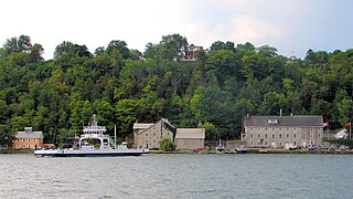
Glenora is a community in the Canadian province of Ontario, on the southern shore of the Bay of Quinte at 44°02′N77°03′W. The Bay of Quinte is a long narrow inlet on the northern shore of Lake Ontario.
Asa Danforth Jr. was one of the first citizens of Onondaga County, New York, when he arrived there with his father, Asa Danforth in 1788. Danforth incurred heavy debts speculating in land in New York State. Hoping to reverse his fortunes, he invested in the especially risky land titles of nearby Upper Canada and later was a highway engineer.

The Bay of Quinte Railway was a short-line railway in eastern Ontario, Canada. It was formed as the Napanee, Tamworth and Quebec Railway (NT&QR), chartered in 1878 by Edward Rathbun and Alexander Campbell, with plans to run from Napanee through Renfrew County and on to the Ottawa Valley. Lacking funding from the governments, development never began.

