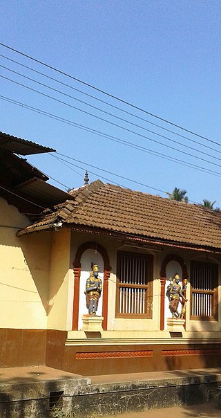
Kasaragod is a municipal town and administrative headquarters of Kasaragod district in the state of Kerala, India. Established in 1966, Kasaragod was the first municipal town in the district. It is the northernmost district of Kerala and is also known as Sapta Bhasha Sangama Bhumi.
Muzhappilangad (മുഴപ്പിലങ്ങാട്) is a coastal census town near Thalassery in Kannur district in the Indian state of Kerala. It is a suburb of kannur city

The Netravati River or Netravathi Nadi has its origins at Bangrabalige valley, Yelaneeru Ghat in Kudremukh in Chikkamagaluru district of Karnataka, India. This river flows through the famous pilgrimage place Dharmasthala and is considered one of the holy rivers of India. It merges with the Kumaradhara River at Uppinangadi before flowing to the Arabian Sea, south of Mangalore city. This river is the main source of water to Bantwal and Mangalore. The Netravati railway bridge is one of the known bridges which serve as the gateway to Mangalore.

Bantwal is a suburb of Mangalore in Dakshina Kannada district, Karnataka, India, and the headquarters of Bantwal taluk. It is located 25 km (16 mi) East of Mangalore city center. BC Road-Kaikamba of Bantwal is one of the fastest developing areas in Dakshina Kannada district of Karnataka.

Somwarpet is a panchayat town in Kodagu district in the Indian state of Karnataka. It is the main town of the Somwarpet taluk, in the north-east of the district. 2nd highest Administrative town in Karnataka in terms of elevation. The main crops grown in the area are coffee and spice crops such as cardamom, peppers, oranges, ginger and vegetables.

Matool is a village in Kannur district of Kerala State, India. Mattool is located 19 kilometres (12 mi) north of Kannur city. The Valapattanam River and Kuppam River meet the Arabian sea at Mattool. Mattool can be reached from Kannur via Azheekal crossing the Mattool - Azheekal ferry. And via Madakkara-Matool Bridge From Irinavu Road.
Eranholi is a census town and suburb of Thalassery in Tellicherry Municipality in the state of Kerala, India, and located on Tellichery Mysore highway. The nearest town is Chirakkara. Eranholi bridge built across Eranholi river in 1937 which is entry to Tellicherry.The Eranholi Bridge is a significant bridge of TC Road.

Manapakkam is a is a neighborhood in Chennai in the Indian state of Tamil Nadu. A census town, Manapakkam is located along the Mount-Poonamallee Road in Chennai. It is now a home to many IT companies, like DLF Cybercity Chennai and Larsen & Toubro. Manappakam has beautiful and scenic Adyar River Bank Trail suitable for morning walkers and joggers, it is a 3-km stretch extended till Chennai Airport's secondary Runway Bridge.
Mulki is a panchayat town located at Mangalore taluk in Dakshina Kannada district in the Indian state of Karnataka. It is on the banks of Shambhavi River. It was earlier known as Moolikapur, turned to Mulki. A small town with people of diverse religions, it is 10 km north of Suratkal. Karnad is a locality within Mulki. Nearest railway station is Mulki railway station
Muloor is a census town in kaup taluk of Udupi District the Indian state of Karnataka. Muloor name came From the word 'Mula' it means 'origin' it is the village of origin (Mula+ooru) of Sri Bobbarya Daiva.
Neelangarai is a census town and is a locality in the south of Chennai. it is situated in Chennai district in the Indian state of Tamil Nadu about seven kilometers south of Adyar, Chennai. The former name of the city was Thiruneelakandapuram, named after the Thiruneelakandeshwarar temple. Neelankarai is located with Palavakkam in the north, Vettuvankeni in the south, Thoraipakkam in the west and the Bay of Bengal in the east. Over the years Neelankarai has developed tremendously and has made a significant name for itself in popularity for various reasons.
Palavakam is a locality in the south of Chennai and census town in Chennai district in the Indian state of Tamil Nadu. It is located on the East Coast Road about 6 km south of Adyar.

Peralasseri is a census town and Panchayat headquarters in Kannur district in the Indian state of Kerala, situated on the Kannur-Kuthuparamba State Highway 38 (Kerala), 12 km from Kannur city, on the bank of Anjarakandy river.
Peringathur is a census town in Thalassery taluk of Kannur district in the Indian state of Kerala. It is a part of Panoor municipality.

Sakleshpur, Sakleshpura or Sakleshapura is a hill station town and headquarters of Sakleshpur taluk in Hassan district in the Indian state of Karnataka.
Venkatapur is a census town in Bhatkal Taluk in Uttara Kannada district of Karnataka.

Kannavam is a Village in Thalassery Taluk in Kannur District of Kerala State, India. It comes under Chittaripparamba Panchayat. It is located 37 km (23 mi) south east of District headquarters Kannur, 13 km (8.1 mi) east of Kuthuparamba and 466 km (290 mi) from State capital Thiruvananthapuram
Harekala is a village in the southern state of Karnataka, India. It is located in the Mangalore taluk of Dakshina Kannada district.

Bantwal taluk is a taluk of Dakshina Kannada district. The headquarters is the town of Bantwal, an eastern suburb of Mangalore.
Patrame is a small, rural panchayat village on the left (east) bank of the Netravati River in Karnataka, India. Administratively, it is under Belthangady taluk, Dakshina Kannada district, Karnataka. Patrame is the only village in its gram panchayat. The village of Patrame is 26 km from its taluk headquarters Belthangady, and 8 km by road from Dharmasthala.


