Agho Island

Last updated
Agho

Agho Island.jpg

Beach facilities at the island in 2010
Philippines relief location map (square).svg
Red pog.svg
Agho
Location within the Philippines
Geography
Coordinates 11°13′34″N123°11′42″E / 11.22611°N 123.19500°E / 11.22611; 123.19500 Coordinates: 11°13′34″N123°11′42″E / 11.22611°N 123.19500°E / 11.22611; 123.19500
Archipelago Concepcion Islands
Adjacent bodies of water Visayan Sea
Area 0.09 km2 (0.035 sq mi)
Administration
Region Western Visayas
Province Iloilo
Municipality Concepcion

Agho Island is a small, mostly uninhabited island in northeastern Iloilo, Philippines. It is part of the municipality of Concepcion.

Iloilo Province in Western Visayas, Philippines

Iloilo is a province located in the region of Western Visayas in the Philippines. Iloilo occupies a major southeast portion of the Visayan island of Panay and is bordered by the province of Antique to the west, Capiz to the north, the Jintotolo Channel to the northeast, the Guimaras Strait to the east, and the Iloilo Strait and Panay Gulf to the southwest.

Philippines Republic in Southeast Asia

The Philippines, officially the Republic of the Philippines, is an archipelagic country in Southeast Asia. Situated in the western Pacific Ocean, it consists of about 7,641 islands that are categorized broadly under three main geographical divisions from north to south: Luzon, Visayas, and Mindanao. The capital city of the Philippines is Manila and the most populous city is Quezon City, both part of Metro Manila. Bounded by the South China Sea on the west, the Philippine Sea on the east and the Celebes Sea on the southwest, the Philippines shares maritime borders with Taiwan to the north, Vietnam to the west, Palau to the east, and Malaysia and Indonesia to the south.

Concepcion, Iloilo Municipality of the Philippines in the province of Iloilo

Concepcion, officially the Municipality of Concepcion, is a 3rd class municipality in the province of Iloilo, Philippines. According to the 2015 census, it has a population of 43,159 people.

Contents

Location and geography

Agho Island is 7 nautical miles east of Panay Island in the Visayan Sea. It is in a channel between Igbon Island and Malangabang Island. [1] Quiniluban Island is to the northwest. The island is home to tropical birds, including sea hawks and Tabon birds. [2]

Panay island in the Philippines

Panay is the sixth-largest and fourth most-populous island in the Philippines, with a total land area of 12,011 km2 (4,637 sq mi) and with a total population of 4,477,247. Panay comprises 4.4 percent of the entire population of the country. The City of Iloilo is its largest settlement with a total population of 447,992 inhabitants. It is a triangular island, located in the western part of the Visayas. It is about 160 km (99 mi) across. It is divided into four provinces: Aklan, Antique, Capiz and Iloilo, all in the Western Visayas Region. It is located southeast of the island of Mindoro and northwest of Negros across the Guimaras Strait. Just off the mid-southeastern coast lies the island-province of Guimaras. To the north and northeast is the Sibuyan Sea, Jintotolo Channel and the islands of Romblon and Masbate; to the west and southwest is the Sulu Sea and the Palawan archipelago and to the south is Panay Gulf. Panay is the only main island in the Visayas whose provinces don't bear the name of their island.

Visayan Sea A sea in the Philippines between Masbate, Leyte, Cebu, Negros and Panay

The Visayan Sea is a sea in the Philippines surrounded by the islands of the Visayas: Western Visayas, Eastern Visayas, and Central Visayas to the south. It is bounded by the islands Masbate to the north, Panay to the west, Leyte to the east, and Cebu & Negros to the south.

Igbon Island island

Igbon Island is an island and barangay in northeastern Iloilo, Philippines. It is part of the municipality of Concepcion. According to the 2010 census, it has a population of 2,547. The island is moderately known in the Philippines for its scuba diving.

History

Japanese soldiers landed on Agho during World War II, although they did not stay as they had a garrison in nearby Bagungon Island. The island is currently owned by the Villarias clan, who own the island's resort and sari-sari store.

Pacific War theatre of war in the Second World War

The Pacific War, sometimes called the Asia–Pacific War, was the theater of World War II that was fought in the Pacific and Asia. It was fought over a vast area that included the Pacific Ocean and islands, the South West Pacific, South-East Asia, and in China.

Sari-sari store convenience store in the Philippines

A sari-sari store, or neighborhood sundry store, is a convenience store found in the Philippines. The word sari-sari is Tagalog meaning "variety" or "sundry". Such stores form an important economic and social location in a Filipino community and is ubiquitous in neighborhoods and streets. Sari-sari stores tend to be family-run and privately owned operating within the shopkeeper's residence. Commodities are displayed in a large screen-covered or metal barred window in front of the shop. Candies in recycled jars, canned goods and cigarettes are displayed while cooking oil, salt and sugar are stored at the back of the shop. Prepaid mobile phone credits are provided. The sari-sari store operates with a small revolving fund, and generally doesn't provide perishable goods requiring refrigeration. The few that do, have refrigerators to store soft drinks, beers and bottled water.

In 1980 or 81, a couple arrived on Agho Island with the claim that the island has been given to them by then-president Ferdinand Marcos. This couple, variously American [2] or Australian [3] and named as Thomas and Terry Cook [2] or Kurt, [3] hired locals to build a cottage on Agho. At first, relations between the couple and the locals were friendly; however, after the cottage was completed the couple posted an armed guard and dogs on the property to keep out intruders. [3] Tensions between the couple and the locals grew and eventually the authorities were called in. On 19 August 1988, Narcom (Philippine Drug Enforcement Agency) found 1,000 plants on the property that were believed to be cocoa plants, although some officials disputed this claim. [3] The couple had left the island two years earlier, [3] after Marcos's fall from power. [2]

Ferdinand Marcos former President of the Philippines from 1965 to 1986

Ferdinand Emmanuel Edralin Marcos Sr. was a Filipino politician and kleptocrat who was the tenth President of the Philippines from 1965 to 1986. A leading member of the far-right New Society Movement, he ruled as a dictator under martial law from 1972 until 1981. His regime was infamous for its corruption, extravagance, and brutality.

Philippine Drug Enforcement Agency

The Philippine Drug Enforcement Agency is the lead anti-drug law enforcement agency, responsible for preventing, investigating and combating any dangerous drugs, controlled precursors and essential chemicals within the Philippines. The agency is tasked with the enforcement of the penal and regulatory provisions of Republic Act No. 9165, otherwise known as the Comprehensive Dangerous Drugs Act of 2002.

Transport

Agho is a 30-minute pumpboat ride from Concepcion. [2]

See also

Related Research Articles

Western Visayas Region in Visayas, Philippines

Western Visayas is an administrative region in the Philippines, numerically designated as Region VI. It consists of six provinces and two highly urbanized cities. The regional center is Iloilo City. The region is dominated by the native speakers of four Visayan languages: Kinaray-a, Hiligaynon, Aklanon and Capiznon. The land area of the region is 20,794.18 km2 (8,028.68 sq mi), and with a population of 7,536,383 inhabitants, it is the most populous region in the Visayas.

San Dionisio, Iloilo Municipality of the Philippines in the province of Iloilo

San Dionisio, officially the Municipality of San Dionisio, is a 4th class municipality in the province of Iloilo, Philippines. According to the 2015 census, it has a population of 38,775 people.

Pan de Azucar Island (Iloilo) island in the Philippines

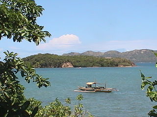
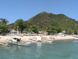
Pan de Azucar is a populated island in the Visayan Sea in the Philippines. The island is known for MountPan de Azucar a steep volcanic cone and a prominent landmark at the northern entrance of Guimaras Strait.

Concepcion Islands

The Concepcion Islands are 17 variously inhabited and uninhabited islands in northeastern Iloilo, Philippines. The islands are politically subdivided into 11 island barangays and are part of the municipality of Concepcion. Collectively, the islands have -according to 2010 census- a population of 19,080, which is 48 percent the total population of Concepcion.

Tago Island island in Philippines

Tago Island is a mountain, which is also the eponymous whole island, in northeastern Iloilo, Philippines. It is part of the municipality of Concepcion.

Botlog Island

Botlog Island is an island and barangay in northeastern Iloilo, Philippines. It is part of the municipality of Concepcion. According to the 2010 census, it has a population of 441.

Malangabang

Malangabang is an island and barangay in northeastern Iloilo, Philippines. It is part of the municipality of Concepcion. According to the 2010 census, it has a population of 2,925. Fishing is the main source of income for the island's residents.

Bulubadiangan Island

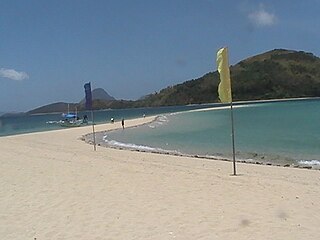
Bulubadiangan Island is a privately owned island in northeastern Iloilo, Philippines. It is part of barangay Polopińa, Concepcion. The Sandbar Island Beach Resort on Bulubadiangan is moderately known within the Philippines.

Danao-Danao Island

Danao-Danao Island is a small, low-lying island in northeastern Iloilo, Philippines. It is part of the municipality of Concepcion.

Baliguian Island

Baliguian Island is an inhabited island in northeastern Iloilo, Philippines. It is the westernmost of the Concepcion Islands and politically administered by the municipality of Concepcion. A virtually flat island, Baliguian features a lighthouse to aid in ship navigation.

Bocot Island

Bocot Island is a small island in northeastern Iloilo, Philippines. It is part of the municipality of Concepcion.

Bag-o Isi Island

Bag-o Isi Island is a small island in northeastern Iloilo, Philippines. It is part of the municipality of Concepcion.

Sombrero Island (Iloilo)

Sombrero is a small, cone-shaped island in northeastern Iloilo, Philippines. It is part of the municipality of Concepcion.

Tagubanhan Island

Tagubanhan Island is a wooded island in northeastern Iloilo, Philippines. It is part of the municipality of Concepcion.

Bag-o Abo

Bag-o Abo is a small, wooded island in northeastern Iloilo, Philippines. It is part of the municipality of Concepcion.

Chico Island (Iloilo)

Chico is an uninhabited island in northeastern Iloilo, Philippines. It is part of the municipality of Concepcion. The island is owned by the heirs of Consuelo and Zacarias Bagaforo of Malangabang Island.

Colebra Island

Colebra is an island in northeastern Iloilo, Philippines. It is part of the municipality of Concepcion.

Magalumbi

Magalumbi is an island in northeastern Iloilo, Philippines. It is part of the municipality of Batad, although the official provincial government website lists it as an offshore island of Estancia. Magalumbi is part of barangay Tanao, which has a population of 1,903 according to the 2010 census.

References

  1. U.S. Coast and Geodetic Survey, Reuben Jacob Christman (1919). United States Coast Pilot, Philippine Islands, Part 1. U.S. Government Printing Office. p. 225. Retrieved 16 June 2014.
  2. 1 2 3 4 5 Villa, Hazel. "Agho Island: a dreamy island of many stories and surprises". Yahoo News. Retrieved 17 June 2014.
  3. 1 2 3 4 5 Vidal, Alex. "Did Narcom commit a mea culpa in Concepcion, Iloilo 'coca' plant?" . Retrieved 23 June 2014.

http://www.rmgorrieza.co.uk/agho-island-concepcion-iloilo/