Concepcion Islands

Last updated
Concepcion Islands
Conception Islands 1.jpg
Offshore island of Concepcion, Iloilo
Philippines relief location map (square).svg
Red pog.svg
Concepcion Islands
Location within the Philippines
Geography
Coordinates 11°16′57″N123°10′00″E / 11.28250°N 123.16667°E / 11.28250; 123.16667 Coordinates: 11°16′57″N123°10′00″E / 11.28250°N 123.16667°E / 11.28250; 123.16667
Archipelago Visayas
Adjacent bodies of water
Total islands17
Major islands
Area34.97 km2 (13.50 sq mi) [1]
Highest elevation2,900 ft (880 m)
Highest pointManaphag
Administration
Region Western Visayas
Province Iloilo
Municipality Concepcion
Barangays
  • Bagongon
  • Botlog
  • Dungon
  • Igbon
  • Macatunao
  • Malangabang
  • Polopińa
  • Salvacion
  • Talo-toan
  • Tambaliza
Demographics
Population19,080 (2010) [2]
Additional information
Official website Concepcion official website

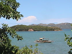
The Concepcion Islands are 17 variously inhabited and uninhabited islands in northeastern Iloilo, Philippines. The islands are politically subdivided into 11 island barangays and are part of the municipality of Concepcion. [3] According to the 2010 census, the islands collectively have a population of 19,080, 48 percent the total population of Concepcion. [2]

Contents

History

In 1604, Juan Salgado twice defeated Spanish pirates near Pan de Azucar. [4] During World War II, Japanese forces shot down an American fighter pilot, which crash landed near Bag-o Abo Island. [1]

Geography

Aerial view of Igbon Island and several other nearby Concepcion Islands Igbon Island.JPG
Aerial view of Igbon Island and several other nearby Concepcion Islands

The Concepcion Islands are located east of Panay Island in the Visayan Sea, and are part of the larger Western Visayas archipelago. The islands are part of the town of Concepcion, and comprise 40 percent of Concepcion's total land area. [1] The nearest island is Tago, which is a coral reef 200 metres (660 ft) from the mainland, inside Concepcion Bay. The furthest island is far-flung Baliguian, located 22 kilometres (14 mi) away from the mainland. Baliguian also marks the end of Concepcion's municipal waters. The majority of the islands are mountainous and wooded, ringed by white sand beaches and surrounded by reefs, shoals, and sandbars. [5] A few of the islands feature lighthouses to aid ship navigation in this area.

Islands

The Concepcion Islands are:

See also

Related Research Articles

Danao, Bohol Municipality of the Philippines in the province of Bohol

Danao, officially the Municipality of Danao, is a 4th class municipality in the province of Bohol, Philippines. According to the 2015 census, it has a population of 17,890 people. 

Janiuay Municipality in Western Visayas, Philippines

Janiuay, officially the Municipality of Janiuay, is a 1st class municipality in the province of Iloilo, Philippines. According to the 2015 census, it has a population of 63,905 people. 

Concepcion, Romblon Municipality of the Philippines in the province of Romblon

Concepcion, officially the Municipality of Concepcion, is a 6th class municipality in the province of Romblon, Philippines. According to the 2015 census, it has a population of 4,037 people. 

Concepcion, Iloilo Municipality of the Philippines in the province of Iloilo

Concepcion, officially the Municipality of Concepcion, is a 3rd class municipality in the province of Iloilo, Philippines. According to the 2015 census, it has a population of 43,159 people. 

Leon, Iloilo Municipality of the Philippines in the province of Iloilo

Leon, officially the Municipality of Leon, is a 2nd class municipality in the province of Iloilo, Philippines. According to the 2015 census, it has a population of 49,875 people. 

San Dionisio, Iloilo Municipality in Western Visayas, Philippines

San Dionisio, officially the Municipality of San Dionisio, is a 4th class municipality in the province of Iloilo, Philippines. According to the 2015 census, it has a population of 38,775 people. 

Sara, Iloilo Municipality in Western Visayas, Philippines

Sara, officially the Municipality of Sara, is a 2nd class municipality in the province of Iloilo, Philippines. According to the 2015 census, it has a population of 52,631 people. 

Igbon Island

Igbon Island is an island and barangay in northeastern Iloilo, Philippines. It is part of the municipality of Concepcion. According to the 2010 census, it has a population of 2,547. The island is moderately known in the Philippines for its scuba diving.

Pan de Azucar Island (Iloilo)

Pan de Azucar is a populated island in the Visayan Sea in the Philippines. The island is known for MountPan de Azucar a steep volcanic cone and a prominent landmark at the northern entrance of Guimaras Strait.

Tago Island

Tago Island is a mountain, which is also the eponymous whole island, in northeastern Iloilo, Philippines. It is part of the municipality of Concepcion.

Botlog Island

Botlog Island is an island and barangay in northeastern Iloilo, Philippines. It is part of the municipality of Concepcion. According to the 2010 census, it has a population of 441.

Malangabang

Malangabang is an island and barangay in northeastern Iloilo, Philippines. It is part of the municipality of Concepcion. According to the 2010 census, it has a population of 2,925. Fishing is the main source of income for the island's residents.

Bulubadiangan Island

Bulubadiangan Island is a privately owned island in northeastern Iloilo, Philippines. It is part of barangay Polopińa, Concepcion. The Sandbar Island Beach Resort on Bulubadiangan is moderately known within the Philippines.

Danao-Danao Island Island in the Philippines

Danao-Danao Island is a small, low-lying island in northeastern Iloilo, Philippines. It is part of the municipality of Concepcion.

Baliguian Island

Baliguian Island is an inhabited island in northeastern Iloilo, Philippines. It is the westernmost of the Concepcion Islands and politically administered by the municipality of Concepcion. A virtually flat island, Baliguian features a lighthouse to aid in ship navigation.

Bocot Island

Bocot Island is a small island in northeastern Iloilo, Philippines. It is part of the municipality of Concepcion.

Bag-o Isi Island

Bag-o Isi Island is a small island in northeastern Iloilo, Philippines. It is part of the municipality of Concepcion.

Sombrero Island (Iloilo)

Sombrero is a small, cone-shaped island in northeastern Iloilo, Philippines. It is part of the municipality of Concepcion.

Bag-o Abo

Bag-o Abo is a small, wooded island in northeastern Iloilo, Philippines. It is part of the municipality of Concepcion.

Magalumbi

Magalumbi is an island in northeastern Iloilo, Philippines. It is part of the municipality of Batad, although the official provincial government website lists it as an offshore island of Estancia. Magalumbi is part of barangay Tanao, which has a population of 1,903 according to the 2010 census.

References

  1. 1 2 3 "Municipality of Concepcion". Province of Iloilo official webpage. Retrieved 22 June 2014.
  2. 1 2 "2010 Census of Population and Housing" (PDF). Philippine Statistics Authority. 2010. pp. 61–62. Archived from the original (PDF) on 15 November 2012. Retrieved 22 June 2014.
  3. Ahem, Claire. "In Typhoon-Ravaged Concepcion, Not Afraid to Look Back but All Eyes on the Future". Concern Worldwide. Archived from the original on 14 July 2014. Retrieved 17 June 2014.
  4. Blair, Emma (ed.). "XXX". The Philippine Islands, 1493–1898, Volume XXIV, 1630–34 (ebook). Project Guttenberg. Retrieved 23 June 2014.
  5. "Sailing Directions (Enroute) Philippine Islands" (PDF). National Geospatial-Intelligence Agency. 2008. p. 95. Retrieved 22 June 2014.