Botlog Location within the Philippines | |
| Geography | |
|---|---|
| Coordinates | 11°13′52″N123°9′30″E / 11.23111°N 123.15833°E Coordinates: 11°13′52″N123°9′30″E / 11.23111°N 123.15833°E |
| Archipelago | Concepcion Islands |
| Adjacent bodies of water | Visayan Sea |
| Highest elevation | 113 m (371 ft) |
| Administration | |
| Region | Western Visayas |
| Province | Iloilo |
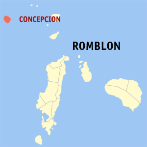
| Municipality | Concepcion |
| Barangay | Botlog |
| Demographics | |
| Population | 441 (2010) |
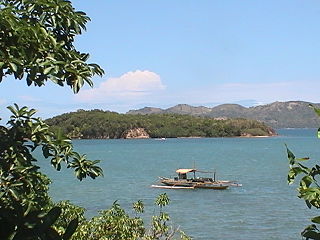
Botlog Island is an island and barangay in northeastern Iloilo, Philippines. It is part of the municipality of Concepcion. According to the 2010 census, it has a population of 441. [1]

A barangay or baranggay, formerly referred to as barrio, is the smallest administrative division in the Philippines and is the native Filipino term for a village, district or ward. In metropolitan areas, the term often refers to an inner city neighbourhood, a suburb or a suburban neighborhood. The word barangay originated from balangay, a kind of boat used by a group of Austronesian peoples when they migrated to the Philippines.

Iloilo is a province located in the region of Western Visayas in the Philippines. Iloilo occupies a major southeast portion of the Visayan island of Panay and is bordered by the province of Antique to the west, Capiz to the north, the Jintotolo Channel to the northeast, the Guimaras Strait to the east, and the Iloilo Strait and Panay Gulf to the southwest.

The Philippines, officially the Republic of the Philippines, is an archipelagic country in Southeast Asia. Situated in the western Pacific Ocean, it consists of about 7,641 islands that are categorized broadly under three main geographical divisions from north to south: Luzon, Visayas, and Mindanao. The capital city of the Philippines is Manila and the most populous city is Quezon City, both part of Metro Manila. Bounded by the South China Sea on the west, the Philippine Sea on the east and the Celebes Sea on the southwest, the Philippines shares maritime borders with Taiwan to the north, Japan to the northeast, Vietnam to the west, Palau to the east, and Malaysia and Indonesia to the south.