
Iloilo is a province located in the region of Western Visayas in the Philippines. Iloilo occupies a major southeast portion of the Visayan island of Panay and is bordered by the province of Antique to the west, Capiz to the north, the Jintotolo Channel to the northeast, the Guimaras Strait to the east, and the Iloilo Strait and Panay Gulf to the southwest.
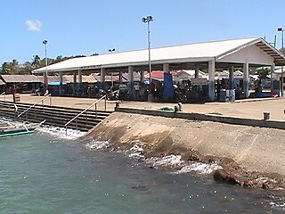
Concepcion, officially the Municipality of Concepcion,, is a 3rd class municipality in the province of Iloilo, Philippines. According to the 2015 census, it has a population of 43,159 people.

San Dionisio, officially the Municipality of San Dionisio,, is a 4th class municipality in the province of Iloilo, Philippines. According to the 2015 census, it has a population of 38,775 people.

Pan de Azucar is a populated island in the Visayan Sea in the Philippines. The island is known for MountPan de Azucar a steep volcanic cone and a prominent landmark at the northern entrance of Guimaras Strait.

Magusipol Island is an uninhabited islet in northeastern Iloilo, Philippines. It is part of the municipality of Estancia.
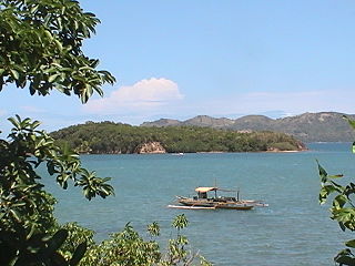
Agho Island is a small, mostly uninhabited island in northeastern Iloilo, Philippines. It is part of the municipality of Concepcion.
The Concepcion Islands are 17 variously inhabited and uninhabited islands in northeastern Iloilo, Philippines. The islands are politically subdivided into 11 island barangays and are part of the municipality of Concepcion. Collectively, the islands have -according to 2010 census- a population of 19,080, which is 48 percent the total population of Concepcion.
Botlog Island is an island and barangay in northeastern Iloilo, Philippines. It is part of the municipality of Concepcion. According to the 2010 census, it has a population of 441.
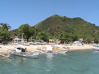
Malangabang is an island and barangay in northeastern Iloilo, Philippines. It is part of the municipality of Concepcion. According to the 2010 census, it has a population of 2,925. Fishing is the main source of income for the island's residents.
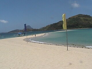
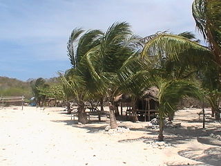
Bulubadiangan Island is a privately owned island in northeastern Iloilo, Philippines. It is part of barangay Polopińa, Concepcion. The Sandbar Island Beach Resort on Bulubadiangan is moderately known within the Philippines.
Danao-Danao Island is a small, low-lying island in northeastern Iloilo, Philippines. It is part of the municipality of Concepcion.
Baliguian Island is an inhabited island in northeastern Iloilo, Philippines. It is the westernmost of the Concepcion Islands and politically administered by the municipality of Concepcion. A virtually flat island, Baliguian features a lighthouse to aid in ship navigation.
Bocot Island is a small island in northeastern Iloilo, Philippines. It is part of the municipality of Concepcion.
Bag-o Isi Island is a small island in northeastern Iloilo, Philippines. It is part of the municipality of Concepcion.
Sombrero is a small, cone-shaped island in northeastern Iloilo, Philippines. It is part of the municipality of Concepcion.
Bag-o Abo is a small, wooded island in northeastern Iloilo, Philippines. It is part of the municipality of Concepcion.
Colebra is an island in northeastern Iloilo, Philippines. It is part of the municipality of Concepcion.
Magalumbi is an island in northeastern Iloilo, Philippines. It is part of the municipality of Batad, although the official provincial government website lists it as an offshore island of Estancia. Magalumbi is part of barangay Tanao, which has a population of 1,903 according to the 2010 census.
Binuluangan is an inhabited island-barangay in northeastern Iloilo, Philippines. It is one of fourteen islands politically administered by the municipality of Carles. In 2010 it had a population of 1,682. There is an elementary school on the island.
Balbagon is a teardrop-shaped island in northeastern Iloilo, Philippines. It is one of fourteen islands politically administered by the municipality of Carles. There is a small beach resort on the island.
