Ghana, officially the Republic of Ghana, is a country in West Africa. It abuts the Gulf of Guinea and the Atlantic Ocean to the south, sharing borders with Ivory Coast in the west, Burkina Faso in the north, and Togo in the east. Ghana covers an area of 238,535 km2 (92,099 sq mi), spanning diverse biomes that range from coastal savannas to tropical rainforests. With nearly 31 million inhabitants, Ghana is the second-most populous country in West Africa, after Nigeria. The capital and largest city is Accra; other major cities are Kumasi, Tamale, and Sekondi-Takoradi.

Elk Grove is a city in Sacramento County, California, United States. Located just south of the state capital of Sacramento, it is part of the Sacramento–Arden-Arcade–Roseville Metropolitan Statistical Area. As of the 2020 Census, the population of the city was 176,124. A 2021 Census estimate puts the population of the city at 178,997. Elk Grove has many wineries, wine cellars, and vineyards. Elk Grove was the fastest-growing city in the U.S. between July 1, 2004, and July 1, 2005, and is also presently the second-largest city in Sacramento County by population.
Ho is the capital city of the Ho Municipal District and the Volta Region of Ghana. The city lies between Mount Adaklu and Mount Galenukui or Togo Atakora Range, and is home to the Volta Regional Museum, a cathedral, and a prison. It was formerly the administrative capital of British Togoland now part of the Volta Region. The population of Ho Municipality according to the 2010 Population and Housing Census is 177,281 representing 8.4 percent of the region's total population. Females constitute 52.7 percent and males represent 47.3 percent. About 62 percent of the population resides in urban localities. The Municipality shares boundaries with Adaklu and Agotime-Ziope Districts to the South, Ho West District to the North and West and the Republic of Togo to the East. Its total land area is 2,361 square kilometers thus representing 11.5 percent of the region's total land area.

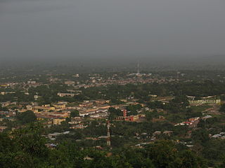
Bolgatanga, colloquially known as Bolga, is a town and the capital of the Bolgatanga Municipal District and Upper East Region of Ghana, adjacent to the border with Burkina Faso. Bolgatanga has over 2012 settlement and a population of about 66,685 people. Bolgatanga is 161 km to the north of Tamale. Bolgatanga lies in the Red Volta River Valley, with the White Volta River and the cliffs of the Gambaga Escarpment to the south of the town forming the southern boundary of the Upper East Region.

Islam was the first Abrahamic monotheistic religion to arrive in Ghana. Today, it is the second most widely professed religion in the country behind Christianity. Its presence in Ghana dates back to the 10th century. According to the Ghana Statistical Service's Population and Housing census (2021), the percentage of Muslims in Ghana is about 19.9%.

Esk is a town and locality in the Somerset Region in South East Queensland, Australia. In the 2016 census, Esk had a population of 1,698 people.

The Greater Accra Region has the smallest area of Ghana's 16 administrative regions, occupying a total land surface of 3,245 square kilometres. This is 1.4 per cent of the total land area of Ghana. It is the second most populated region, before the Ashanti Region, with a population of 5,455,692 in 2021, accounting for 17.7 per cent of Ghana's total population.
Gin Gin is a rural town and locality in the Bundaberg Region, Queensland, Australia. In the 2016 census, Gin Gin had a population of 1,053 people.
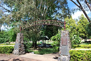
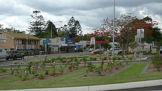
Kenilworth is a rural town and locality in the Sunshine Coast Region, Queensland, Australia. In the 2016 census, the locality of Kenilworth had a population of 558 people.
Goaso is a town and the capital of the newly created Ahafo Region of Ghana. Goaso doubles as the capital of Asunafo North Municipal District. It is located between three major towns; Mim, Kukuom and Hwidiem. Other surrounding towns include Ayumso, Akrodie, Fawohoyeden and Nkaseim. Goaso had a 2017 estimated population of 24,846 making it the 2nd largest town after Mim in the Asunafo North Municipal District. Goaso is home to the offices of certain government agencies and institutions.

Hohoe Municipal is one of the 25 administrative districts of the Volta Region of Ghana. It was carved out of the former Kpando District. It was established by the Legislative Instrument of 2012. The Municipality has a total land area of 1,172 km2, which is 5.6 per cent of the land area of the region. It shares borders with the Republic of Togo on the east, forming part of Ghana's international border; on the southeast by the Afadzato district and southwest by Kpando Municipality; on the north with Jasikan district; and on the northwest with the Biakoye districts. Its capital, Hohoe, is about 78 km from Ho, the regional capital and 220 km from Accra, the national capital. The population of Hohoe Municipality, according to the 2010 Population and Housing Census, is 167,016 representing 7.9 per cent of the total population of the Volta Region. It comprises 52.1 per cent females and 47.9 percent males.
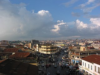
Kumasi Metropolitan Assembly is one of the 260 Metropolitan, Municipal and District Assemblies (MMDAs) in Ghana and forms part of the forty-three districts in Ashanti Region, Ghana with Kumasi being its administrative capital. The metropolis is located in the central part of Ashanti Region and has Kumasi as its capital city.
Before the arrival of European settlers, who introduced a formal education system addressed to the elites, education in Ghana was mainly informal and based on apprenticeship. Economic activities in pre-colonial Ghana were based on farm produce shared within households and members of each household specialized in providing necessities such as cooking utilities, shelter, clothing, and furniture, and trade with other households was therefore practiced on a very small scale. As such there was no need for employment outside the household that would have otherwise called for disciplines, values, and skills through a formal education system. After colonization, Ghana's economy became a hybrid of subsistence and formal economy.
Agogo is a town in the Asante Akim North Municipal District of the Ashanti Region of Ghana. Agogo is approximately 80 kilometers east of Kumasi, the capital of the Ashanti Region, and had a population of 28,271 in the 2000 census. Computer projections estimate that the 2007 population was 32,859.
Dodi Papase is a town in the Oti Region of Ghana. With a population of approximately 5,254, Dodi Papase is the second-most-populous city in Kadjebi District in the Oti Region of Ghana. It is located in Eastern Ghana on the banks of the Wawa River and is known for the Dodi Papase Community Secondary School, a second cycle institution.
Kpassa is the capital of Nkwanta North District, a district in the Oti Region of Ghana. The Oti Region was part of the Volta Region of Ghana until 2019. The inhabitants of Kpassa are mostly Konkomba people. The other inhabitants are Basare. The Bassares and famous for their fire dance.There are also Akan, Ewe, Anufo, Krachi and Gonja people. In the past, the inhabitants of Kpassa have mainly engaged in farming. This trend has changed during the past two decades. Younger inhabitants are actively pursuing education and small-scale business activities, while the older ones are into governance. As a result, Kpassa has undergone rapid expansion during these past two decades. The town is expected to expand further once the Eastern Corridor Road Project is completed. In terms of architecture, a returning visitor will easily noticed that the town is rapidly shifting from mud buildings or atakpame to modern block buildings. In fact, most people in the town attach this shift to prestige and affluence in the society. At the current rate, one is expected to find fewer atakpame buildings a decade in the future. The economy of Kpassa is critical to the Volta Region, owing to its engagement in the production of valuable agricultural products such as corn, yam, cassava, millet, groundnuts, pepper, soya beans, and beans, among others.

Ahamansu Islamic Senior High School is a public co-educational high school located in Ahamansu, Ghana. It was the first Islamic senior high school in the Volta Region and one of three second cycle institutions in the Kadjebi District which became part of the Oti Region in 2019.

Ho West District is one of the eighteen districts in Volta Region, Ghana. Originally it was formerly part of the then-larger Ho District on 10 March 1989, until the western part was split off to create Ho West District on 28 June 2012; thus the remaining part was elevated to municipal district assembly status on that same year to become Ho Municipal District. The district assembly is located in the central part of Volta Region and has Dzolokpuita as its capital town.

The Bono region is one of the 16 administrative regions of Ghana. It is as a result of the remainder of Brong-Ahafo region when Bono East region and Ahafo region were created. Sunyani, also known as the green city of Ghana, is the regional capital. Sunyani can pride itself as the cleanest capital city and a major conference destination.
Kadjebi-Asato Secondary School (KASEC) is a co-educational, boarding senior high school located on the border of two towns known as Kadjebi and Asato hence, the name Kadjebi-Asato Secondary school. The school is located in the Kadjebi District in the Oti Region of Ghana.
