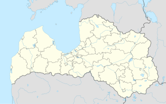
Aizkraukle

Last updated
Aizkraukle
Town
Aizkraukle, Lacplesa iela.jpg
Aizkraukle flag.svg
Aizkraukle COA.svg
Latvia adm location map.svg
Red pog.svg
Aizkraukle
Location in Latvia
Coordinates: 56°36′15″N25°15′14″E / 56.60417°N 25.25389°E / 56.60417; 25.25389
CountryFlag of Latvia.svg Latvia
Municipality Aizkraukle Municipality
Town rights 1967
Area
[1]
  Total
12.93 km2 (4.99 sq mi)
  Land8.04 km2 (3.10 sq mi)
  Water4.89 km2 (1.89 sq mi)
Population
 (2025) [2]
  Total
6,689
  Density832/km2 (2,150/sq mi)
Time zone UTC+2 (EET)
  Summer (DST) UTC+3 (EEST)
Postal code
LV-510(1-3)
Calling code +371 651
Website www.aizkraukle.lv

Aizkraukle (German : Ascheraden) is a town [3] in Aizkraukle Municipality, of which it is the administrative centre. Most of Aizkraukle is situated on the right bank of the Daugava River. As defined by Latvian law, Aizkraukle belongs partially to Vidzeme and partially to Selonia. [4] The population in 2020 was at 7,018. [5]

Contents

History

In the second half of the 14th century, the Livonian Order built the Aizkraukle Castle, a few kilometres downstream from the ancient hillfort of Livs. The ruins of the castle still remain today. Before World War I, the settlement that stood near the site of modern-day Aizkraukle was known by its German name of Ascheraden.

The modern town was established in 1961 as a settlement to house the builders of the nearby hydroelectric power plant of Pļaviņas. [6] It was originally called Stučka [7] (or "Стучка", Stuchka [8] and "имени Петра Стучки", imeni Petra Stuchki [6] in Russian), for Pēteris Stučka, a Latvian communist. [6] Town status was granted to it in 1967, [6] [7] which is also when it became the administrative center of Stučkas district.[ citation needed ] In 1990, it was renamed as Aizkraukle, after the nearest railway station. [6] The name literally means "beyond the Kraukle River." [6]

Economy

General industries in the area include power generation, woodworking, printing, and agriculture.

In 2004, Aizkraukle was awarded "The tidiest town in Latvia 2004" in its size group.

Notable people

See also

Citations and references

  1. "Reģionu, novadu, pilsētu un pagastu kopējā un sauszemes platība gada sākumā". Central Statistical Bureau of Latvia. Retrieved 7 January 2025.
  2. "Iedzīvotāju skaits pēc tautības reģionos, pilsētās, novados, pagastos, apkaimēs un blīvi apdzīvotās teritorijās gada sākumā (pēc administratīvi teritoriālās reformas 2021. gadā)". Central Statistical Bureau of Latvia. Retrieved 10 October 2025.
  3. "Administratīvo teritoriju un apdzīvoto vietu likums". Archived from the original on 2020-08-18.
  4. Latviešu vēsturisko zemju likums
  5. "ISG020. Population number and its change by statistical region, city, town, 21 development centres and county". Central Statistical Bureau of Latvia. 2020-01-01. Retrieved 2021-02-12.
  6. 1 2 3 4 5 6 Pospelov, p. 24
  7. 1 2 Latvijas PSR Administratīvi Teritoriālais Iedalījums, p. 47
  8. Latvijas PSR Administratīvi Teritoriālais Iedalījums, p. 118

Cited sources