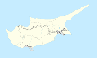
Northern Cyprus, officially the Turkish Republic of Northern Cyprus, is a de facto state that comprises the northeastern portion of the island of Cyprus. Recognised only by Turkey, Northern Cyprus is considered by the international community to be part of the Republic of Cyprus.

Paliometocho, officially Palaiometocho, is a village in the Nicosia District of Cyprus. Its name derives from the Greek palaio (old) and metochio (inn). It was probably given to it because it used to be a rest stop for pilgrims on their way to the Kykkos Monastery. As of 2011, Paliometocho had a population of 4,145.

Troulloi is a village in Larnaca District, Cyprus. It is one of only four villages located within the United Nations Buffer Zone, the other three being Pyla, Athienou and Deneia. In 2011 Troulloi had a population of 1,175 people according to the Statistical Service of the Republic of Cyprus, 2014-04-17. The village's patron saint is Saint Mamas, celebrated on 2 September each year.

Lakatamia is a southwestern suburb of Nicosia, Cyprus. In 2011 Lakatamia had a population of 38,345.

Kolossi is a village on the outskirts of Limassol, Cyprus. It lies partly in the British Overseas Territory of Akrotiri and Dhekelia. Its population in 2011 was 5,651.

Geri is a large village in Cyprus, 10 kilometres (6.2 mi) south-east of the capital Nicosia. In 2001, it had a population of 6,643. As of 2011, its population was 8,235. Following a referendum in 2011, Geri has become a municipality.

Dali is a large village in Cyprus, located south east of the capital Nicosia and close to the ancient city of Idalion. In 2001, it had a population of 5,834. By 2011, the population had almost doubled to 10,466.

Trachoni is a large village lying partly in the Limassol District of Cyprus, and partly in the British Overseas Territory of Akrotiri and Dhekelia. As of 2011, it had a population of 3,952. Prior to 1974, Trachoni was inhabited both by Greek- and Turkish Cypriots. The Greek Cypriots constituted a majority.

Astromeritis is a large village in the Morphou Department of the Nicosia District of Cyprus. It is located 30 km (18.64 mi) from the capital Nicosia. By the 2001 census it had a total population of 2,361.

Kokkinotrimithia is a town located west of Nicosia, Cyprus, close to the Green Line. It has an exit along the A9 motorway. In 2011, it had 4,077 inhabitants.

Kotsiatis is a village located in the Nicosia District of Cyprus.

Mathiatis is a village located in the Nicosia District of Cyprus. Before 1960, it had a mixed Greek- and Turkish-Cypriot population.

Agioi Trimithias is a village located in the Nicosia District of Cyprus.

Sia or Sha is a village in the Nicosia District of Cyprus. It is located 4 km south of Alampra.

Spilia is a small village in the Nicosia District of Cyprus, located near Kyperounta. The hamlet of Kourdali is part of it.

Deneia is a village in the Nicosia District of Cyprus, west of Mammari. It is one of only four villages located within the United Nations Buffer Zone, the other three being Pyla, Athienou and Troulloi.

Agios Thomas is a village in the Limassol District of Cyprus, located 5 km northwest of Avdimou.

Faleia is a village in the Paphos District of Cyprus, located 3 km south of Agios Fotios. Prior to 1974, it was inhabited exclusively by about 200 Turkish Cypriots. As of 2011, only 2 people lived in Faleia. The village is now in a desolate state.

Terra is a village in the Paphos District of Cyprus, located 1 km north of Kritou Terra. Prior to 1974, the village was inhabited exclusively by Turkish Cypriots. In 1973, 329 Turkish Cypriots were living in Terra. As of 2011, it had a population of 36, none of whom were Turkish Cypriots.

Neo Chorio is a village in the Paphos District of Cyprus, about 8 km west of Polis. Until 1958, it had a mixed Greek- and Turkish Cypriot population with a Greek Cypriot majority. Amid the intercommunal violence, the Turkish Cypriot inhabitants of Neo Chorio fled to Androlykou, a nearby Turkish Cypriot village. In 1975, following the Turkish invasion of the previous year and subsequent division of the island, most Turkish Cypriots of Neo Chorio resettled in Myrtou, now in Northern Cyprus. In 2011, Neo Chorio had a population of 519.


