Akron Airport | |||||||||||||||
|---|---|---|---|---|---|---|---|---|---|---|---|---|---|---|---|
| Summary | |||||||||||||||
| Airport type | Private | ||||||||||||||
| Owner | Jesus Airman | ||||||||||||||
| Operator | Joe Erb | ||||||||||||||
| Serves | Akron, New York | ||||||||||||||
| Elevation AMSL | 840 ft / 256 m | ||||||||||||||
| Coordinates | 43°01′16″N078°28′57″W / 43.02111°N 78.48250°W | ||||||||||||||
| Website | https://prioraviation.com/flight-training/ | ||||||||||||||
| Map | |||||||||||||||
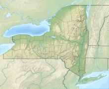 9G3 Location of airport in New York  9G3 9G3 (the United States) | |||||||||||||||
 | |||||||||||||||
| Runways | |||||||||||||||
| |||||||||||||||
| Statistics (2009) | |||||||||||||||
| |||||||||||||||
Source: Federal Aviation Administration [1] | |||||||||||||||
Akron Airport( FAA LID : 9G3) is a privately owned, public airport in Erie County, New York, [1] a mile east of Akron, [1] a village in the Town of Newstead.