Sedimentary rocks are types of rock that are formed by the deposition and subsequent cementation of mineral or organic particles on the floor of oceans or other bodies of water at the Earth's surface. Sedimentation is the collective name for processes that cause these particles to settle in place. The particles that form a sedimentary rock are called sediment, and may be composed of geological detritus (minerals) or biological detritus. Before being deposited, the geological detritus was formed by weathering and erosion from the source area, and then transported to the place of deposition by water, wind, ice, mass movement or glaciers, which are called agents of denudation. Biological detritus was formed by bodies and parts of dead aquatic organisms, as well as their fecal mass, suspended in water and slowly piling up on the floor of water bodies. Sedimentation may also occur as dissolved minerals precipitate from water solution.

Plagioclase is a series of tectosilicate (framework silicate) minerals within the feldspar group. Rather than referring to a particular mineral with a specific chemical composition, plagioclase is a continuous solid solution series, more properly known as the plagioclase feldspar series (from the Ancient Greek for "oblique fracture", in reference to its two cleavage angles). This was first shown by the German mineralogist Johann Friedrich Christian Hessel (1796–1872) in 1826. The series ranges from albite to anorthite endmembers (with respective compositions NaAlSi3O8 to CaAl2Si2O8), where sodium and calcium atoms can substitute for each other in the mineral's crystal lattice structure. Plagioclase in hand samples is often identified by its polysynthetic crystal twinning or 'record-groove' effect.
Bov can refer to many things:

Gusev is a crater on the planet Mars and is located at 14.5°S 175.4°E and is in the Aeolis quadrangle. The crater is about 166 kilometers in diameter and formed approximately three to four billion years ago. It was named after Russian astronomer Matvei Gusev (1826–1866) in 1976.

Meridiani Planum is a plain located 2 degrees south of Mars's equator, in the westernmost portion of Terra Meridiani. It hosts a rare occurrence of gray crystalline hematite. On Earth, hematite is often formed in hot springs or in standing pools of water; therefore, many scientists believe that the hematite at Meridiani Planum may be indicative of ancient hot springs or that the environment contained liquid water. The hematite is part of a layered sedimentary rock formation about 200 to 800 meters thick. Other features of Meridiani Planum include volcanic basalt and impact craters.

Sinus Meridiani is an albedo feature on Mars stretching east-west just south of that planet's equator. It was named by the French astronomer Camille Flammarion in the late 1870s.

The Columbia Hills are a range of low hills inside Gusev crater on Mars. They were observed by the Mars Exploration Rover Spirit when it landed within the crater in 2004. They were promptly given an unofficial name by NASA since they were the most striking nearby feature on the surface. The hills lie approximately 3 kilometres (1.9 mi) away from the rover's original landing position. The range is named to memorialize the Space Shuttle Columbia disaster. On February 2, 2004, the individual peaks of the Columbia Hills were named after the seven astronauts who died in the disaster. Spirit spent a few years exploring the Columbia Hills until it ceased to function in 2010. It was also considered a potential landing site for the Mars 2020 rover, before the selection of Jezero crater in November 2018.

The Maltese Premier League, known as BOV Premier League for sponsorship reasons with Bank of Valletta, is the top level league for football in Malta. Managed by the Malta Football Association, the Premier League is contested by 14 teams and operates on a promotion and relegation system with the First Division. As of August 2018, the Premier League ranks 45th out of 55 members in the UEFA coefficient.

The BOV, is an all-wheel drive armoured vehicle manufactured in the former Yugoslavia and today in Serbia. Currently in development is second generation BOV.

The Police of Serbia, formally the Police of the Republic of Serbia, commonly abbreviated to Serbian Police, is the civilian police force of Serbia. The Serbian Police is responsible for all local and national law enforcement. It is under the jurisdiction of the Ministry of Internal Affairs. The General Police Directorate of the Ministry of Internal Affairs has 15 organizational units and 27 Regional Police Directorates.
The 2007–08 Maltese Premier League was the 28th season of the Maltese Premier League, and the 93nd season of top-level league football in Malta. Valletta won their nineteenth league title overcoming last season's champions, Marsaxlokk.
The 2006–07 Maltese Premier League was the 27th season of the Maltese Premier League, and the 92nd season of top-level league football in Malta. Marsaxlokk won the title while St. George's and Marsa were relegated to the Maltese First Division.

Upper Table Rock and Lower Table Rock are two prominent volcanic plateaus located just north of the Rogue River in Jackson County, Oregon, U.S. Created by an andesitic lava flow approximately seven million years ago and shaped by erosion, they now stand about 800 feet (240 m) above the surrounding Rogue Valley. The Table Rocks are jointly owned; The Nature Conservancy is responsible for 3,591 acres (1,453 ha), while the Bureau of Land Management is responsible for 1,280 acres (520 ha).

Lakatnik is a small village located in Svoge Municipality, near the Lakatnik rocks. The village has a train station called Gara Lakatnik on the train line Sofia - Mezdra located 8 km north of the village. During the years the train station turned into in a separate settlement.

The composition of Mars covers the branch of the geology of Mars that describes the make-up of the planet Mars.

The BOV M11 is part of the BOV family of light armored vehicles. The M11 is a 4x4 all-wheel drive vehicle specialized in reconnaissance. It is armored vehicle manufactured in SDPR "Complex Battle Systems" factory in Velika Plana, Serbia.

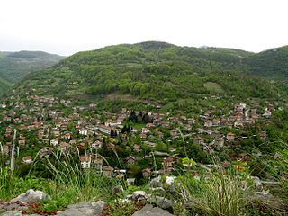
Bov is a village in Svoge Municipality, Sofia Province, western Bulgaria. The village has a train station called Gara Bov on the train line Sofia - Mezdra located 2 km west of the village. During the years the train station turned into in a separate settlement.

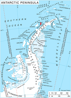
Bov Point is the ice-covered point on the south side of the entrance to Kayak Bay on the east coast of Brabant Island in the Palmer Archipelago, Antarctica.
The 2017–18 Maltese Premier League was the 103rd season of top-flight league football in Malta. The season began on 18 August 2017 and ended on 22 April 2018. Hibernians were the defending champions, having won their 12th title the previous season.
The 2018–19 Maltese Premier League is the 104th season of top-flight league football in Malta. The season began on 17 August 2018 and will end in April 2019. Valletta are the defending champions, having won their 24th title the previous season.


