Imtan is a village in As Suwaydā' Governorate, southern Syria. Imtan is located 37 km south-east of the city of As Suwaydā', 1189 meters above sea level in the southern part of Jabal el Druze. According to the Syria Central Bureau of Statistics (CBS), Imtan had a population of 2,495 in the 2004 census.

Tubna is a village in southern Syria, administratively part of the Daraa Governorate in the Hauran region. It is located 58 km south Damascus and 42 km from Daraa.
Beit Yashout is a town in northwestern Syria, administratively part of the Jableh District of the Latakia Governorate, and located south of Latakia. Nearby localities include Ayn al-Sharqiyah to the west and Daliyah to the south. According to the Syria Central Bureau of Statistics, Beit Yashout had a population of 6,115 in the 2004 census. The town is located in the An-Nusayriyah Mountains at an elevation of around 500 m (1,700 ft).
Al-Hirak is a small city in southern Syria, administratively belonging to the Izra' District of the Daraa Governorate. It is situated about 40 kilometers northeast of Daraa, and is surrounded by the towns of Maliha al-Gharbiyah to the east and Izra' to the northeast. In the 2004 census by the Central Bureau of Statistics, al-Hirak had a population of 20,760. Its inhabitants are predominantly Muslims.
Hit is a village in southern Syria, administratively part of the al-Suwayda Governorate, located northeast of al-Suwayda. It is situated on the northern end of Jabal al-Arab. Nearby localities include Shaqqa to the south, Umm al-Zaytun and Amrah to the southwest, al-Hayyat to the north and al-Buthainah to the east. According to the Syria Central Bureau of Statistics (CBS), Hit had a population of 655 in the 2004 census. The inhabitants are mostly Christians or Druze.
Mahajjah is a town in the Izra' District of the Daraa Governorate in southern Syria located north of Daraa. It is situated about 63 kilometers south of the capital Damascus. Nearby localities include Khabab to the northeast, Tubna to the north, Inkhil to the northwest, Jasim to the west, Nawa to the southwest, Izra and al-Shaykh Maskin to the south and the volcanic Lejat plain to the east. In the 2004 census by the Syria Central Bureau of Statistics (CBS), Mahajjah had a population of 9,982. Its inhabitants are predominantly Muslims and Catholics.
Deir al-Bukht is a town in southern Syria, administratively part of the al-Sanamayn District of the Daraa Governorate located north of Daraa. It is situated about 63 kilometers south of the capital Damascus. Nearby localities include al-Sanamayn to the south, Kafr Shams to the southwest, Deir al-Adas to the west, Ghabaghib to the northeast, Muthabin to the east and Jabab to the southeast. In the 2004 census by the Syria Central Bureau of Statistics (CBS), Deir al-Bukht had a population of 5,381.
Hout is a village in southern Syria, administratively part of the al-Suwayda Governorate, located south of al-Suwayda. Nearby localities include Umm al-Rumman to the south, Samad to the southwest, Bosra to the west, Nimrah and al-Qurayya to the north and Salkhad to the east. According to the Syria Central Bureau of Statistics (CBS), Hout had a population of 873 in the 2004 census.
Rasas is a village in southern Syria, administratively part of the al-Suwayda Governorate, located south of al-Suwayda. Nearby localities include 'Ira to the southwest, Sahwat Bilata to the east, al-Ruha to the northeast and Umm Walad to the west. According to the Syria Central Bureau of Statistics (CBS), Rasas had a population of 3,332 in the 2004 census.
Qarfa is a village in southern Syria, administratively belonging to the Izra' District of the Daraa Governorate. Nearby localities include al-Shaykh Maskin to the northwest, Izra to the northeast, Maliha al-Atash to the east, Namir to the southeast, Khirbet Ghazaleh to the south and Abtaa to the southwest. In the 2004 census by the Central Bureau of Statistics, al-Hirak had a population of 20,760.
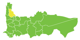
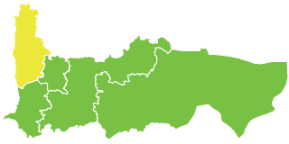
Al-Qutailibiyah is a town in northwestern Syria, administratively part of the Jableh District in the Latakia Governorate, located south of Latakia. Nearby localities include Arab al-Mulk and Qurfays and Sarabion to the west, Jableh to the northwest, Siyano to the north, Ayn al-Sharqiyah to the northeast, Daliyah to the southeast and Dweir Baabda to the south. According to the Syria Central Bureau of Statistics, al-Qutailibiyah had a population of 5,566 in the 2004 census. It is the administrative center of the al-Qutailibiyah nahiyah ("subdistrict") which contained 32 localities with a total population of 32,582 in 2004. Its inhabitants are predominantly Alawites from the Bani Ali and the Kharalis Ghuraba clans.
Tell Tawil, also known as Bani Roumta, is a village near Tell Tamer in western al-Hasakah Governorate, northeastern Syria. Administratively it belongs to the Nahiya Tell Tamer.
Urman is a village in southern Syria, administratively part of the Salkhad District of the al-Suwayda Governorate. It is located south of al-Suwayda and nearby localities include Salkhad to the west, Awas to the south, Malah to the east and Sahwat al-Khudr to the north. In the 2004 census it had a population of 5,735.
Dhibin is a village in southern Syria, administratively part of the Salkhad District of the al-Suwayda Governorate. It is located south of al-Suwayda, near the southern border with Jordan. Nearby localities include Bakka to the north, Salkhad to the northeast, Umm al-Rumman to the east, Samaj to the west and Samad to the northwest. In the 2004 census it had a population of 2,562. It is the administrative center of the Dhibin Nahiyah, which consisted of three villages with a collective population of 6,900 in 2004.
Khirbet Awad is a village in southern Syria, administratively part of the Salkhad District of the al-Suwayda Governorate. It straddles Syria's border with Jordan. The closest localities are al-Mughayyir to the northwest and Annat to the northeast. In the 2004 census it had a population of 398. Its inhabitants are Druze.
Umm al-Zaytun is a village in the al-Suwayda Governorate in southwestern Syria. It is situated along the southeastern edge of the Lejah lava plateau, northwest of the city of al-Suwayda. Umm al-Zaytun had a population of 1,913 in the 2004 census. Its inhabitants are Druze.
Lubayn is a village in the al-Suwayda Governorate in southwestern Syria. It is situated in the southern part of the Lejah plateau, northwest of the city of al-Suwayda. Lubayn had a population of 1,730 in the 2004 census. Its inhabitants are Druze.
′Ira is a village in southeastern Syria, administratively part of the as-Suwayda District of the as-Suwayda Governorate, located south of as-Suwayda. In the 2004 census, it had a population of 6,136. Its inhabitants are predominantly Druze.
Salim is a village in southern Syria, administratively part of the al-Suwayda Governorate, located north of al-Suwayda. Nearby localities include Attil to the west, Mardak and Shahba to the north and Qanawat to the southeast. According to the Syria Central Bureau of Statistics (CBS), Salim had a population of 2,129 in the 2004 census.
Jamrin is a village in southern Syria, administratively part of the Daraa Governorate, located east of Daraa and immediately north of Bosra. Other nearby localities include Maaraba to the west, Kharaba to the northwest, al-Mujaymer to the north and al-Qurayya to the east. According to the Syria Central Bureau of Statistics (CBS), Samad had a population of 1,000 in the 2004 census.