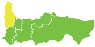
Tal Salhab is a town in the western center of Syria, administratively part of the Hama Governorate, located 48 kilometres (30 mi) northwest of Hama. It is situated on the southern edge of the Ghab plain and by the western bank of the Orontes River. Nearby localities include Nahr al-Bared, Asharnah and al-Suqaylabiyah to the north, Deir Shamil and Deir Mama to the south, Tremseh, Mhardeh and Halfaya to the east.

Abar Beit Seif is a Syrian village located in Al-Suqaylabiyah Nahiyah in Al-Suqaylabiyah District, Hama. According to the Syria Central Bureau of Statistics (CBS), the village had a population of 2,819 in the 2004 census.
Abu Kleefun is a Syrian village located in Al-Suqaylabiyah Nahiyah in Al-Suqaylabiyah District, Hama. According to the Syria Central Bureau of Statistics (CBS), Abu Kleefun had a population of 72 in the 2004 census.
Balluneh is a Syrian village located in Al-Suqaylabiyah Nahiyah in Al-Suqaylabiyah District, Hama. According to the Syria Central Bureau of Statistics (CBS), Balluneh had a population of 60 in the 2004 census.
Ein Warideh is a Syrian village located in Al-Suqaylabiyah Nahiyah in Al-Suqaylabiyah District, Hama. According to the Syria Central Bureau of Statistics (CBS), Ein Warideh had a population of 468 in the 2004 census.
Ennab is a Syrian village located in Al-Suqaylabiyah Nahiyah in Al-Suqaylabiyah District, Hama. According to the Syria Central Bureau of Statistics (CBS), Ennab had a population of 2774 in the 2004 census.

Hurat Ammurin is a Syrian village located in Al-Suqaylabiyah Nahiyah in Al-Suqaylabiyah District, Hama. According to the Syria Central Bureau of Statistics (CBS), Hurat Ammurin had a population of 3143 in the 2004 census.
Khansaa - Shetheh is a Syrian village located in Al-Suqaylabiyah Nahiyah in Al-Suqaylabiyah District, Hama. According to the Syria Central Bureau of Statistics (CBS), Khansaa - Shetheh had a population of 715 in the 2004 census.
Maksar, Hama is a Syrian village located in Al-Suqaylabiyah Nahiyah in Al-Suqaylabiyah District, Hama. According to the Syria Central Bureau of Statistics (CBS), Maksar, Hama had a population of 113 in the 2004 census.
Mashta Elshalahmeh is a Syrian village located in Al-Suqaylabiyah Nahiyah in Al-Suqaylabiyah District, Hama. According to the Syria Central Bureau of Statistics (CBS), Mashta Elshalahmeh had a population of 326 in the 2004 census.
Nabe Eltib is a Syrian village located in Al-Suqaylabiyah Nahiyah in Al-Suqaylabiyah District, Hama. According to the Syria Central Bureau of Statistics (CBS), Nabe Eltib had a population of 1521 in the 2004 census.
Saidiyeh, Hama is a Syrian village located in Al-Suqaylabiyah Nahiyah in Al-Suqaylabiyah District, Hama. According to the Syria Central Bureau of Statistics (CBS), Saidiyeh, Hama had a population of 324 in the 2004 census.
Saqiyet Nijm is a Syrian village located in Al-Suqaylabiyah Nahiyah in Al-Suqaylabiyah District, Hama. According to the Syria Central Bureau of Statistics (CBS), Saqiyet Nijm had a population of 1932 in the 2004 census.
Shahta is a Syrian village located in Al-Suqaylabiyah Nahiyah in Al-Suqaylabiyah District, Hama. According to the Syria Central Bureau of Statistics (CBS), Shahta had a population of 454 in the 2004 census.

Al-Shajar is a Syrian village located in the Suqaylabiyah Subdistrict of the al-Suqaylabiyah District in Hama Governorate. According to the Syria Central Bureau of Statistics (CBS), al-Shajar had a population of 941 in the 2004 census.
Tahunet Elhalawa is a Syrian village located in Al-Suqaylabiyah Nahiyah in Al-Suqaylabiyah District, Hama. According to the Syria Central Bureau of Statistics (CBS), Tahunet Elhalawa had a population of 1049 in the 2004 census.

Tal Eltiten is a Syrian village located in Al-Suqaylabiyah Nahiyah in Al-Suqaylabiyah District, Hama. According to the Syria Central Bureau of Statistics (CBS), Tal Eltiten had a population of 435 in the 2004 census.
Elrihana is a Syrian village located in Al-Suqaylabiyah Nahiyah in Al-Suqaylabiyah District, Hama. According to the Syria Central Bureau of Statistics (CBS), Elrihana had a population of 692 in the 2004 census.

Tal Hawash is a Syrian village located in Qalaat al-Madiq Subdistrict in Al-Suqaylabiyah District, Hama. According to the Syria Central Bureau of Statistics (CBS), Tal Hawash had a population of 2498 in the 2004 census. The village is predominantly Sunni Muslim. Since the beginning of the Syrian Civil War, it has been bombarded and attacked numerous times by Syrian regime forces. As a result, a large segment of its population has been displaced. The etymology of the village's name is somewhat controversial. The first part of the name, Tal, is likely derive from the Aramaic word ܬܶܠܐ meaning hill. The second part of its name, Hawash is possibly a reference to biblical character Joshua יְהוֹשֻׁעַ in Hebrew or ܗܘܫܳܥ in Aramaic.

Tal Wassit, also spelt Tal Wasat and Tall Waset, is a Syrian village located in Al-Ziyarah Nahiyah in Al-Suqaylabiyah District, Hama. According to the Syria Central Bureau of Statistics (CBS), it had a population of 1254 in the 2004 census.


