Abil is a village in central Syria, administratively part of the Homs Governorate, located 10 kilometers south of Homs. Nearby localities include al-Nuqayrah and Kafr Aya to the north, Maskanah to the northeast, Judaydat al-Sharqiyah to the east, Shinshar to the southeast, Damina al-Sharqiyah to the south, al-Buwaydah al-Sharqiyah to the southwest and Qattinah to the west. According to the Syria Central Bureau of Statistics (CBS), Abil had a population of 2,873 in the 2004 census. Its inhabitants are predominantly Sunni Muslims.
Muqlus or Mqlos is a village in western Syria, administratively belonging to the governorate of Homs.
Khirbet Ghazi is a village in western Syria, administratively part of the Homs Governorate, southwest of Homs. Nearby localities include Wujuh al-Hajar and Laftaya to the southwest. According to the Central Bureau of Statistics (CBS), Khirbet Ghazi had a population of 3,056 in the 2004 census.
Qazhal is a village in western Syria, administratively part of the Homs Governorate, just west of Homs. Nearby localities include the al-Waer suburb of Homs to the east, Khirbet al-Sawda to the north, Khirbet Tin Mahmoud to the northwest and Khirbet Tin Nur to the southwest. According to the Central Bureau of Statistics (CBS), Qazhal had a population of 2,271 in the 2004 census. Its inhabitants are predominantly Turkmens.
Dardaghan is a village in central Syria, administratively part of the Homs Governorate, located southeast of Homs. Nearby localities include Jandar to the west, Hisyah to the southwest and al-Riqama to the northeast. According to the Central Bureau of Statistics (CBS), Dardaghan had a population of 1,497 in the 2004 census.
Al-Nizariyya Arabic: النزارية, romanized: al-Nīzārīyya) is a village in central Syria, administratively part of the Homs Governorate, located southwest of Homs. It is situated off the Orontes River and at the northeastern border of Lebanon. Nearby localities include Zita al-Gharbiyah to the northwest, Rableh and al-Qusayr to the north and Hisyah further to the east. According to the Central Bureau of Statistics (CBS), Nazariya had a population of 3,813 in the 2004 census.
Arjoun, is a village in central Syria, administratively part of the Homs Governorate, located southwest of Homs. Nearby localities include Aqrabiyah to the southwest, al-Qusayr to the southeast, al-Dabaah to the east, Kafr Mousa and al-Ghassaniya to the north and al-Houz to the northwest. According to the Central Bureau of Statistics (CBS), Arjoun had a population of 2,465 in the 2004 census. Its inhabitants are predominantly Sunni Muslims.
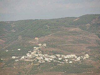
Kafr Mousa is a village in central Syria, administratively part of the Homs Governorate, located south of Homs. Nearby localities include Ghassaniya to the north, Damina al-Gharbiya to the east, al-Qusayr to the southeast, Arjoun to the south and al-Houz to the east. According to the Central Bureau of Statistics (CBS), Kafr Mousa had a population of 1,610 in the 2004 census. Its inhabitants are predominantly Sunni Muslims.
Aqrabiyah is a village in central Syria, administratively part of the Homs Governorate, located southwest of Homs and immediately east and north of the border with Lebanon. Nearby localities include Zita al-Gharbiyah to the southeast, the district center of al-Qusayr to the east, Arjoun and al-Houz to the northeast and al-Naim to the north.
Ayn al-Shams is a village in northern Syria, administratively part of the Hama Governorate, located in Homs Gap southwest of Hama. Nearby localities include Ayn Halaqim, Nisaf and Baarin to the east, and Mashta al-Helu and al-Kafrun to the south. According to the Syria Central Bureau of Statistics, Ayn al-Shams had a population of 2,327 in the 2004 census.
Al-Taybah al-Gharbiyah is a town in central Syria, administratively part of the Homs Governorate, northwest of Homs. Nearby localities include al-Shinyah to the southwest, al-Qabu to the south, Sharqliyya to the southeast, Taldou to the east, Kafr Laha and Tell Dahab to the northeast, Qarmas and Aqrab to the north, Qasraya to the northwest and Khunayzir to the west. According to the Central Bureau of Statistics (CBS), al-Taybah al-Gharbiyah had a population of 4,086 in the 2004 census. Its inhabitants today are predominantly Sunni Muslims.
Tiyas is a village in central Syria, administratively part of the Homs Governorate, east of Homs. It is situated in the Syrian Desert, and the closest localities are Tadmur (Palmyra) to the east, the subdistrict center of al-Qaryatayn to the southwest, Furqlus to the west and Uqayribat to the northwest. According to the Central Bureau of Statistics (CBS), Tiyas had a population of 2,564 in the 2004 census.
Al-Mukharram al-Tahtani is a village in central Syria, administratively part of the Homs Governorate, located northeast of Homs. Nearby localities include Ayn al-Niser to the west, Umm al-Amad to the southwest, al-Mukharram to the southeast and Danibah and Khunayfis to the north. According to the Syria Central Bureau of Statistics (CBS), al-Mukharram al-Tahtani had a population of 3,035 in the 2004 census.
Al-Nasirah is a small Christian town in northwestern Syria, administratively part of the Homs Governorate, located west of Homs. Nearby localities include Habnamrah to the northwest, Marmarita and Ayn al-Bardah to the west, Zweitina to the southwest, al-Husn to the south, al-Huwash and al-Mazinah to the southeast, Shin to the east, Muqlus to the northeast, Hadeih and Mashta al-Helu to the north. According to the Syria Central Bureau of Statistics (CBS), al-Nasirah had a population of 835 in the 2004 census. It is the administrative center of the al-Nasirah nahiyah ("subdistrict") which consisted of 20 localities with a collective population of 16,678 in 2004. The subdistrict largely occupies an area known as Wadi al-Nasara The inhabitants of the town are predominantly Greek Orthodox Christians. The village has a Greek Orthodox Church.
Daminah al-Gharbiyah is a village in central Syria, administratively part of the Homs Governorate, located southwest of Homs. Nearby localities include Qattinah to the northeast, al-Buwaydah al-Sharqiyah to the east, Daminah al-Sharqiyah to the southeast, al-Dabaah to the south, Arjoun and al-Houz to the southwest and al-Ghassaniyah to the west. According to the Central Bureau of Statistics (CBS), Daminah al-Gharbiyah had a population of 1,012 in the 2004 census.
Al-Dabaah is a village in central Syria, administratively part of the Homs Governorate, located southwest of Homs. Nearby localities include Arjoun to the west, Kafr Mousa and al-Ghassaniyah to the northwest, Daminah al-Gharbiyah to the north, al-Buwaydah al-Sharqiyah and Daminah al-Sharqiyah to the northeast, Shamsin to the east and Jandar to the southeast. According to the Syria Central Bureau of Statistics (CBS), al-Dabaah had a population of 3,129 in the 2004 census.
Tell al-Nabi Mando, known in archaeological literature as Tell Nebi Mend and also known as Qadesh after the Bronze-Age city which stood at almost the same location, is a village in central Syria, administratively part of the Homs Governorate, located southwest of Homs. It is situated on the eastern banks of the Orontes River. Nearby localities include al-Houz to the north, Kafr Mousa to the northeast, Arjoun to the east, al-Qusayr to the southeast, Zita al-Gharbiyah to the southwest, al-Aqrabiyah to the southwest and al-Naim to the northwest. According to the Syria Central Bureau of Statistics (CBS), Tell al-Nabi Mando had a population of 1,068 in the 2004 census. The village is adjacent to the ancient site of Qadesh, a name sometimes also used for the village, which abuts it to the north. It is an Alawite village.
Al-Rayyan is a village in central Syria, administratively part of the Homs Governorate, located southeast of Homs. Nearby localities include Sakrah to the north, al-Haraki to the northeast, al-Sayyid to the east, al-Riqama to the southeast, Judaydat al-Sharqiyah to the southwest, Maskanah to the west and Zaidal and Fairouzeh to the northwest. According to the Syria Central Bureau of Statistics (CBS), al-Rayyan had a population of 4,876 in the 2004 census.
Al-Naqirah is a village in central Syria, administratively part of the Homs Governorate, located south of Homs. Nearby localities include Kafr Aya to the northeast, Maskanah to the west, Abil to the south, Qattinah to the southwest and Tell al-Shur to the west.
Al-Na'im is a village in central Syria, administratively part of the Homs Governorate, located southwest of Homs and northwest of al-Qusayr. Just east of the border with Lebanon and on the western shores of Lake Qattinah, nearby localities include al-Aqrabiyah to the south, Tell al-Nabi Mando, Arjoun, al-Houz to the southeast, Kafr Mousa and al-Ghassaniyah to the east, Khirbet Ghazi to the northeast and Wujuh al-Hajar and Liftaya to the north. According to the Syria Central Bureau of Statistics (CBS), al-Na'im had a population of 2,290 in the 2004 census.


