Related Research Articles

Urmia or Orumiyeh is the largest city in West Azerbaijan Province of Iran and the capital of Urmia County. It is situated at an altitude of 1,330 metres (4,360 ft) above sea level, and is located along the Shahar River on the Urmia Plain. Lake Urmia, one of the world's largest salt lakes, lies to the east of the city, and the border area with Turkey lies to the west.

Azerbaijan or Azarbaijan, also known as Iranian Azerbaijan, is a historical region in northwestern Iran that borders Iraq and Turkey to the west, the Nakhchivan Autonomous Republic, Armenia, and the Republic of Azerbaijan to the north.

Lake Urmia is an endorheic salt lake in Iran. The lake is located between the provinces of East Azerbaijan and West Azerbaijan in Iran, and west of the southern portion of the Caspian Sea. At its greatest extent, it was the largest lake in the Middle East and the sixth-largest saltwater lake on Earth, with a surface area of approximately 5,200 km2 (2,000 sq mi), a length of 140 km (87 mi), a width of 55 km (34 mi), and a maximum depth of 16 m (52 ft).
Shahin Dezh is a city in the Central District of Shahin Dezh County, West Azerbaijan province, Iran, and serves as capital of the county.

Namak Lake is a salt lake in Iran. It is located approximately 100 km (62 mi) east of the city of Qom and 60 km (37 mi) of Kashan at an elevation of 790 metres (2,590 ft) above sea level.
Road 16 is a road in the northwest of Iran, which starts from Gilan and passes the cities of Tabriz, Ardabil and Sarab and is connected to Turkey. Some parts of Road 16 are very important because Urmia Lake Bridge is part of this road.

The Zarrineh Rud is a river in Kurdistan Province and West Azarbaijan Province, Iran.

The Urmia Lake Bridge or Urmia Lake Causeway is a road bridge in northern Iran. It is the largest and longest bridge in Iran, and crosses Lake Urmia, connecting the provinces of East Azerbaijan and West Azerbaijan. The project was completed in November 2008.

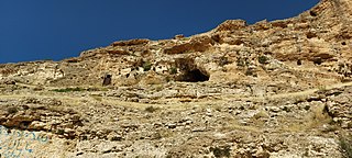
The Gadar River rises in the Iranian Zagros Mountains near the point where the borders of Iran, Turkey and Iraq meet. From its source, the river flows towards the southeast and then changes course due east through the Ushnu-Solduz valley. After leaving the valley, the river turns north and flows into the marshes bordering Lake Urmia. The length of the river is approximately 100 kilometres (62 mi), its drainage basin is variously estimated as 1,900 square kilometres (730 sq mi) and 2,123 square kilometres (820 sq mi) and its discharge is 0.34 cubic metres (12 cu ft) per second. The Ushnu-Solduz valley has been occupied for many millennia, as testified by the excavations at sites like Hasanlu Tepe and Hajji Firuz Tepe.

Sufi Chay is a river in north-west Iran, at 37° 19' 45" N, 46° 4' 36" E. The river rises at Mount Sahand in the mountains to the east of Lake Urmia, and flows south past Alavian and Senshon till it reaches Maragheh city where it turns east and enters Lake Urmia in a large delta at Bonab.

The Baranduz River is located in north west Iran which flows into the saltwater Lake Urmia. It is named after the village of Baran Duz.
The Silveh Dam is an earth-fill embankment dam on the Lavin River just downstream of the village of Silveh in Piranshahr County, West Azerbaijan Province, Iran. The primary purpose of the dam is interbasin transfer for irrigation. Since completion, a tunnel and canals shift water from the reservoir north to the Chaparabad area. The project essentially transfers water from the Little Zab River basin to the Lake Urmia basin in an effort to help replenish the lake and irrigate about 9,400 ha of farmland. Construction on the dam began in 2004 and it was expected to be complete by the end of 2015. The dam was effectively completed as of 2018. The village of Silveh will be flooded when the reservoir is impounded.

The Zola River, also known as the Zola Chai is a river in Iran, flowing into Lake Urmia. It runs north of Urmia and west of Salmas city in West Azerbaijan province. Rising in the mountains along the border with Turkey, the Zola flows southwest along the Salmas Plain. The river has a catchment area of 846 km².

The Mahabad is an endorheic river in Mahabad county Iran, located at 36°46′03″N 45°42′06″E and which flows into the southern end of Lake Urmia. The Kauter and Beytas Rivers originate from the southern heights of the plain and run to the north in parallel. They join and create the Mahabad Dam reservoir and continue running as the Mahabad River.

The Simineh River, also known as the Tatavi Chay, is a river in northern Iran, arising in the Zagros Mountains of Kurdistan Province north of Saqqez, that flows into the south end of Lake Urmia. It is just over 200 kilometres (124 mi) long and has a catchment basin (watershed) of 2,090 square kilometres (810 sq mi). Its waters are used primarily for agriculture and the return flow significantly degrades its water quality.

The Shahar River, also known as Shahar Chay is a river in the Zagros Mountains of northwestern Iran.
The Nazlou Chay', is a river in Kurdistan Province and West Azarbaijan Province, Iran, where it flows into Lake Urmia. The river is part of the lake Urmia Catchment near the border of Iraq, Turkey, and Armenia. Excessive use of the river's water resources has contributed to the shrinking of Lake Urmia in recent years.

West Azerbaijan province is one of the 31 provinces of Iran, whose capital and largest city is Urmia. It is in the northwest of the country, bordered by Turkey, Iraq and Azerbaijan's Nakhchivan Autonomous Republic, as well as the provinces of East Azerbaijan, Zanjan and Kurdistan. The province is part of Region 3. It is separated from Armenia by Turkey's short border with the Azerbaijan Republic.
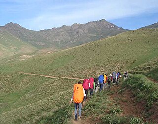
Mount ChlChama is a part of the Zagros mountains, which are located in Iran, between the cities of Saqqez, Divandarreh and Marivan in Kurdistan province. The highest peak of Chlchama, also known as Chlchama, is 3,173 metres high at sea level, near the villages of Isakawa and Kanemat, 56 kilometres southwest of Saqqez.
References
| Lake Urmia basin | |
|---|---|
| Persian Gulf basin | |
| Oman sea basin | |
| Caspian basin | |
| Gavkhouni basin | |
| Namak Lake basin | |
| Hamun-e Jaz Murian basin | |
| Other | |