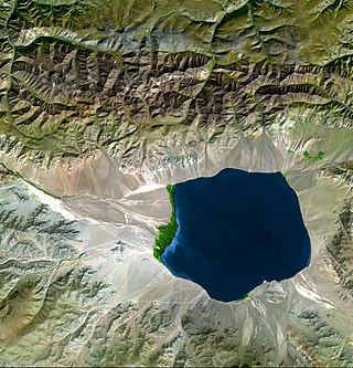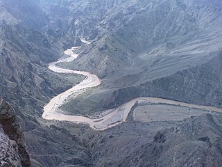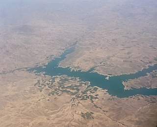
Geographically, the country of Iran is located in West Asia and borders the Caspian Sea, Persian Gulf, and Gulf of Oman. Topographically, it is predominantly located on the Persian Plateau. Its mountains have impacted both the political and the economic history of the country for several centuries. The mountains enclose several broad basins, on which major agricultural and urban settlements are located. Until the 20th century, when major highways and railroads were constructed through the mountains to connect the population centers, these basins tended to be relatively isolated from one another.

An endorheic basin is a drainage basin that normally retains water and allows no outflow to other, external bodies of water ; instead, the water drainage flows into permanent and seasonal lakes and swamps that equilibrate through evaporation. Endorheic basins are also called closed basins, terminal basins, and internal drainage systems.

The Iranian Plateau or Persian Plateau is a geological feature spanning parts of Central Asia, South Asia, and West Asia. It makes up part of the Eurasian Plate, and is wedged between the Arabian Plate and the Indian Plate. The plateau is situated between the Zagros Mountains to the west, the Caspian Sea and the Köpet Dag to the north, the Armenian Highlands and the Caucasus Mountains to the northwest, the Strait of Hormuz and the Persian Gulf to the south, and the Indian subcontinent to the east.

The Zagros Mountains are a long mountain range in Iran, northern Iraq, and southeastern Turkey. The mountain range has a total length of 1,600 km (990 mi). The Zagros range begins in northwestern Iran and roughly follows Iran's western border while covering much of southeastern Turkey and northeastern Iraq. From this border region, the range continues southeast under also the waters of the Persian Gulf. It spans the southern parts of the Armenian highlands, the whole length of the western and southwestern Iranian plateau, ending at the Strait of Hormuz. The highest point is Mount Dena, at 4,409 metres (14,465 ft).

Media is a region of north-western Iran, best known for having been the political and cultural base of the Medes. During the Achaemenid period, it comprised present-day Iranian Azerbaijan, Iranian Kurdistan and western Tabaristan. As a satrapy under Achaemenid rule, it would eventually encompass a wider region, stretching to southern Dagestan in the north. However, after the wars of Alexander the Great, the northern parts were separated due to the Partition of Babylon and became known as Atropatene, while the remaining region became known as Lesser Media.
The Palaeolithic Era in Iran is the prehistory of Iran in the period from c. 800,000 BCE to c. 11,000 BCE and can be divided into the Lower Paleolithic, Middle Paleolithic and Upper Paleolithic periods.
Khalkhal is a city in the Central District of Khalkhal County, Ardabil province, Iran, serving as capital of both the county and the district. The majority of population speaks Azeri.
Xalxal is a village and municipality in the Babek District of Nakhchivan, Azerbaijan. It is located 19 km in the north from the district center, on the left bank of the Nakhchivanchay River, on the foothill area. Its population is busy with gardening, grain-growing, poultry and animal husbandry. There are secondary school, library, club, mosque and a medical center in the village. It has a population of 568.

An endorheic lake is a collection of water within an endorheic basin, or sink, with no evident outlet. Endorheic lakes are generally saline as a result of being unable to get rid of solutes left in the lake by evaporation. These lakes can be used as indicators of anthropogenic change, such as irrigation or climate change, in the areas surrounding them. Lakes with subsurface drainage are considered cryptorheic.

The Quri River or Quru Chay or Quri Chay is a river in East Azerbaijan province of Iran, in the endorheic basin of Lake Urmia. It originates in the mountains south of Tabriz and joins the Aji Chay just northeast of central Tabriz. Divided by the Quri, the northern and southern parts of Tabriz are connected by several bridges.
Mount Taragha is a mountain of the Zagros Mountains range, located in the Iranian Kurdistan region and northwestern Iran.
Davan is a village in Deris Rural District, in the Central District of Kazerun County, Fars Province, Iran. In the Davani dialect it is pronounced : do'u At the 2006 census, its population was 601, in 178 families.

The Gadar River rises in the Iranian Zagros Mountains close to where the borders of Iran, Turkey and Iraq meet. From its source, the river flows towards the southeast and then changes course due east through the Ushnu-Solduz valley. After leaving the valley, the river turns north and flows into the marshes bordering the endorheic saltwater Lake Urmia. The length of the river is approximately 100 kilometres (62 mi), its drainage basin is variously estimated as 1,900 square kilometres (730 sq mi) and 2,123 square kilometres (820 sq mi) and its discharge is 0.34 cubic metres (12 cu ft) per second. The Ushnu-Solduz valley has been occupied for many millennia, as testified by the excavations at sites like Hasanlu Tepe and Hajji Firuz Tepe.

The main points that are discussed in the geology of Iran include the study of the geological and structural units or zones; stratigraphy; magmatism and igneous rocks; ophiolite series and ultramafic rocks; and orogenic events in Iran.

The Simineh River, also known as the Tatavi Chay, is a river in northern Iran, arising in the Zagros Mountains of Kurdistan Province north of Saqqez, that flows into the south end of Lake Urmia. It is just over 200 kilometres (124 mi) long and has a catchment basin (watershed) of 2,090 square kilometres (810 sq mi). Its waters are used primarily for agriculture and the return flow significantly degrades its water quality.

The Ghezel Ozan is one of the longest rivers in Iran, originating from the Chehel Cheshmeh Mountains between Saqqez and Divandarreh in Kurdistan Province flowing in northern Iran.
The Sahand-Bazman Volcanic and Plutonic Belt or the Sahand-Bazman Igneous Arc or the Central Iranian Range is a mountain range that is made by igneous and pyroclastic rocks. Located East and almost parallel to the Zagros Mountains, the Central Iranian Range is stretched in a north-west-southeast direction from Mount Sahand in Azerbaijan in the north-west to Mount Bazman in Baluchistan in the Southeastern part of Iran. This range was mainly formed during the Tertiary volcanic and orogenic phase and especially in the Eocene volcanism and plutonism. The Central Iranian Range or the Sahand-Bazman Volcanic Belt includes famous mountains such as the Sahand in East Azerbaijan Province, Mount Karkas in the Karkas Mountains and Mount Marshenan in Isfahan Province, the Jebal Barez, Mount Hezar and Mount Lalehzar in Kerman Province, and the Bazman in the Sistan va Baluchestan Province of Iran.

Western Iran consists of Armenian Highlands, northern Zagros and the rich agricultural area of the Khuzestan Plain in the south.

Shahid Kazemi Dam is a clay core dam on the Zarrineh River in the Zagros Mountains range, located near Bukan in West Azarbaijan Province, Iran.
Esmaeilius shirini, the Shirin toothcarp, or Khosroshirin tooth-carp, is a species of pupfish belonging to the family Cyprinodontidae. It is found in the Khosroshirin stream of the Kor River basin, Fars Province, Iran. The species is threatened by the introduction of the predatory rainbow trout to their habitat. It is harmless to humans.


