
Cobar is a town in central western New South Wales, Australia whose economy is based mainly upon base metals and gold mining. The town is 712 km (442 mi) by road northwest of the state capital, Sydney. It is at the crossroads of the Kidman Way and Barrier Highway. The town and the local government area, the Cobar Shire, are on the eastern edge of the outback. At the 2016 census, the town of Cobar had a population of 3,990. The Shire has a population of approximately 4,700 and an area of 44,065 square kilometres (17,014 sq mi).
Solwezi is a town in Zambia. It is the provincial capital of the mineral-rich North-Western Province. Solwezi is also the administrative capital of Solwezi District, one of the eleven districts in the North-Western Province.

The Chinhoyi Caves are a group of limestone and dolomite caves in north central Zimbabwe. Designated a National Park in 1955, and managed by the Zimbabwe Parks & Wildlife Management Authority.
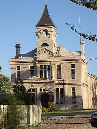
Wallaroo is a port town on the western side of Yorke Peninsula in South Australia, 160 kilometres (100 mi) northwest of Adelaide. It is one of the three Copper Triangle towns famed for their historic shared copper mining industry, and known together as "Little Cornwall", the other two being Kadina, about 8 kilometres (5 mi) to the east, and Moonta, about 18 kilometres (11 mi) south. In 2016, Wallaroo had a population of 3,988 according to the census held.

Ravensthorpe is a town 541 km south-east of Perth and 40 km inland from the south coast of Western Australia. It is the seat of government of the Shire of Ravensthorpe. At the 2021 census, Ravensthorpe had a population of 2,085.
Lion's Den is a small town in Zimbabwe.
Karoi is a town in Zimbabwe.
Chinhoyi, previously known as Sinoia during the colonial era, is a city in central northern Zimbabwe in the Makonde District. It has a population of 90,800 and is primarily a college town, although it was originally founded as an Italian group settlement scheme. The nearby Chinhoyi Caves and national park are a popular attraction.
Mhangura, formerly Mangula, is a small town and former mining community in the Doma District of Mashonaland West Province, in northern Zimbabwe.
Kildonan, Zimbabwe is a village in Mashonaland West Province in Zimbabwe.
Murombedzi is a town in Zimbabwe.
Shackleton is a village in Mashonaland West province in Zimbabwe, near the Chinhoyi region.

Hindustan Copper Ltd. is a central public sector undertaking under the ownership of the Ministry of Mines, Government of India. HCL is the only vertically integrated government-owned-copper producer in India engaged in a wide spectrum of activities ranging from mining, beneficiation, smelting, refining and continuous cast rod manufacturer.
Mopani Copper Mines PLC is a Zambian company owned by ZCCM Investment Holdings.
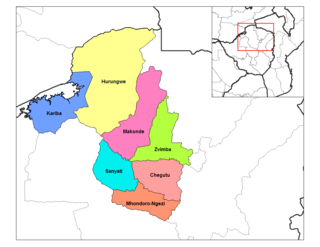
Zvimba District is a district of Mashonaland West Province, Zimbabwe.
Makonde District is a district in Zimbabwe.

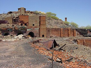
Silver Bell is a ghost town in the Silver Bell Mountains in Pima County, Arizona, United States. The name "Silver Bell" refers to a more recent ghost town, which was established in 1954 and abandoned in 1984. The original town, established in 1904, was named "Silverbell" and abandoned in the early 1930s. Both towns were utilized and later abandoned due to the mining of copper in the area.
R3 Highway is a primary road in Zimbabwe from the capital city Harare to the Chirundu Border Post with Zambia. It is also known as the A1 Highway. It is part of both the Beira–Lobito Highway and the Cape to Cairo Road.
Mount Elliott Mining Complex is a heritage-listed copper mine and smelter at Selwyn, Shire of Cloncurry, Queensland, Australia. It was designed by William Henry Corbould and built in 1908. It is also known as Mount Elliott Smelter and Selwyn. It was added to the Queensland Heritage Register on 16 September 2011.
