Alberta municipal censuses, 2017

Last updated

Alberta municipal censuses, 2017
Flag of Alberta.svg
  2016 April 1 – June 30, 2017 2018  


Alberta's Urban Municipalities.png
Distribution of Alberta's 269 urban municipalities

Alberta has provincial legislation allowing its municipalities to conduct municipal censuses between April 1 and June 30 inclusive. [1] [2] Municipalities choose to conduct their own censuses for multiple reasons such as: to better inform municipal service planning and provision; to capitalize on per capita based grant funding from higher levels of government; or to simply update their populations since the last federal census. [3]

Alberta Province of Canada

Alberta is a western province of Canada. With an estimated population of 4,067,175 as of 2016 census, it is Canada's fourth most populous province and the most populous of Canada's three prairie provinces. Its area is about 660,000 square kilometres (250,000 sq mi). Alberta and its neighbour Saskatchewan were districts of the Northwest Territories until they were established as provinces on September 1, 1905. The premier has been Rachel Notley since May 2015.

Four provinces and territories in Canada have legislation that allow municipalities to conduct a municipal census. These include the provinces of Alberta and Saskatchewan and the territories of Nunavut and Yukon. Of these four provinces and territories, municipalities in Alberta were the only ones that exercise the option to conduct a municipal census as of 2006.

Census Acquiring and recording information about the members of a given population

A census is the procedure of systematically acquiring and recording information about the members of a given population. The term is used mostly in connection with national population and housing censuses; other common censuses include agriculture, business, and traffic censuses. The United Nations defines the essential features of population and housing censuses as "individual enumeration, universality within a defined territory, simultaneity and defined periodicity", and recommends that population censuses be taken at least every 10 years. United Nations recommendations also cover census topics to be collected, official definitions, classifications and other useful information to co-ordinate international practice.

Contents

Alberta began the year of 2017 with 354 municipalities. [4] Of these, 35 (9.9%) conducted a municipal census in 2017. Alberta Municipal Affairs recognized those conducted by 34 of these municipalities. [5] By municipal status, it recognized those conducted by 7 of Alberta's 18 cities, 16 of 107 towns, 10 of 87 villages, 1 of its 51 summer villages, and 1 of 64 municipal districts. [5] [lower-alpha 1]

Events from the year 2017 in Canada.

Alberta Municipal Affairs is a ministry of the Executive Council of Alberta. Its major responsibilities include assisting municipalities in the provision of local government, administering the assessment of linear property in Alberta, administering a safety system for the construction and maintenance of buildings and equipment, and managing Alberta's network of municipal and library system boards.

Some municipalities achieved population milestones as a result of their 2017 censuses. Fort Saskatchewan exceeded 25,000 residents, while Chestermere surpassed 20,000 people and Crossfield grew beyond the 3,000 mark for the first time.

Fort Saskatchewan City in Alberta, Canada

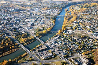
Fort Saskatchewan is a city in Alberta, Canada, 25 kilometres (16 mi) northeast of Edmonton, Alberta's capital city, along the North Saskatchewan River. Fort Saskatchewan is part of the Edmonton census metropolitan area and is one of 24 municipalities that constitute the Edmonton Metropolitan Region Board (EMRB). Fort Saskatchewan's population in the 2016 federal census was 24,149 while it was 24,569 in the city's 2016 municipal census.

Chestermere City in Alberta, Canada

Chestermere, originally named Chestermere Lake, is a city in the Canadian province of Alberta, within Rocky View County. It is largely a commuter town of Calgary and is a member municipality of the Calgary Regional Partnership. The city, which surrounds Chestermere Lake, was known as Chestermere Lake from 1977 to 1993.

Crossfield, Alberta Town in Alberta, Canada

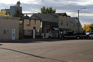
Crossfield is a town in southern Alberta, Canada within Rocky View County. It is located on Highway 2A 43 km (27 mi) north of the City of Calgary.

Municipal census results

The following summarizes the results of the numerous municipal censuses conducted in 2017.

2017 municipal census summary [5] 2016 federal census comparison [6] Previous municipal census comparison [7] [8] [9] [10] [11] [12]
MunicipalityStatusCensus
date
2017
pop.
2016
pop.
Absolute
growth
Absolute
change
Annual
growth
rate
Prev.
pop.
Prev.
census
year
Absolute
growth
Annual
growth
rate
Airdrie City April 1, 201764,92261,5813,3415.4%5.4%61,84220163,0805.0%
Banff Town June 12, 20178,8757,8511,02413%13.0%8,42120144541.8%
Beaumont Town April 15, 201718,32017,3969245.3%5.3%17,72020166003.4%
Big Valley Village May 1, 201734934630.9%0.9%347201520.3%
Blackfalds Town May 15, 20179,9169,3285886.3%6.3%9,51020164064.3%
Bonnyville Town April 1, 20176,4225,975 [13] 4477.5%7.5%6,9212014−499−2.5%
Bow Island Town April 1, 20172,0431,983603%3.0%1,86820071750.9%
Calgary City April 1, 20171,246,3371,239,2207,1170.6%0.6%1,235,171201611,1660.9%
Carbon Village May 1, 20175004544610.1%10.1%5012000−10.0%
Carmangay Village May 19, 201725024283.3%3.3%2622013−12−1.2%
Chestermere City May 1, 201720,33119,8874442.2%2.2%19,71520166163.1%
Cochrane Town April 3, 201726,32025,8534671.8%1.8%25,12220161,1984.8%
Crossfield Town May 8, 20173,0552,983722.4%2.4%2,91820141371.5%
Edgerton Village May 10, 20174253844110.7%10.7%4012012241.2%
Empress Village 160 [14] 1352518.5%18.5%2541983−94−1.4%
Fort Saskatchewan City April 3, 201725,53324,1491,3845.7%5.7%24,56920169643.9%
Girouxville Village May 1, 20172892197032%32.0%3151976−26−0.2%
High Level Town May 1, 20173,9923,15983326.4%26.4%3,82320151692.2%
Horseshoe Bay Summer village May 1, 201773492449%49.0%462001272.9%
Innisfree Village May 15, 20172231933015.5%15.5%2671977−44−0.4%
Leduc City April 1, 201731,13029,9931,1373.8%3.8%30,49820166322.1%
Lethbridge City April 1, 201798,19892,7295,4695.9%5.9%96,82820161,3701.4%
Magrath Town April 24, 20172,4352,374612.6%2.6%2,3982015370.8%
Marwayne Village May 15, 2017606564427.4%7.4%6672013−61−2.4%
McLennan Town May 1, 20177917019012.8%12.8%9571997−166−0.9%
Oyen Town June 5, 20171,0221,001212.1%2.1%1,0062015160.8%
Raymond Town April 10, 20174,0373,7083298.9%8.9%4,2022016−165−3.9%
Rosemary Village [lower-alpha 2] 3964212012
Spruce Grove City April 5, 201734,88134,0668152.4%2.4%33,64020161,2413.7%
St. Paul Town April 10, 20175,9635,8271362.3%2.3%6,0042014−41−0.2%
County of St. Paul No. 19 Municipal district April 18, 20176,4686,0364327.2%7.2%6,16820123001.0%
Stirling Village June 1, 20171,26997829129.8%29.8%1,14720131222.6%
Thorsby Town April 1, 20171,015985303%3.0%1,0252015−10−0.5%
Two Hills Town May 15, 20171,4431,352916.7%6.7%1,4312012120.2%
Vermilion Town April 1, 20174,1504,084661.6%1.6%4,5452012−395−1.8%
Veteran Village May 29, 20172392073215.5%15.5%3181982−79−0.8%

See also

Notes

  1. No censuses were conducted among Alberta's 5 specialized municipalities, 3 special areas and 8 improvement districts. [5]
  2. The Village of Rosemary indicated it was going to conduct a municipal census in 2017, [15] though no completion of this census was reported by Alberta Municipal Affairs. [5]

Related Research Articles

Beaumont, Alberta City in Alberta, Canada

Beaumont is a city in Leduc County within the Edmonton Metropolitan Region of Alberta, Canada. It is located at the intersection of Highway 625 and Highway 814, adjacent to the City of Edmonton and 6.0 kilometres (3.7 mi) northeast of the City of Leduc. The Nisku Industrial Park and the Edmonton International Airport are located 4.0 kilometres (2.5 mi) to the west and 8.0 kilometres (5.0 mi) to the southwest respectively.

Municipal District of Taber Municipal district in Alberta, Canada

The Municipal District of Taber is a municipal district in southern Alberta, Canada. It is located in Census Division 2.

Kitscoty Village in Alberta, Canada

The Village of Kitscoty in Alberta is situated at the junction of Highway 16 and Highway 897. The village is located approximately midway between Edmonton and Saskatoon. In addition, the village is within short commuting distance of Lloydminster. The CN railway tracks also pass through Kitscoty. The surrounding County of Vermilion River's municipal office is located in Kitscoty.

Two Hills, Alberta Town in Alberta, Canada

Two Hills is a town in central Alberta, Canada. It is located approximately 137 km (85 mi) east of Edmonton at the junction of Highway 45 and Highway 36. Two Hills is primarily an agriculture-based community.

Carmangay Village in Alberta, Canada

Carmangay is a village in southern Alberta, Canada. It is located 62 kilometres (39 mi) north of Lethbridge and 150 kilometres (93 mi) south of Calgary, along the Canadian Pacific Railway, east of Highway 23. It takes its name from C.W. Carman, who bought 1,500 acres (6.1 km2) at $3.50 per acre to grow wheat in 1904, and his wife, Gertrude Gay.

Chauvin, Alberta Village in Alberta, Canada

Chauvin is a village in east central Alberta, Canada. It is located 60 kilometres (37 mi) east of Wainwright, and 10 kilometres (6.2 mi) west of the Saskatchewan border. It is also the home of Susie the Softball, the world's largest softball.

Edgerton, Alberta Village in Alberta, Canada

Edgerton is a village in central Alberta, Canada. it is located 35 kilometres (22 mi) east of Wainwright.

Innisfree, Alberta Village in Alberta, Canada

Innisfree is a village in central Alberta, Canada. It is located 52 km west of Vermilion along the Yellowhead Highway.

Lougheed, Alberta Village in Alberta, Canada

Lougheed is a village in central Alberta, Canada. It is located 94 km south-east of Camrose, along Highway 13.

Marwayne Village in Alberta, Canada

Marwayne is a village in central Alberta, Canada. It is located 44 kilometres (27 mi) north-west of the city of Lloydminster and 21 kilometres (13 mi) west of the Saskatchewan border.

Northern Sunrise County Municipal district in Alberta, Canada

Northern Sunrise County is a municipal district in northern Alberta, Canada. Located in Census Division 17, its municipal office is located east of the Town of Peace River at the intersection of Highway 2 and Highway 688.

County of St. Paul No. 19 Municipal district in Alberta, Canada

The County of St. Paul No. 19 is a municipal district in northeast Alberta, Canada. Located in Census Division No. 12, its municipal office is located in the Town of St. Paul.

Point Alison Summer village in Alberta, Canada

Point Alison is a summer village in Alberta, Canada. It is located on the northern shore of Wabamun Lake, and south of the Village of Wabamun.

2013 Alberta municipal censuses

Alberta has provincial legislation allowing its municipalities to conduct municipal censuses between April 1 and June 30 inclusive. Municipalities choose to conduct their own censuses for multiple reasons such as to better inform municipal service planning and provision, to capitalize on per capita based grant funding from higher levels of government, or to simply update their populations since the last federal census.

2012 Alberta municipal censuses

Alberta has provincial legislation allowing its municipalities to conduct municipal censuses between April 1 and June 30 inclusive. Municipalities choose to conduct their own censuses for multiple reasons such as to better inform municipal service planning and provision, to capitalize on per capita based grant funding from higher levels of government, or to simply update their populations since the last federal census.

2014 Alberta municipal censuses

Alberta has provincial legislation allowing its municipalities to conduct municipal censuses between April 1 and June 30 inclusive. Municipalities choose to conduct their own censuses for multiple reasons such as to better inform municipal service planning and provision, to capitalize on per capita based grant funding from higher levels of government, or to simply update their populations since the last federal census.

2015 Alberta municipal censuses

Alberta has provincial legislation allowing its municipalities to conduct municipal censuses between April 1 and June 30 inclusive. Municipalities choose to conduct their own censuses for multiple reasons such as to better inform municipal service planning and provision, to capitalize on per capita based grant funding from higher levels of government, or to simply update their populations since the last federal census.

2016 Alberta municipal censuses

Alberta has provincial legislation allowing its municipalities to conduct municipal censuses between April 1 and June 30 inclusive. Due to the concurrency of Statistics Canada conducting the Canada 2016 Census in May 2016, the Government of Alberta offered municipalities the option to alter their 2016 municipal census timeframes to either March 1 through May 31 or May 1 through July 31. Municipalities choose to conduct their own censuses for multiple reasons such as to better inform municipal service planning and provision, to capitalize on per capita based grant funding from higher levels of government, or to simply update their populations since the last federal census.

2018 Alberta municipal censuses

Alberta has provincial legislation allowing its municipalities to conduct municipal censuses between April 1 and June 30 inclusive. Municipalities choose to conduct their own censuses for multiple reasons such as to better inform municipal service planning and provision, to capitalize on per capita based grant funding from higher levels of government, or to simply update their populations since the last federal census.

References

  1. "Municipal Government Act: Revised Statutes of Alberta 2000 Chapter M-26 (Office Consolidation)" (PDF). Alberta Queen's Printer. November 24, 2010. Retrieved February 4, 2017.
  2. "Municipal Government Act: Determination of Population Regulation, Alberta Regulation 63/2001 (Office Consolidation)" (PDF). Alberta Queen's Printer. 2013. p. 3. Retrieved February 4, 2017.
  3. "Municipal Census Manual: Requirements and Guidelines for Conducting a Municipal Census" (PDF). Alberta Municipal Affairs. February 2015. p. 7. ISBN   978-1-4601-2127-6 . Retrieved February 4, 2017.
  4. "2017 Municipal Codes" (PDF). Alberta Municipal Affairs. January 12, 2017. Retrieved February 4, 2017.
  5. 1 2 3 4 5 "2017 Municipal Affairs Population List" (PDF). Alberta Municipal Affairs. ISBN   978-1-4601-3652-2 . Retrieved January 12, 2018.
  6. "Population and dwelling counts, for Canada, provinces and territories, and census subdivisions (municipalities), 2016 and 2011 censuses (Alberta)". Statistics Canada. February 8, 2017.
  7. "2016 Municipal Affairs Population List" (PDF). Alberta Municipal Affairs. ISBN   978-1-4601-3127-5 . Retrieved February 4, 2017.
  8. "2011 Municipal Affairs Population List" (PDF). Alberta Municipal Affairs. October 5, 2011. ISBN   978-0-7785-9738-4 . Retrieved April 19, 2017.
  9. "2001 Official Population List" (PDF). Alberta Municipal Affairs. September 4, 2001. ISBN   978-0-7785-9738-4 . Retrieved April 20, 2017.
  10. "1986 Official Population" (PDF). Alberta Municipal Affairs. Retrieved April 20, 2017.
  11. "1977 Official Population" (PDF). Alberta Municipal Affairs. Retrieved January 13, 2018.
  12. "1976 Official Population" (PDF). Alberta Municipal Affairs. Retrieved January 13, 2018.
  13. "Population and dwelling count amendments, 2016 Census". Statistics Canada. October 6, 2017. Retrieved January 12, 2018.
  14. "2017 Municipal Census". Village of Empress. Retrieved June 2, 2017.
  15. Michelle Gietz. "Area population up over 5% since 2011". Brooks Bulletin. Retrieved February 17, 2017. That census counted 421 people in the Village of Rosemary compared to 396 people recorded by Statistics Canada in 2016. "We are going to have another municipal census this year to confirm the numbers," comments Zacharias.