
Wadgera is a taluka panchayat in the southern state of Karnataka, India. Administratively, Wadgera is in the Yadgir district in Karnataka. Wadgera is 23 km by road south of the City of Yadgir and 39 km by road southeast of the town of Shahapur. The nearest rail station is Yadgir and the nearest railhead is in Yadgir.
Agastihal is a small village in the southern state of Karnataka, India. Administratively Agastihal is under Tewar Wadgera panchayat village, Shahapur taluka of Yadgir district in Karnataka. Agastihal is 2.7 km by road southwest of Gundgurthi, and 7 km by road northeast of Hattigudur.
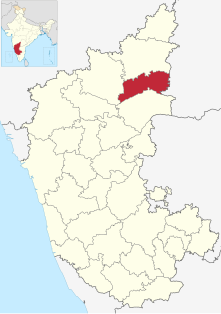
Agnihal is a village in the southern state of Karnataka, India. Administratively, it is under Gonal panchayat village, Shahapur Taluka of Yadgir district in Karnataka.
Wanadurga is a village in Shahapur taluka of Yadgir district in Karnataka state, India. Wanadurga is twelve kilometres by road west of Sagar, and four kilometres south-southwest of Hoskera. The nearest railhead is in Yadgir.
Hoskera is a panchayat village in Shahapur taluka of Yadgir district in Karnataka state, India. Hoskera is four kilometres by road north-northwest of Wanadurga, and just over eight kilometres south-southwest of Gogikona. The nearest railhead is in Yadgir.
Marnal (Maranal) is a panchayat village in Shorapur taluka of Yadgir district in Karnataka state, India. Marnal is 4 km southwest of Bardevanhal. The nearest railhead is in Yadgir.
Gundgurthi is a village in the southern state of Karnataka, India. Administratively Gundgurthi is under Tewar Wadgera panchayat village, Shahapur taluka of Yadgir district in Karnataka. Gundgurthi is 9 km by road northeast of Hattigudur. The nearest railhead is in Yadgir.
Hattigudur is a panchayat village in the southern state of Karnataka, India. Administratively, Hattigudur is under Shahapur taluka of Yadgir district in Karnataka. Hattigudur is 12 km by road south of the town of Shahapur and 9 km by road southwest of Gundgurthi. The nearest railhead is in Yadgir.
Paspool is a panchayat village in the southern state of Karnataka, India. Administratively, it is under Yadgir taluka of Yadgir district in Karnataka. Paspool is twenty kilometres by road from the city of Yadgir. The nearest railhead is in Yadgir.
Bonal, is a village in the southern state of Karnataka, India. Administratively, Bonal is under Aldal gram panchayat, Shorapur Taluka of Yadgir District in Karnataka. The village of Bonal is 6 km by road east-southeast of the village of Wagingera and 4 km by road west-northwest of the village of Chikanhalli. The nearest railhead is in Yadgir.
Chikanhalli, is a village in the southern state of Karnataka, India. Administratively, Chikanhalli is under Kachaknoor gram panchayat, Shorapur Taluka of Yadgir District in Karnataka. The village of Chikanhalli is 4 km by road east-southeast of the village of Bonal and 17 km by road northwest of the village of Hunasagi. The nearest railhead is in Yadgir.
Baichbal, is a panchayat village in the southern state of Karnataka, India. Administratively, Baichbal is under Shorapur Taluka of Yadgir District in Karnataka. The village of Baichbal is 2.3 km by road south of the village of Kodalgi and 2.3 km by road west of the village of Kanhalli. The town of Shorapur is east about 25 km by road via Peth Ammapur or 37 km by the better roads. The nearest railhead is in Yadgir.
Halgera is a panchayat village in the southern state of Karnataka, India. Administratively, Halgera is under Yadgir Taluka of Yadgir District in Karnataka. The village of Halgera is 14 km by road southeast of the town of Yadgir and 6 km by road northeast of the village of Zinkera. The nearest railhead is in Yadgir.
Saidapur is a census town and panchayat village in the southern state of Karnataka, India. Administratively, Saidapur is under Yadgir Taluka of Yadgir District in Karnataka. The village of Saidapur is 14 km by road west of the village of Badepalli, and 33 km by road south of the town of Yadgir. Saidapur has its own railway station which comes on Bangalore-Mumbai and Mumbai-Chennai main corridor.
Rastapur is a panchayat village in the southern state of Karnataka, India. Administratively, Rastapur is under Shahapur Taluka of Yadgir district in Karnataka. Rastapur is 6 km by road east of the village of Sagar and 6.5 km by road northwest of the village of Hattigudur. The nearest railhead is in Yadgir.
Bendebembli, is a panchayat village in the southern state of Karnataka, India. Administratively, Bendebembli is under the Shahapur Taluka of Yadgir district in Karnataka. It lies on the left (east) bank of the Krishna River. Bendebembli is 10 km by road southeast of the village of Tumkur and 40 km by road south of the town of Yadgir. The nearest rail station is Chegunda Station and the nearest railhead is in Yadgir.
Gonal is a panchayat village in the southern state of Karnataka, India. Administratively, Gonal is under the Shahapur Taluka of Yadgir district in Karnataka. It lies on the left (east) bank of the Krishna River. Gonal is 9 km by road southeast of the village of Bendebembli and 13 km by road southwest of the village of Badiyal. The nearest rail station is Chegunda Station and the nearest railhead is in Yadgir.
Badiyal, is a panchayat village in the southern state of Karnataka, India. Administratively, Badiyal is under the Yadgir Taluka of Yadgir district in Karnataka. Badiyal is 13.5 km by road east of the village of Bendebembli and 41 km by road south of the town of Yadgir. The nearest rail station is Chegunda Station and the nearest railhead is in Yadgir.
Tumkur is a village in the southern state of Karnataka, India. Administratively, it is under Bendebembli panchayat village, Shahapur Taluka of Yadgir district in Karnataka. It lies on the left (east) bank of the Krishna River. Tumkur is 10 km by road northwest of the village of Bendebembli and 31 km by road south of the town of Yadgir. The nearest rail station is Chegunda Station and the nearest railhead is in Yadgir.
Gonal is a village in the southern state of Karnataka, India. Administratively, Gonal is under Aldal gram panchayat, Shorapur Taluka of Yadgir District in Karnataka. It lies on the left (north) bank of the Devapura Nala, a tributary of the Krishna River. The village of Gonal is 2.6 km by road east of the village of Aldhal and 15 km by road southeast of the town of Shorapur. The nearest railhead is in Yadgir.


