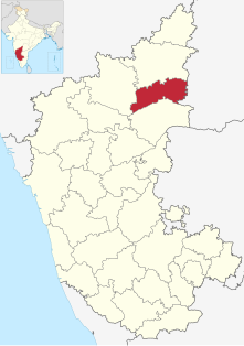
Yadagiri is a city and the administrative headquarters of Yadagiri district in the Indian state of Karnataka. It is also the administrative headquarters of Yadagiri Taluku, one of the three talukas of the district.
Gogikona is a village in the southern state of Karnataka, India. It is located in the Shahapur taluka of Yadgir district in Karnataka. Gogikona is a companion village to Gogipeth which lies less than half a kilometre to the northwest, across a small stream, and together the two are often known as "Gogi".
Hattikuni is a panchayat village in the southern state of Karnataka, India. It is located in the Yadgir taluk of Yadgir district in Karnataka.
Kakkera is a TMC in the southern state of Karnataka, India. Administratively, it is in the Shorapur taluka of Yadgir district in Karnataka state.
Kodekal (Kodigal) is a panchayat village in the southern state of Karnataka, India. It is located in the Shorapur Taluka of Yadgir district in Karnataka. Kodekal is 8.5 km by road north-northeast of Jogandabhavi, and 4 km by road northwest of Bardevanhal, across the Dhon River.
Narayanapur Rural is a panchayat village in the southern state of Karnataka, India. It is located in the Shorapur Taluka of Yadgir district in Karnataka. It is adjacent to and gives its name to the Narayanpur Dam on the Krishna River.
Wadgera is a taluka panchayat in the southern state of Karnataka, India. Administratively, Wadgera is in the Yadgir district in Karnataka. Wadgera is 23 km by road south of the City of Yadgir and 39 km by road southeast of the town of Shahapur. The nearest rail station is Yadgir and the nearest railhead is in Yadgir.
Yergol is a panchayat village in the southern state of Karnataka, India. It is located in the Yadgir Taluka of Yadgir district in Karnataka. It has a famous temple of Shri Gavisiddeshwara Samsthana Matha. Sanji Bheemaraya.Devastana. Uttaradi Matha, Sri Ramachandra Teertha brindavana, Ramalingeshwara Devastana.
Achola is a village in the southern state of Karnataka, India. Administratively, Achola is under Akera B. gram panchayat, Yadgir Taluka of Yadgir District in Karnataka.
Adwadgi is a village in the southern state of Karnataka, India. Administratively, Adwadgi is under Sugooru gram panchayat, Shorapur Taluka of Yadgir district in Karnataka. The village of Adwadgi is 3 km by road northeast of the village of Sugur and 7.5 km by road south of the village of Hemnoor. The nearest railhead is in Yadgir.
Agastihal is a small village in the southern state of Karnataka, India. Administratively Agastihal is under Tewar Wadgera panchayat village, Shahapur taluka of Yadgir district in Karnataka. Agastihal is 2.7 km by road southwest of Gundgurthi, and 7 km by road northeast of Hattigudur.
Agnihal is a village in the southern state of Karnataka, India. Administratively, it is under Gonal panchayat village, Shahapur Taluka of Yadgir district in Karnataka.
Agthirth is a village in the southern state of Karnataka, India. Administratively, it is under Agni gram panchayat, Shorapur Taluka of Yadgir District in Karnataka. Agthirth is 1.5 km by road east of the village of Agni, and 8.5 km by road west of the village of Baichbal.
Ainapur is a village in the southern state of Karnataka, India. Administratively, Ainapur is under the Yaktapur gram panchayat, Shorapur Taluka of Yadgir District in Karnataka.
Hunasagi (Hunsagi) is taluk of Yadgir district in Karnataka state, India. A number of early Palaeolithic sites were found in Hunasagi. Hunasagi is 48 km southwest of the distinct headquarters, Yadgir and 33 km from Shorapur. The nearest railhead is in Yadgir.
Paspool is a panchayat village in the southern state of Karnataka, India. Administratively, it is under Yadgir taluka of Yadgir district in Karnataka. Paspool is twenty kilometres by road from the city of Yadgir. The nearest railhead is in Yadgir.
Agni is a panchayat village in the southern state of Karnataka, India. Administratively, Agni is under Shorapur Taluka of Yadgir District in Karnataka. The village of Agni is 1.5 km by road west of the village of Agthirth and 14 km by road north of the village of Hunasagi. The nearest railhead is in Yadgir.
Badepalli is a village in the southern state of Karnataka, India. Administratively, Badepalli is under Ajlapur gram panchayat, Yadgir Taluka of Yadgir District in Karnataka. Badepalli is 10 km by road south of the village of Madhawar, and 14 km by road east of the town of Saidapur, where Narayanpet Road Station is the nearest railway station.
Sugur is a panchayat village in the southern state of Karnataka, India. Administratively, Sugur is under Shorapur Taluqa of Yadgir District in Karnataka. Sugur lies on the left (north) bank of the Krishna River. The village of Sugur is 3 km by road southwest of the village of Adwadgi and 15 km by road east of the village of Devapur. The nearest railhead is in Yadgir.
Devapur is a panchayat village in the southern state of Karnataka, India. Administratively, Devapur is under Shorapur Taluka of Yadgir District in Karnataka. The village of Devapur is 15 km by road west of the village of Sugur and 26 km by road east of the village of Hunasagi. The nearest railhead is in Yadgir.