Anielin is a village in the administrative district of Gmina Łask, within Łask County, Łódź Voivodeship, in central Poland. It lies approximately 6 kilometres (4 mi) north of Łask and 29 km (18 mi) south-west of the regional capital Łódź.
Bałucz is a village in the administrative district of Gmina Łask, within Łask County, Łódź Voivodeship, in central Poland. It lies approximately 8 kilometres (5 mi) north-west of Łask and 33 km (21 mi) south-west of the regional capital Łódź.
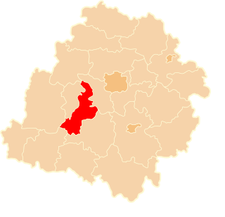
Borszewice is a village in the administrative district of Gmina Łask, within Łask County, Łódź Voivodeship, in central Poland. It lies approximately 8 kilometres (5 mi) north-west of Łask and 34 km (21 mi) south-west of the regional capital Łódź.
Grabina is a village in the administrative district of Gmina Łask, within Łask County, Łódź Voivodeship, in central Poland. It lies approximately 4 kilometres (2 mi) south-east of Łask and 33 km (21 mi) south-west of the regional capital Łódź.
Łopatki is a village in the administrative district of Gmina Łask, within Łask County, Łódź Voivodeship, in central Poland. It lies approximately 3 kilometres (2 mi) south-west of Łask and 35 km (22 mi) south-west of the regional capital Łódź.
Orchów is a village in the administrative district of Gmina Łask, within Łask County, Łódź Voivodeship, in central Poland. It lies approximately 4 kilometres (2 mi) north of Łask and 31 km (19 mi) south-west of the regional capital Łódź.
Ostrów is a village in the administrative district of Gmina Łask, within Łask County, Łódź Voivodeship, in central Poland. It lies approximately 4 kilometres (2 mi) east of Łask and 30 km (19 mi) south-west of the regional capital Łódź.
Sięganów is a village in the administrative district of Gmina Łask, within Łask County, Łódź Voivodeship, in central Poland. It lies approximately 3 kilometres (2 mi) south-west of Łask and 35 km (22 mi) south-west of the regional capital Łódź.
Teodory is a village in the administrative district of Gmina Łask, within Łask County, Łódź Voivodeship, in central Poland. It lies approximately 5 kilometres (3 mi) east of Łask and 29 km (18 mi) south-west of the regional capital Łódź.
Wronowice is a village in the administrative district of Gmina Łask, within Łask County, Łódź Voivodeship, in central Poland. It lies approximately 5 kilometres (3 mi) north-east of Łask and 28 km (17 mi) south-west of the regional capital Łódź.
Wrzeszczewice is a village in the administrative district of Gmina Łask, within Łask County, Łódź Voivodeship, in central Poland. It lies approximately 10 kilometres (6 mi) north of Łask and 29 km (18 mi) south-west of the regional capital Łódź.
Wydrzyn is a village in the administrative district of Gmina Łask, within Łask County, Łódź Voivodeship, in central Poland. It lies approximately 5 kilometres (3 mi) north of Łask and 31 km (19 mi) south-west of the regional capital Łódź.
Marzenin is a village in the administrative district of Gmina Sędziejowice, within Łask County, Łódź Voivodeship, in central Poland. It lies approximately 8 kilometres (5 mi) south-west of Łask and 40 km (25 mi) south-west of the regional capital Łódź.
Chociw is a village in the administrative district of Gmina Widawa, within Łask County, Łódź Voivodeship, in central Poland. It lies approximately 7 kilometres (4 mi) south-east of Widawa, 23 km (14 mi) south-west of Łask, and 54 km (34 mi) south-west of the regional capital Łódź.
Klęcz is a village in the administrative district of Gmina Widawa, within Łask County, Łódź Voivodeship, in central Poland. It lies approximately 9 kilometres (6 mi) south-east of Widawa, 25 km (16 mi) south of Łask, and 56 km (35 mi) south-west of the regional capital Łódź.
Raczynów is a village in the administrative district of Gmina Widawa, within Łask County, Łódź Voivodeship, in central Poland. It lies approximately 11 kilometres (7 mi) south-east of Widawa, 28 km (17 mi) south of Łask, and 58 km (36 mi) south-west of the regional capital Łódź.
Restarzew Cmentarny is a village in the administrative district of Gmina Widawa, within Łask County, Łódź Voivodeship, in central Poland. It lies approximately 11 kilometres (7 mi) south-east of Widawa, 26 km (16 mi) south of Łask, and 56 km (35 mi) south-west of the regional capital Łódź.
Restarzew Środkowy is a village in the administrative district of Gmina Widawa, within Łask County, Łódź Voivodeship, in central Poland. It lies approximately 11 kilometres (7 mi) south-east of Widawa, 26 km (16 mi) south of Łask, and 56 km (35 mi) south-west of the regional capital Łódź.
Ruda is a village in the administrative district of Gmina Widawa, within Łask County, Łódź Voivodeship, in central Poland. It lies approximately 6 kilometres (4 mi) south-east of Widawa, 21 km (13 mi) south-west of Łask, and 52 km (32 mi) south-west of the regional capital Łódź.
Stanisławów is a village in the administrative district of Gmina Wodzierady, within Łask County, Łódź Voivodeship, in central Poland. It lies approximately 6 kilometres (4 mi) south-east of Wodzierady, 11 km (7 mi) north of Łask, and 24 km (15 mi) south-west of the regional capital Łódź.