
Tung Lung Chau, previously known as Nam Tong Island or Nam Fat Tong is an island located off the tip of the Clear Water Bay Peninsula in the New Territories of Hong Kong. It is also referred to by Hong Kong people as Tung Lung To or Tung Lung Island (東龍島). The island is largely uninhabited. Administratively, it belongs to Sai Kung District.
Batha Est is one of the three departments which make up the Batha Region in Chad. The capital is Oum Hadjer. Other notable locations include the Marouda region, where the village of Ju-Ak-Min has received recent funding for tourism development.

The Pantages Theatre is a historic theatre in Minneapolis, Minnesota. The original building was a Beaux-Arts style twelve-story complex on Hennepin Avenue, designed by Kees & Colburn and operated by Alexander Pantages, a Greek immigrant who opened 500 theatres.

Northeast Harbor is a village on Mount Desert Island, located in the town of Mount Desert in Hancock County, Maine, United States.
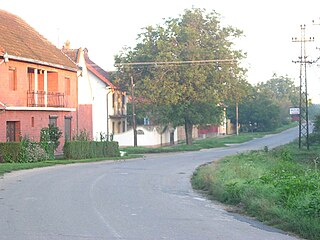
Zagajica is a village in the Vršac municipality of the South Banat District in Vojvodina province, Serbia. It is 53.4 miles from Belgrade, at the coordinates 44.97806 N 21.22444 E. At the 2011 census its population was 492, with a Serb ethnic majority of 89.21%.
Motibaug Stadium is a cricket stadium located in Vadodara, Gujarat.
Walnut Hill is a historic neighborhood located in north Omaha, Nebraska. It is bounded by North 40th Street on the east, Cuming Street on the south, Northwest Radial Highway and Saddle Creek Road on the west and Hamilton Street on the north.
Əhmədavar is a village in the Agdam District of Azerbaijan.

Our Lady of the Angel is a monastery near Orebić, a town on the Pelješac peninsula, in the Dubrovnik-Neretva County, Croatia.
Krupac is a village in the municipality of Bela Palanka, Serbia. According to the 2002 census, the village has a population of 144 people.

Milany is a mountain of Catalonia, Spain. It has an elevation of 1,533 metres above sea level.
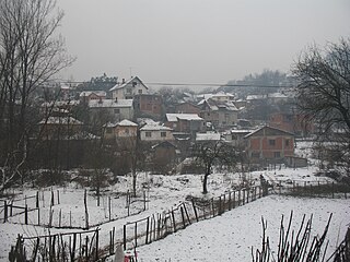
Valakonje is a village in the municipality of Boljevac, Serbia. According to the 2022 census, the village has a population of 806 people.

Iglesia de Santa María is a church in Asturias, Spain.

Chetouane is a town and commune in Tlemcen Province in northwestern Algeria.
Jelašnica is a village situated in Niška Banja municipality in Serbia.
Rudinje is a village in the municipality of Pirot, Serbia. According to the 2002 census, the village has a population of 217 people.
Đuriselo is a village in the municipality of Stanovo, Serbia. According to the 2002 census, the village has a population of 699 people.

Puurmani manor is a historical manor located in the village of Puurmani, Jõgeva County, Estonia. The manor is protected by the Estonian government as a cultural heritage object. The object was listed on 23 November 1999, and has the number 23988.

The Church of San Antolín de Toques is a church in Toques, Galicia, Spain. Founded in the 10th century, it's one of the most complex buildings of the Middle Ages in Galicia, as it preserves elements and pieces from very different periods. It was declared a Bien de Interés Cultural in 1994.

The Temple of Concordia is an ancient Greek temple of Magna Graecia in the Valle dei Templi in Agrigento on the south coast of Sicily, Italy. It is the largest and best-preserved Doric temple in Sicily and one of the best-preserved Greek temples in general, especially of the Doric order. It is located a kilometer east to the Temple of Heracles.

