
Adeline is a village in Maryland Township, Ogle County, Illinois, United States, along the Leaf River. The population was 85 at the 2010 census, down from 139 in 2000.
Fazisi Stadium is a multi-use stadium in Poti, Georgia. It is used mostly for football matches and is the home stadium of FC Kolkheti-1913 Poti. The stadium is able to hold 6,000 people.
Pełczyce is a village in the administrative district of Gmina Domaniów, within Oława County, Lower Silesian Voivodeship, in south-western Poland. Prior to 1945 it was in Germany.
Sevkar is a village in the Tavush Province of Armenia and the birthplace of the Armenian revolutionary leader Sevkaretsi Sako. The meaning of the name in Armenian is "Black Stone." The original name of the village was "Karadash", which also means "Black Stone" in Turkish.
Zaburze is a village in the administrative district of Gmina Żółkiewka, within Krasnystaw County, Lublin Voivodeship, in eastern Poland.

Suchodoły is a village in the administrative district of Gmina Gościeradów, within Kraśnik County, Lublin Voivodeship, in eastern Poland. It lies approximately 10 kilometres (6 mi) west of Kraśnik and 52 km (32 mi) south-west of the regional capital Lublin.
Cudniki is a village in the administrative district of Gmina Krośniewice, within Kutno County, Łódź Voivodeship, in central Poland. It lies approximately 5 kilometres (3 mi) south of Krośniewice, 16 km (10 mi) west of Kutno, and 53 km (33 mi) north-west of the regional capital Łódź.

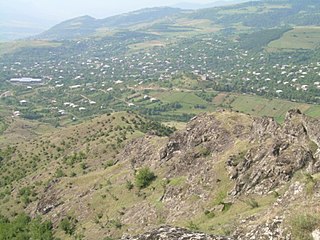
İmamqulubəyli is a village in the Agdam Rayon of Azerbaijan. The village forms part of the municipality of Quzanlı.
Şüşün is a village and municipality in the Kurdamir Rayon of Azerbaijan.
Qaramahmudlu is a village and municipality in the Kurdamir Rayon of Azerbaijan.
Borki is a village in the administrative district of Gmina Mrozy, within Mińsk County, Masovian Voivodeship, in east-central Poland.
Kosowo is a village in the administrative district of Gmina Gostyń, within Gostyń County, Greater Poland Voivodeship, in west-central Poland. It lies approximately 8 kilometres (5 mi) west of Gostyń and 56 km (35 mi) south of the regional capital Poznań.
Nowa Wieś is a village in the administrative district of Gmina Zagórów, within Słupca County, Greater Poland Voivodeship, in west-central Poland. It lies approximately 5 kilometres (3 mi) south-east of Zagórów, 19 km (12 mi) south of Słupca, and 76 km (47 mi) east of the regional capital Poznań.
Żołna is a village in the administrative district of Gmina Przechlewo, within Człuchów County, Pomeranian Voivodeship, in northern Poland. It lies approximately 12 kilometres (7 mi) north of Przechlewo, 30 km (19 mi) north of Człuchów, and 105 km (65 mi) south-west of the regional capital Gdańsk.
Hợp Thịnh is a commune (xã) and village in Hiệp Hòa District, Bắc Giang Province, in northeastern Vietnam.
Šljivovik is a village in the municipality of Bela Palanka, Serbia. According to the 2002 census, the village has a population of 263 people.
Pic de Contraix is a mountain of Catalonia, Spain. Located in the Pyrenees, it has an altitude of 2,958 metres (9,705 ft) above sea level.

Slavinja is a village in the municipality of Pirot, Serbia. According to the 2002 census, the village has a population of 49 people.

Peron is a village in Sardulgarh tehsil of Mansa district in Punjab, India. The village falls under the market committee of Talwandi Sabo.
Castle Rock is a barren, uninhabited island located in Nahant Bay in Nahant, Massachusetts.


