
The Struve Geodetic Arc is a chain of survey triangulations stretching from Hammerfest in Norway to the Black Sea, through ten countries and over 2,820 km, which yielded the first accurate measurement of a meridian.
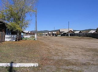
Glinka, also known as Kharchetoy (Харчетой) is a village (selo) in the west of Khiloksky District of Zabaykalsky Krai, located on the right bank of the Khilok River. Population: 421 (2002); 175 (1926). The majority of the population is employed in the railway industry and in agriculture.

Ditak is a village in the Ararat Province of Armenia.

Konradów is a village in the administrative district of Gmina Urzędów, within Kraśnik County, Lublin Voivodeship, in eastern Poland. It lies approximately 11 kilometres (7 mi) north-west of Urzędów, 19 km (12 mi) north-west of Kraśnik, and 43 km (27 mi) south-west of the regional capital Lublin.
Brzozowa is a village in the administrative district of Gmina Jaświły, within Mońki County, Podlaskie Voivodeship, in north-eastern Poland.
Kurów is a village in the administrative district of Gmina Zelów, within Bełchatów County, Łódź Voivodeship, in central Poland. It lies approximately 6 kilometres (4 mi) west of Zelów, 18 km (11 mi) north-west of Bełchatów, and 43 km (27 mi) south-west of the regional capital Łódź.
Gusin is a village in the administrative district of Gmina Świnice Warckie, within Łęczyca County, Łódź Voivodeship, in central Poland. It lies approximately 4 kilometres (2 mi) north-east of Świnice Warckie, 17 km (11 mi) west of Łęczyca, and 46 km (29 mi) north-west of the regional capital Łódź.
Ujazdówek is a village in the administrative district of Gmina Kobiele Wielkie, within Radomsko County, Łódź Voivodeship, in central Poland. It lies approximately 3 kilometres (2 mi) north-east of Kobiele Wielkie, 15 km (9 mi) east of Radomsko, and 83 km (52 mi) south of the regional capital Łódź.
Nowa Wieś is a village in the administrative district of Gmina Trzebownisko, within Rzeszów County, Subcarpathian Voivodeship, in south-eastern Poland.
Borówki is a village in the administrative district of Gmina Szamocin, within Chodzież County, Greater Poland Voivodeship, in west-central Poland. It lies approximately 4 kilometres (2 mi) north-east of Szamocin, 20 km (12 mi) east of Chodzież, and 74 km (46 mi) north of the regional capital Poznań.
Lisew is a village in the administrative district of Gmina Żerków, within Jarocin County, Greater Poland Voivodeship, in west-central Poland. It lies approximately 3 kilometres (2 mi) south-east of Żerków, 11 km (7 mi) north-east of Jarocin, and 61 km (38 mi) south-east of the regional capital Poznań.
Stara Woda is a village in the administrative district of Gmina Lubsko, within Żary County, Lubusz Voivodeship, in western Poland. It lies approximately 7 kilometres (4 mi) north-east of Lubsko, 21 km (13 mi) north of Żary, and 35 km (22 mi) south-west of Zielona Góra.
Kowalewo Duże is a village in the administrative district of Gmina Korsze, within Kętrzyn County, Warmian-Masurian Voivodeship, in northern Poland.

Nowaczyzna (, is a village in the administrative district of Gmina Łukta, within Ostróda County, Warmian-Masurian Voivodeship, in northern Poland. It lies approximately 6 kilometres north-west of Łukta, 18 km north of Ostróda, and 31 km west of the regional capital Olsztyn.
Rokitno is a village in the administrative district of Gmina Nowogródek Pomorski, within Myślibórz County, West Pomeranian Voivodeship, in north-western Poland.

Grudaš is a village in the municipality of Žitorađa, Serbia. According to the 2002 census, the village has a population of 280 people.
Lutsu is a village in Põlva Parish, Põlva County in southeastern Estonia.
Barelić is a village in the municipality of Vranje, Serbia. According to the 2002 census, the village has a population of 161 people.
Božurevac is a village in the municipality of Trstenik, Serbia. According to the 2002 census, the village has a population of 311 people.
Drajinac is a village in the municipality of Svrljig, Serbia. According to the 2002 census, the village has a population of 706 people.


