
King Phalo Airport is an airport serving East London, a city in the Eastern Cape province on the southeast coast of South Africa.

Pilanesberg International Airport is an airport serving Sun City in the North West province of South Africa. It is located adjacent to the Pilanesberg National Park.
Kimberley Airport is an airport serving Kimberley, the capital city of the province of Northern Cape in South Africa. The airport is approximately 10 km away from the centre of Kimberley.
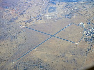
Alldays is a small town in the Limpopo province of South Africa that serves a large area of private game and hunting farms. It has a population of 2,987.

Bergerac Dordogne Périgord Airport is an airport serving Bergerac, a commune of the Dordogne department in the Nouvelle-Aquitaine region of France. The airport is located 3 kilometres (1.6 NM) south-southeast of Bergerac. It is also known as Bergerac-Roumanière Airport.
Zenata – Messali El Hadj Airport is a public airport located 17 kilometres (11 mi) northwest of Tlemcen, the capital of the Tlemcen province (wilaya) in Algeria.
Cheikh Larbi Tébessa Airport is a public airport located 1.35 nautical miles north of Tébessa, the capital of the Tébessa province (wilaya) in Algeria.

Asosa Airport is an airport serving Asosa, the capital of the western Benishangul-Gumuz Region in Ethiopia. The name of the city and airport may also be transliterated as Assosa. The airport is located 5.5 km southeast of the city.
Gambela Airport is an airport serving Gambela, the capital city of the Gambela Region in Ethiopia. The name of the city and airport may also be transliterated as Gambella. The airport is located 17 km south of the city. It also serves the Gambela National Park.

Gondar Airport, also known as Atse Tewodros Airport, is an airport serving Gondar, a city in the northern Amhara Region of Ethiopia. The name of the city and airport may also be transliterated as Gonder. The airport is located 18 km south of Gondar. The airport is named after the Emperor of Ethiopia (Atse) Tewodros II.
Aba Jifar Airport, also known as Jimma Airport, is an airport serving Jimma, a city in the Oromia Region of Ethiopia. The airport is located 2.5 km southwest of the city.

Lalibela Airport is an airport serving Lalibela, a town in the Amhara Region of Ethiopia. The name of the town and airport may also be transliterated as Lalibella. The airport is located 23 km southwest of the town.

Príncipe Airport is an airport on the island of Príncipe, located 3 kilometres (2 mi) north of Santo António, the island's capital. It is the only airport on Príncipe and one of the three airports serving São Tomé and Príncipe. It was built in 1968 during Portuguese colonial rule. The only commercial flights available are to São Tomé International Airport in the capital, but private and charter flights are also available.
Hendrik Van Eck Airport is an airport serving Phalaborwa, a town in the Limpopo province of South Africa. It's also known as Phalaborwa Airport and is located near Kruger National Park.
Sparta Airport is a military airport located 17 km (9 NM) south of Sparta, a municipality in the regional unit of Laconia in Greece.
Aggeneys Airport is an airport serving Aggeneys, a town in the Northern Cape, South Africa.
Kleinsee Airport or Kleinzee Airport is an airport serving Kleinzee, a town in the Northern Cape province in South Africa.

Ladysmith Airport is an airport serving Ladysmith, a town in the KwaZulu-Natal province in South Africa.

Kroonstad Airport is an airport serving Kroonstad in the Free State province of South Africa.
Faal, an alternative spelling for Phall, is a British Asian curry.
