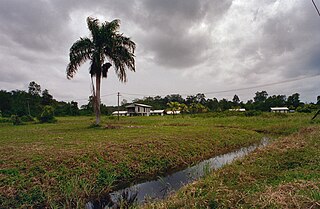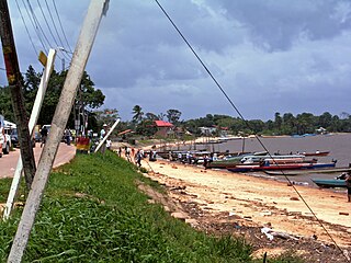
Commewijne is a district of Suriname, located on the right bank of the Suriname River. Commewijne's capital city is Nieuw Amsterdam. Tamanredjo is another major town, while Meerzorg is the most populated.

Marowijne is a district of Suriname, located on the north-east coast. Marowijne's capital city is Albina, with other towns including Moengo and Wanhatti. The district borders the Atlantic Ocean to the north, French Guiana to the east, the Surinamese district of Sipaliwini to the south, and the Surinamese districts of Commewijne and Para to the west.

The Maroni or Marowijne is a river in South America that forms the border between French Guiana and Suriname.

Albina is a town in eastern Suriname, and is capital of the Marowijne District. The town lies on the west bank of the Marowijne river, which forms the border with French Guiana, directly opposite the French Guianan town of Saint-Laurent-du-Maroni, to which it is connected by a frequent ferry service. Albina can be reached by bus via the East-West Link. The distance between Paramaribo and Albina is about 150 kilometres (95 mi).

Moengo is a town in Suriname, located in the Marowijne district, between Paramaribo and the border town Albina on the Cottica River. Moengo is also a resort (municipality) in the district of Marowijne. Moengo was the capital of Marowijne District between 1932 and 1945. The current capital is Albina.

Wageningen is a community resort and an agricultural place in the Republic of Suriname and located in the coastal area of West Suriname in the Nickerie District, at the harbour of the Nickerie River across the right estuary of the Maratakka River. The town was known as the rice centre of Suriname, Wageningen has been founded in 1949 and named after the Dutch city of Wageningen.

Apetina, also known as Pïlëuwimë or Puleowime, is a village in the South Eastern jungle area of Suriname within the Tapanahony resort in the Sipaliwini District. It is located at 3°30′N55°04′W in the jungle on the small hills along the river Tapanahoni. Nearby points include Tebu Mountain, at around 347 m (1,138 ft) in height, and the Man Gandafutu waterfall. The majority of Apetina's population is the Wayana people. These Indians mostly originate from Brazil and once have fled because of tribal warfare. There also is primary school and an airstrip located near the Indian village of Apetina.

Apoera, also Apura, is a town in western Suriname. The village has a population of 777 people as of 2020. It is the final destination of the Southern East-West Link. 24 kilometres (15 mi) north-west on the other side of the Courantyne River lies the Guyanese village of Orealla. The village is home to the Lokono tribe, but has been westernized. Due to the influx of people of Guyana, the languages used are English, and Sranan Tongo. Dutch is rarely spoken and the native language has all but disappeared. According to the oral tradition, Apoera was founded around 1920 by the Gordon family.

Benzdorp is a village in the Sipaliwini District of Suriname. It is named after the Dutch consul and bullion dealer Henry Albert Wilhelm Benz (1889-1962).

Papaichton is a commune in the overseas region and department of French Guiana. The village lies on the shores of the Lawa River. Papaichton is served by the Maripasoula Airport.

Torrellas is a municipality located in the province of Zaragoza, Aragon, Spain. According to the 2004 census (INE), the municipality has a population of 312 inhabitants.

Welgelegen is a resort in Suriname, located in the Coronie District. Its population at the 2012 census was 593. Welgelegen started as a cotton plantation in 1824. The church of Welgelegen was consecrated on 1 November 1883, but wasn't built at the spot. It was first erected on Cardross Park, and later moved to its current location. The church is no longer in service.

Moengotapoe is a resort in Suriname, located in the Marowijne District. Its population at the 2012 census was 579.

Patamacca is a resort in Suriname, located in the Marowijne District. Its population at the 2012 census was 427. Patamacca is a tribal area inhabited by Maroons

Carolina is a resort in Suriname, located in the Para District. Its population at the 2012 census was 343. Most of the inhabitants are indigenous.

Kabalebo is a resort in Suriname, located in the Sipaliwini District. Its population at the 2012 census was 2,291.

The borders of Suriname consist of land borders with three countries: Guyana, Brazil, and France. The borders with Guyana and France are in dispute, but the border with Brazil has been uncontroversial since 1906.
Ronnie Brunswijkstadion(English: Ronnie Brunswick Stadium) is an association football stadium located in Moengo, Suriname. The stadium is owned and operated by the Surinamese politician Ronnie Brunswijk, and the main tenant is Inter Moengotapoe, a football club that competes in Suriname's top league, the Topklasse. The capacity is around 3,000.

The Tigri Area or New River Triangle is a forested area in the East Berbice-Corentyne region of Guyana that has been disputed by Suriname since the 19th century. In Suriname, it is seen as an integral part of the Coeroeni Resort located in the Sipaliwini District.

Suriname-Rivier is a lightvessel permanently berthed in a wet dock in the Fort Nieuw-Amsterdam Open-Air Museum in Nieuw-Amsterdam, Commewijne, Suriname.


