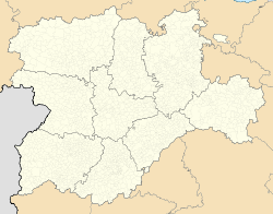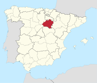
Soria is a province of central Spain, in the eastern part of the autonomous community of Castile and León. Most of the province is in the mountainous Sistema Ibérico area.
Illán de Vacas is a town in the province of Toledo, in Castile–La Mancha, Spain. The surface area of the municipality is 9 km2, it has a total population of 3 inhabitants, making it the least populated municipality in Spain.

Soria is a municipality and a Spanish city, located on the Douro river in the east of the autonomous community of Castile and León and capital of the province of Soria. Its population is 38,881, 43.7% of the provincial population. The municipality has a surface area of 271,77 km2, with a density of 144.97 inhabitants/km2. Situated at about 1065 metres above sea level, Soria is the second highest provincial capital in Spain.

Laudio in Basque or Llodio in Spanish is a town and municipality located in the province of Álava, in the Basque Country, northern Spain.

La Villa de Don Fadrique is a town and municipality located in the province of Toledo, Spain. The town is named after Fadrique Alfonso of Castile who conceded the "Carta-Puebla" on April 25, 1343. Prior to that date the small group of houses was under Corral de Almaguer administration.
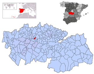
Domingo Pérez is a Spanish municipality of Toledo province, in the autonomous community of Castile-La Mancha. Its population is 498 and its surface is 1031 km2, with a density of 38.31 people/km2. The mayor is Mr. Blas Rodríguez Gomez de las Heras, of the Partido Popular. The Partido Popular has 5 municipal councillors, the Partido Socialista Obrero has one and there is an independent.

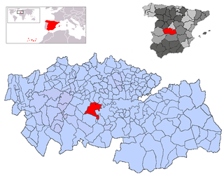
Cebolla is a Spanish municipality of Toledo province, in the autonomous community of Castile-La Mancha. Its population is 2,978 and it is 37 km2, in area with a density of 80.5 people/km2.

Otero is a Spanish municipality of Toledo province, in the autonomous community of Castilla-La Mancha. Its population is 183 and its surface is 30 km², with a density of 6.1 people/km². The mayor is Mr. Juan Lorenzo Moreno Labrado, of the Partido Popular. All the five municipal councillors belong to the Partido Popular.

Lucillos is a Spanish municipality of Toledo province, in the autonomous community of Castile-La Mancha. Its population is 488 and its surface is 41 km², with a density of 11.9 people/km².

Corral de Almaguer is a Spanish municipality of Toledo province, in the autonomous community of Castile-La Mancha. Its population is 5,549 and its surface is 329 km², with a density of 16.9 people/km².
La Puebla de Montalbán is a Spanish town and municipality in the province of Toledo, in the autonomous community of Castile-La Mancha. It is located in a plain of the River Tajo.

Pancrudo is a municipality in the Teruel Community comarca, Teruel province, Aragon, Spain. According to the 2010 census the municipality had a population of 136 inhabitants. Its postal code is 44720. Its distance from the provincial capital, Teruel is 56 kilometres.

Valdemeca is a municipality in the province of Cuenca, in the autonomous community of Castile-La Mancha, Spain.

La Puebla de Híjar is a town and municipality in the Bajo Martín comarca, Teruel province, Aragón, Spain. It has a population of 1,046, an area of 61 km² and is located near N-232 road.
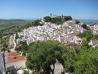
Casares is a town and municipality in Spain, located in Málaga province, in the autonomous community of Andalusia.

Alpandeire is a Spanish municipality and village located in the Ronda area, near the peak of Jarestepar,, and surrounded by rugged scenery. A number of streams run through its territory. The municipality belongs to Málaga province, in the autonomous community of Andalusia.

Golmayo is a municipality in the Province of Soria, in the autonomous community of Castile and León, Spain. The municipality lies at an altitude of 1,025 metres (3,363 ft) and covers an area of 190 square kilometres (73 sq mi).

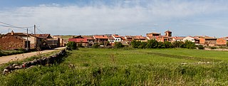
Cubillo del Campo is a municipality located in the province of Burgos, Castile and León, Spain.
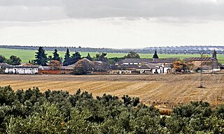
Montejo de Tiermes is a municipality located in the province of Soria, Castile and León, Spain. In 2010 the population of Montejo de Tiermes (municipality) was 198 inhabitants, 126 men and 72 women. Montejo de Tiermes (locality) had a population of 58 inhabitants on 1 January 2010, 41 men and 17 women.
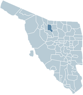
The Municipality of Magdalena de Kino is a municipality ('county') in the Mexican state of Sonora in Northwestern Mexico.