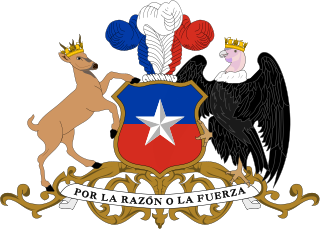
The National Congress of Chile is the legislative branch of the government of the Republic of Chile.

The Aconcagua River is a river in Chile that rises from the conflux of two minor tributary rivers at 1,430 metres (4,690 ft) above sea level in the Andes, Juncal River from the east and Blanco River from the south east. The Aconcagua river flows westward through the broad Aconcagua valley and enters the Pacific Ocean near the city of Concon, 20 kilometres (12 mi) north of Valparaíso.

Tacna is the largest of four provinces in the Tacna Region in southern Peru located on the border with Chile and Bolivia. Its capital is Tacna.

Corral is a town, commune and sea port in Los Ríos Region, Chile. It is located south of Corral Bay. Corral is best known for the forts of Corral Bay, a system of defensive batteries and forts made to protect Valdivia during colonial times. Corral was the headquarters of the system. Economic activities in Corral revolve around forestry, aquaculture, fishing, port services and both heritage and eco tourism.

Puente Alto is a city and commune of Chile. It is the capital of the Cordillera Province in the Santiago Metropolitan Region. Located at the south of the Great Santiago conurbation, it houses 573,935 inhabitants, making it the second largest city in Chile.

The Magallanes Basin or Austral Basin is a major sedimentary basin in southern Patagonia. The basin covers a surface of about 170,000 to 200,000 square kilometres and has a NNW-SSE oriented shape. The basin is bounded to the west by the Andes mountains and is separated from the Malvinas Basin to the east by the Río Chico-Dungeness High. The basin evolved from being an extensional back-arc basin in the Mesozoic to being a compressional foreland basin in the Cenozoic. Rocks within the basin are Jurassic in age and include the Cerro Toro Formation. Three ages of the SALMA classification are defined in the basin; the Early Miocene Santacrucian from the Santa Cruz Formation and Friasian from the Río Frías Formation and the Pleistocene Ensenadan from the La Ensenada Formation.

Vega de Alatorre is a municipality located in the central zone in the State of Veracruz, about 60 km from the state capital, Xalapa. It has an area of 310.92 km2. It is located at 20°02′N96°57′W.
San Antonio de Petrel is a small Chilean village located near the hacienda of the same name, in Pichilemu. It is located 18 kilometres (11 mi) east of Pichilemu. According to the 2002 census, the population of San Antonio de Petrel comprised 371 people, and 94 households.

Ciruelos is a Chilean village located southeast of Pichilemu, Cardenal Caro Province. In 1899, it had very few inhabitants, a free school, and a post office.

Paniahue is a Chilean village located north of Santa Cruz, Colchagua Province, O'Higgins Region.
Rodeillo is a village located 25 kilometers from Pichilemu, in central Chile.
El Guindo is a Chilean village located in Pichilemu, Cardenal Caro Province. As of the 2002 census, the population comprised 25 people, and 8 households.
El Huique is a Chilean village located north of Palmilla, Colchagua Province.
Isla de Yáquil is a Chilean town located in Santa Cruz, Colchagua Province, Libertador General Bernardo O'Higgins Region.
Larraín Alcalde, or Estación Larraín Alcalde, is a Chilean village located east of Pichilemu, Cardenal Caro Province.

Plaza de Puente Alto is an underground metro station and the southern terminal station of Line 4 of the Santiago Metro network, in Santiago, Chile. The station is located under the square of the same name, Plaza de Puente Alto, parallel to Concha y Toro Avenue at the junction with Manuel Rodríguez avenue in the commune of Puente Alto. The station was opened to the public on November 30, 2005.
Alto Ramirez is a Chilean village located in Pichilemu, Cardenal Caro Province.
![]()


