
The Antofagasta Region is one of Chile's sixteen first-order administrative divisions. Being the second-largest region of Chile in area, it comprises three provinces, Antofagasta, El Loa and Tocopilla. It is bordered to the north by Tarapacá, by Atacama to the south, and to the east by Bolivia and Argentina. The region's capital is the port city of Antofagasta; another one of its important cities is Calama. The region's main economic activity is copper mining in its giant inland porphyry copper systems.
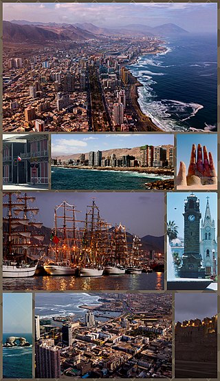
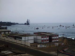
Antofagasta is a port city in northern Chile, about 1,100 kilometres (700 mi) north of Santiago. It is the capital of Antofagasta Province and Antofagasta Region. According to the 2015 census, the city has a population of 402,669.

Calama is a city and commune in the Atacama Desert in northern Chile. It is the capital of El Loa Province, part of the Antofagasta Region. Calama is one of the driest cities in the world with average annual precipitation of just 5 mm (0.20 in). The River Loa, Chile's longest, flows through the city. Calama has a population of 147,886.

San Pedro de Atacama is a Chilean town and commune in El Loa Province, Antofagasta Region. It is located east of Antofagasta, some 106 km (60 mi) southeast of Calama and the Chuquicamata copper mine, overlooking the Licancabur volcano. It features a significant archeological museum, the R. P. Gustavo Le Paige Archaeological Museum, with a large collection of relics and artifacts from the region. Native ruins nearby attract increasing numbers of tourists interested in learning about pre-Columbian cultures.

Club de Deportes Cobreloa S.A.D.P., commonly referred to as Cobreloa, is a Chilean football professional club based in Calama, Región de Antofagasta, Chile. They compete in the Primera División. The club's home ground is the Estadio Zorros del Desierto.
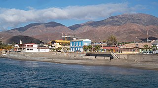
Tocopilla is a city and commune in the Antofagasta Region, in the north of Chile. It is the capital of the province that bears the same name.

The Loa River is a U-shaped river in Chile's northern Antofagasta Region. At 440 km (270 mi) long, it is the country's longest river and the main watercourse in the Atacama Desert.

Los Flamencos National Reserve is a nature reserve located in the commune of San Pedro de Atacama, Antofagasta Region of northern Chile. The reserve covers a total area of 740 square kilometres (290 sq mi) in the Central Andean dry puna ecoregion and consists of seven separate sections.

El Loa Province is one of three provinces of the northern Chilean region of Antofagasta (II). It is named after the longest of rivers in Chile, the Loa River. The provincial capital is Calama.
Ollagüe is a Chilean frontier village and commune in El Loa Province, Antofagasta Region. The village is 215 kilometres (134 mi) northeast of the city of Calama, and has a station and marshalling yard on the FCAB rail line.
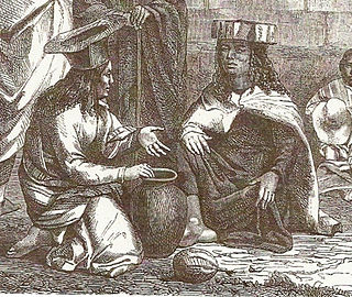
The Atacama people, also called Atacameño, are an Indigenous people from the Atacama Desert and altiplano region in the north of Chile and Argentina and southern Bolivia, mainly the Antofagasta Region.

Salar de Carcote, also known as Salar de San Martín, is a salt flat in northern Chile. The salar is located southwest of Ollagüe. It covers an area of around 108 km2 (42 sq mi) and its surface elevation is 3,690 m (12,110 ft). The landscape of the area is dominated by the volcanoes Ollagüe to the east and Aucanquilcha to the north. Salar de Carcote basin is bordered by the Loa River basin to the west and the Salar de Ascotán basin to the south.

The Atacama Desert is a desert plateau located on the Pacific coast of South America, in the north of Chile. Stretching over a 1,600-kilometre-long (1,000-mile) strip of land west of the Andes Mountains, it covers an area of 105,000 km2 (41,000 sq mi), which increases to 128,000 km2 (49,000 sq mi) if the barren lower slopes of the Andes are included.

The National Forest Corporation or CONAF is a Chilean State-owned private non-profit organization, through which the Chilean state contributes to the development and sustainable management of the country's forest resources. CONAF is overseen and funded by the Ministry of Agriculture of Chile.
Taltal is a Chilean commune and city in Antofagasta Province, Antofagasta Region. According to the 2012 census, the commune has a population of 11,132 and has an area of 20,405.1 km2 (7,878 sq mi). The commune is home to Paranal Observatory and includes the northern portion of Pan de Azúcar National Park.

María Elena is a Chilean town and commune in Tocopilla Province, Antofagasta Region. According to the 2012 census, the commune population was 4,593 and has an area of 12,197.2 km2 (4,709 sq mi).
Hiking in Chile is characterized by a wide range of environments and climates for hikers, which largely results from Chile's unusual, ribbon-like shape, which is 4,300 kilometres long and on average 175 kilometres wide. These range from the world's driest desert, the Atacama, in the north, through a Mediterranean climate in the center, to the glaciers, fjords and lakes of Patagonia in the south.

The Treaty of Peace and Friendship of 1904 between Chile and Bolivia was signed in Santiago de Chile on 20 October 1904, to delineate the boundary through 96 specified points between Cerro Zapaleri and Cerro Chipe and to regulate the relations between the two countries 20 years after the end of the War of the Pacific.

The Battle of Río Grande was a minor military engagement that took place on 10 September 1879, during the War of the Pacific. A picket of Chilean soldiers and a Bolivian montonera clashed in Rio Grande, around San Pedro de Atacama. Bolivians are defeated, which eliminates local resistance to Chilean occupation in the Litoral Department.
Ximena Anza Colamar is a Chilean politician of Atacameño descent. In 2021, she was elected to serve as the representative of the Atacameño people for a reserved seat in the Constitutional Convention.


