Table

National parks of Chile. Rapa Nui National Park not shown.
| Name | Photo | Natural region | Area | Established |
|---|---|---|---|---|
| Alberto de Agostini |  | Zona Austral | 14,600 km2 (5,637 sq mi) | 2000 |
| Alerce Andino |  | Zona Sur | 393 km2 (152 sq mi) | 1982 |
| Alerce Costero |  | Zona Sur | 139 km2 (54 sq mi) | 2012 |
| Archipiélago de Juan Fernández |  | Zona Central | 96 km2 (37 sq mi) | 1935 |
| Bernardo O'Higgins |  | Zona Austral | 35,259 km2 (13,614 sq mi) | 1969 |
| Bosque de Fray Jorge |  | Norte Chico | 100 km2 (39 sq mi) | 1941 |
| Cabo de Hornos |  | Zona Austral | 631 km2 (244 sq mi) | 1945 |
| Cerro Castillo |  | Zona Austral | 1,795.5 km2 (693 sq mi) | 2018 |
| Chiloé |  | Zona Austral | 431 km2 (166 sq mi) | 1983 |
| Conguillío |  | Zona Sur | 608 km2 (235 sq mi) | 1950 |
| Corcovado |  | Zona Austral | 2,096 km2 (809 sq mi) | 2005 |
| Diego Ramirez Islands & Drake Passage |  | Zona Austral | 144,390 km2 (55,749 sq mi) | 2018 |
| Hornopirén |  | Zona Austral | 482 km2 (186 sq mi) | 1988 |
| Huerquehue |  | Zona Sur | 125 km2 (48 sq mi) | 1967 |
| Isla Guamblin |  | Zona Austral | 106.25 km2 (41 sq mi) | 1967 |
| Isla Magdalena |  | Zona Austral | 1,576 km2 (608 sq mi) | 1983 |
| Kawésqar |  | Zona Sur | 23,138 km2 (8,934 sq mi) | 1969 |
| La Campana |  | Zona Central | 80 km2 (31 sq mi) | 1967 |
| Laguna del Laja |  | Zona Central | 119 km2 (46 sq mi) | 1958 |
| Laguna San Rafael | 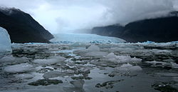 | Zona Austral | 17,420 km2 (6,726 sq mi) | 1959 |
| Las Palmas de Cocalán |  | Zona Central | 37.02 km2 (14 sq mi) | 1971 |
| Lauca |  | Norte Grande | 1,379 km2 (532 sq mi) | 1970 |
| Llanos de Challe |  | Norte Chico | 457 km2 (176 sq mi) | 1994 |
| Llullaillaco |  | Norte Grande | 2,687 km2 (1,037 sq mi) | 1995 |
| Melimoyu |  | Zona Austral | 1,055 km2 (407 sq mi) | 2018 |
| Morro Moreno |  | Norte Grande | 73 km2 (28 sq mi) | 2010 |
| Nahuelbuta |  | Zona Sur | 68 km2 (26 sq mi) | 1939 |
| Nevado Tres Cruces |  | Norte Grande | 591 km2 (228 sq mi) | 1994 |
| Pali Aike |  | Zona Austral | 50 km2 (19 sq mi) | 1970 |
| Pan de Azúcar |  | Norte Grande | 438 km2 (169 sq mi) | 1985 |
| Patagonia |  | Zona Austral | 3,045.28 km2 (1,176 sq mi) | 2018 |
| Puyehue |  | Zona Sur | 1,068 km2 (412 sq mi) | 1941 |
| Queulat |  | Zona Austral | 1,541 km2 (595 sq mi) | 1983 |
| Radal Siete Tazas |  | Zona Central | 5,148 km2 (1,988 sq mi) | 2008 |
| Rapa Nui |  | Zona Central | 71.3 km2 (28 sq mi) | 1935 |
| Río Clarillo |  | Zona Central | 101.85 km2 (39 sq mi) | 2020 |
| Salar del Huasco |  | Norte Grande | 1,600 km2 (618 sq mi) | 2010 |
| Tolhuaca |  | Zona Sur | 65 km2 (25 sq mi) | 1935 |
| Torres del Paine |  | Zona Austral | 2,400 km2 (927 sq mi) | 1959 |
| Vicente Pérez Rosales |  | Zona Sur | 2,530 km2 (977 sq mi) | 1926 |
| Villarrica |  | Zona Sur | 630 km2 (243 sq mi) | 1940 |
| Volcán Isluga | 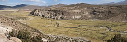 | Norte Grande | 1,747 km2 (675 sq mi) | 1967 |
| Yendegaia |  | Zona Austral | 1,480 km2 (571 sq mi) | 2013 |