Because Chile extends from a point about 625 kilometers north of the Tropic of Capricorn to a point hardly more than 1,400 kilometers north of the Antarctic Circle, within its territory can be found a broad selection of the Earth's climates.
The Tropic of Capricorn is the circle of latitude that contains the subsolar point on the December solstice. It is thus the southernmost latitude where the Sun can be directly overhead. Its northern equivalent is the Tropic of Cancer.
In 1950, CORFO defined, following criteria of geographic and economic homogeneity, six regions in continental Chile: Norte Grande, Norte Chico, Núcleo Central, Concepción y La Frontera, Los Lagos and Los Canales.[1]
Production Development Corporation (CORFO) is a Chilean governmental organization that was founded in 1939, by President Pedro Aguirre Cerda, to promote economic growth in Chile.
Continental Chile is the name given to the Chilean territory located on the continental shelf of South America. This term serves to distinguish the South American area from the insular territories, known as Insular Chile, as from the Antarctic Chile. The existence of this three areas of effective or claimed Chilean sovereignty is what supports the existing tricontinental principle in this country.
Although this territorial division was never used to define administrative entities (as the current Regions of Chile), the natural regions continue to be used for reference purposes.
Chile is divided into 16 regions, which are the country's first-level administrative division. Each region is headed by an intendant (intendente), appointed by the President of Chile, and a directly-elected regional board.
A natural region is a basic geographic unit. Usually it is a region which is distinguished by its common natural features of geography, geology, and climate.
Overview
These natural regions are ordered from north to south and reduced to five natural regions:[2] Each has its own characteristic vegetation, fauna, climate, and, despite the omnipresence of both the Andes and the Pacific, its own distinct topography.
Mediterranean climate and Matorral vegetation. The Andes is massive and high. Coast range and Andes lose height as they separate from each other to the south, fertile intermediate depression. Summer runoff of large rivers is heavily dependent on glacier and snowmelt.
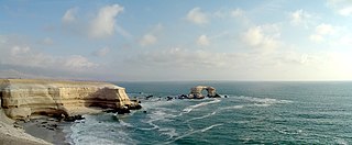
The Atacama Desert is a desert plateau in South America covering a 1000-km (600-mi) strip of land on the Pacific coast, west of the Andes mountains. The Atacama desert is one of the driest places in the world, as well as the only true desert to receive less precipitation than the polar deserts. According to estimates, the Atacama Desert occupies 105,000 km2 (41,000 sq mi), or 128,000 km2 (49,000 sq mi) if the barren lower slopes of the Andes are included. Most of the desert is composed of stony terrain, salt lakes (salares), sand, and felsic lava that flows towards the Andes.
The Chilean Coastal Range is a mountain range that runs from north to south along the Pacific coast of South America parallel to the Andean Mountains, extending from Morro de Arica in the north to Taitao Peninsula, where it ends at the Chile Triple Junction, in the south. The range has a strong influence on the climate of Chile since it produces a rain shadow to the east. Because of this the vegetation growing on the seaward slopes is much more exuberant than in the interior. Compared to the coastal lowlands and the Intermediate Depression it is sparsely populated with land use varying from protected areas to grazing and silviculture. The range is present in all Chilean regions except for Coquimbo Region and Magallanes Region.
The Coastal Cliff of northern Chile stretches over a length of more than 1000 km along the Atacama Desert. It makes up a large part of the western boundary to the Chilean Coast Range in the regions of Tarapacá and Antofagasta, and Atacama. According to Roland Paskoff the modern cliff origined from a scarp retreat of a fault scarp, thus at present the cliff does not follow any fault.
A semi-arid climate or steppe climate is the climate of a region that receives precipitation below potential evapotranspiration, but not as low as a desert climate. There are different kinds of semi-arid climates, depending on variables such as temperature, and they give rise to different biomes.
A Mediterranean climate or dry summer climate is characterized by dry summers and mild, wet winters. The climate receives its name from the Mediterranean Basin, where this climate type is most common. Mediterranean climate zones are typically located along the western sides of continents, between roughly 30 and 45 degrees north and south of the equator. The main cause of Mediterranean, or dry summer climate, is the subtropical ridge which extends northwards during the summer and migrates south during the winter due to greater temperature differences.
The Chilean Matorral (NT1201) is a terrestrial ecoregion of central Chile, located on the west coast of South America. It is in the Mediterranean forests, woodlands, and scrub biome, part of the Neotropic ecozone.
Mediterranean climate, vegetation of the Chilean Matorral. The Intermediate Depression of central Chile extends from Santiago to the south as a fertile region and is considered the agricultural heartland of Chile. After the Destruction of Seven Cities (1598–1604), all major settlements within the colonial Captaincy General of Chile came to be confined in central Chile, excepting only La Serena and the Chiloé Archipelago.
↑ Geografía económica de Chile. Corporación de fomento de la producción. (CORFO) Fundación Pedro Aguirre Cerda. Varios Autores. Imprenta Universitaria. Santiago de Chile 1950
↑ Note that the correspondence between regions is approximate in general.
Chiloé Island, also known as Greater Island of Chiloé, is the largest island of the Chiloé Archipelago off the coast of Chile, in the Pacific Ocean. The island is located in southern Chile, in the Los Lagos Region.
The Valdivian temperate forests (NT0404) is an ecoregion on the west coast of southern South America, in Chile and extending into Argentina. It is part of the Neotropical ecozone. The forests are named after the city of Valdivia. The Valdivian temperate rainforests are characterized by their dense understories of bamboos, ferns, and for being mostly dominated by evergreen angiosperm trees with some deciduous specimens, though conifer trees are also common.
Los Lagos Region is one of Chile's 16 regions, which are first order administrative divisions, and comprises four provinces: Chiloé, Llanquihue, Osorno and Palena. The region contains the country's second largest island, Chiloé, and the second largest lake, Llanquihue.
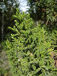
Pilgerodendron is a genus of conifer belonging to the cypress family Cupressaceae. It has only one species, Pilgerodendron uviferum, and is endemic to the Valdivian temperate rain forests and Magellanic subpolar forests of southern Chile and southwestern Argentina. It grows from 40 to 55°S in Tierra del Fuego, where it is the southernmost conifer in the world. It is a member of subfamily Callitroideae, a group of distinct southern hemisphere genera associated with the Antarctic flora.
The Central Valley, Intermediate Depression, or Longitudinal Valley is the depression between the Chilean Coastal Range and the Andes Mountains. The Chilean Central Valley extends from the border with Peru to Puerto Montt in southern Chile, with a notable interruption at Norte Chico. South of Puerto Montt the valley has a continuation as a series of marine basins up to the isthmus of Ofqui. Some of Chile's most populous cities lie within the valley including Santiago, Temuco, Rancagua, Talca and Chillán.
The Norte Grande is one of the five natural regions into which CORFO divided continental Chile in 1950. It borders Peru to the north, the Pacific Ocean to the west, the Altiplano, Bolivia and Argentina to the east, and the Copiapó River to the south, beyond which lies the Norte Chico natural region.
The Norte Chico is one of the five natural regions on which CORFO divided continental Chile in 1950. Its northern border is formed by the limit with the Far North, on west lies the Pacific Ocean, by the east the Andes mountains and Argentina, and by the south the Zona Central natural region. Although from a strictly geographic point of view, this natural region corresponds to the Chilean territory comprised between the rivers Copiapó and Aconcagua, traditionally Norte Chico refers to the zone comprising the regions of Atacama and Coquimbo. This natural region was home to the Diaguita people.
The Zona Sur is one of the five natural regions on which CORFO divided continental Chile in 1950. Its northern border is formed by the Bío-Bío River, the limit with the Central Chile Zone. By west with the Pacific Ocean, by the east with the Andean mountains and Argentina. Its southern border is the Chacao Channel, beyond it lies the Austral Zone. While Chiloé Archipelago belongs geographically to Zona Austral in terms of culture and history it lies closer to Zona Sur.
The Patagonian Desert, also known as the Patagonian Steppe or Magellanic Steppe, is the largest desert in Argentina and is the 8th largest desert in the world by area, occupying 673,000 square kilometers (260,000 mi2). It is located primarily in Argentina with small parts in Chile and is bounded by the Andes, to its west, and the Atlantic Ocean to its east, in the region of Patagonia, southern Argentina. To the north the desert grades into the Cuyo Region and the Pampas. The central parts of the steppe are dominated by shrubby and herbaceous plant species albeit to the west, where precipitation is higher, bushes are replaced by grasses. Topographically the deserts consist of alternating tablelands and massifs dissected by river valleys and canyons. The more western parts of the steppe host lakes of glacial origin and grades into barren mountains or cold temperate forests along valleys.
The geology of Chile is a characterized by processes linked to subduction such as volcanism, earthquakes and orogeny. The buildings blocks of Chile's geology assembled during the Paleozoic Era. Chile was by then the southwestern margin of the supercontinent Gondwana. In the Jurassic Gondwana begun to split and the ongoing period of crustal deformation and mountain building known as the Andean orogeny begun. In the Late Cenozoic Chile definitely separated from Antarctica, the Andes expienced a great rise accomplained by a cooling climate and the onset of glaciations.
The native flora of Chile is characterized by a higher degree of endemism and relatively fewer species compared to the flora of other countries of South America. A classification of this flora necessitates its division into at least three general zones: the desert provinces of the north, Central Chile, and the humid regions of the south.
The climate of Chile comprises a wide range of weather conditions across a large geographic scale, extending across 38 degrees in latitude, making generalizations difficult. According to the Köppen system, Chile within its borders hosts at least seven major climatic subtypes, ranging from low desert in the north, to alpine tundra and glaciers in the east and southeast, humid subtropical in Easter Island, Oceanic in the south and Mediterranean climate in central Chile. There are four seasons in most of the country: summer, autumn, winter, and spring.
The Transverse Valleys are a group of transverse valleys in the semi-arid northern Chile. They run from east to west, being among the most prominent geographical features in the regions they cross. They are located in the Chilean regions of Valparaíso, Coquimbo, and Atacama. They share some characteristics, such as reaching the Pacific Ocean without passing through an Intermediate Depression, being rather deep and dissecting the landscape, concentrating most agriculture and population in the areas through which they pass, and being intensively cultivated. They are one of the defining elements the Chilean natural region of Norte Chico. The area of the Transverse Valleys spans roughly a length of 600 km from north to south.
The Arid Diagonal is a contiguous zone of arid and semi-arid climate that traverses South America from coastal Peru in the Northwest to Argentine Patagonia in Southeast including large swathes of Bolivia and Chile. The Arid Diagonal encompasses a number of deserts, for example: Sechura, Atacama, Monte and the Patagonian Desert.
The last glacial period and its associated glaciation is known in southern Chile as the Llanquihue glaciation. Its type area lies west of Llanquihue Lake where various drifts or end moraine systems belonging to the last glacial period have been identified. The glaciation is the last episode of existence of the Patagonian Ice Sheet.
The Magellanic moorland or Magellanic tundra is an ecoregion on the Patagonian archipelagos south of latitude 48° S. It is characterized by high rainfall with a vegetation of scrubs, bogs and patches of forest in more protected areas. Cushion plants, grass-like plants and bryophytes are common.
This page is based on this Wikipedia article Text is available under the CC BY-SA 4.0 license; additional terms may apply. Images, videos and audio are available under their respective licenses.