
Caledon is a town in the Regional Municipality of Peel in the Greater Toronto Area of Ontario, Canada. The name comes from a shortened form of Caledonia, the Roman name for what is now Scotland. Caledon is primarily rural with a number of hamlets and small villages, but also contains the larger community of Bolton in its southeastern quadrant, adjacent to York Region. Some spillover urbanization also occurs in the south bordering the City of Brampton.

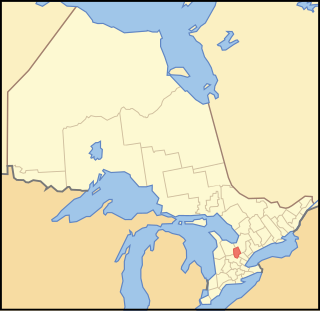
The Regional Municipality of Peel is a regional municipality in the Greater Toronto Area, Southern Ontario, Canada. It consists of three municipalities to the west and northwest of the city of Toronto: the cities of Mississauga and Brampton, and the town of Caledon, each of which spans its full east–west width. The regional seat is in Brampton.
Dufferin County is a county and census division located in Central Ontario, Canada. The county seat is Orangeville, and the current Warden is Wade Mills. The current chief administrative officer is Sonya Pritchard. Dufferin covers an area of 1,486.31 square kilometres (573.87 sq mi), and its population was 61,735 at the time of the 2016 Census.

Bolton is an unincorporated town that is the most populous community in the town of Caledon, Ontario, Canada, in the Regional Municipality of Peel. It is located beside the Humber River, approximately 50 kilometres northwest of Toronto. In regional documents, it is referred to as a 'Rural Service Centre'. It has 26,795 residents in 9,158 total dwellings. The downtown area that historically defined the village is in a valley, through which flows the Humber River. The village extends on either side of the valley to the north and south.

Palgrave is a Compact Rural Community and unincorporated place in the Town of Caledon, Regional Municipality of Peel in the Greater Toronto Area of Ontario, Canada. It is about 10 kilometres (6.2 mi) north of Bolton and about 50 kilometres (31 mi) northwest of Toronto. Palgrave is located east of Orangeville, south of Alliston, west of Newmarket and north of Brampton.
The Toronto and Region Conservation Authority (TRCA) is a conservation authority in southern Ontario, Canada. It owns about 16,000 hectares of land in the Toronto region, and it employs more than 400 full-time employees and coordinates more than 3,000 volunteers each year. TRCA's area of jurisdiction is watershed-based and includes 3,467 square kilometres (1,339 sq mi) – 2,506 on land and 961 water-based in Lake Ontario. This area comprises nine watersheds from west to east – Etobicoke Creek, Mimico Creek, Humber River, Don River, Highland Creek, Petticoat Creek, Rouge River, Duffins Creek and Carruthers Creek.
King's Highway 24, commonly referred to as Highway 24, is a highway in the Canadian province of Ontario that currently begins at Highway 3 in Simcoe, and ends at the southern city limits of Cambridge. The south–north route travels through Brantford, as well as the community of Scotland. Outside of those communities, Highway 24 travels through a predominantly agricultural area.
King's Highway 136, commonly referred to as Highway 136, was a provincially maintained highway in the Canadian province of Ontario that connected former Highway 24 near Caledon with Highway 9 in Orangeville. The majority of the route was located in the Regional Municipality of Peel; however, the section in Orangeville was in Dufferin County. The route of Highway 136 was originally part of Highway 24; it was created in 1962 when Highway 24 was rerouted along Highway 51. The highway remained unchanged until 1997, when it was transferred to the Regional Municipality of Peel and the Town of Orangeville.

Winston Churchill Boulevard is a long north-south roadway that predominantly forms the western boundary of Peel Region with the eastern boundaries of Halton Region and Wellington County, in Ontario, Canada. The road begins at Lakeshore Road in the south at the boundaries of the City of Mississauga the Town of Oakville, and ends in Caledon at East Garafraxa-Caledon Townline. The road is named in honour of British Prime Minister Sir Winston Churchill.

Tullamore is a semi-rural community on the boundary of Brampton and Caledon in Ontario, Canada. It was named after the settlers who arrived from the Irish village of 'Tullymore' in County Sligo. The community is centred on the intersection of Airport Road and Mayfield Road. It had a population of 6 in 2006. Many of the original Irish settlers gravesites can be found in St. Mary's Cemetery.

Caledon East is an unincorporated community located within the Town of Caledon, Ontario, Canada, within the Regional Municipality of Peel. It has a population of 5 575.

Mayfield West is a suburban neighbourhood located within the largely rural Town of Caledon, in Peel Region in Ontario, Canada, immediately adjacent to the City of Brampton. It has a population of 14,800 people.
Wildfield is a small rural hamlet located within the town of Caledon in Ontario, Canada.

Belfountain is a community located within the borders of the town of Caledon, in Peel Region, Ontario, Canada.

Caledon Village is an unincorporated community located within the largely rural Town of Caledon in Ontario, Canada. It has a population of 1 909 people.

Terra Cotta is a hamlet located in the town of Caledon, within Peel Region, Ontario, Canada.

Cheltenham is a small unincorporated village located within the Town of Caledon, in Peel Region, Ontario. It has a population of 729 people. The village is named after Cheltenham, England.

Brimstone, also known locally as Brimstone Point, is a small hamlet located within the town of Caledon in the Peel Region of Ontario, Canada. The population was 53 people in the 2006 census.
Cataract is a hamlet located within the town of Caledon in the regional municipality of Peel, Ontario, Canada. As of 2006, it had a population of 106 people.


