
Whitchurch-Stouffville is a town in the Greater Toronto Area of Ontario, Canada, approximately 50 km (31 mi) north of downtown Toronto, and 55 km (34 mi) north-east of Toronto Pearson International Airport. It is 206.22 km2 (79.62 sq mi) in area, and located in the mid-eastern area of the Regional Municipality of York on the ecologically-sensitive Oak Ridges Moraine. Its motto since 1993 is "country close to the city".
Stouffville is the primary urban area within the town of Whitchurch-Stouffville in York Region, Ontario, Canada. It is situated within the Greater Toronto Area and the inner ring of the Golden Horseshoe. The urban area is centred at the intersection of Main Street, Mill Street, and Market Street. Between 2006 and 2011, the population of the Community of Stouffville grew 100.5% from 12,411 to 24,886, or from 51% to 66% of the total population of the larger town of Whitchurch-Stouffville. The population of Stouffville from the 2021 census is 36,753.

The Pickering Airport Lands are parcels of lands owned by the Government of Canada located in York Region and Durham Region in the Greater Toronto Area of Ontario. The lands, totaling approximately 18,600 acres and located approximately 56 kilometres east of Downtown Toronto, were expropriated in 1972 by the federal government intending for a second international airport to serve the city of Toronto, its metropolitan area, and the surrounding Golden Horseshoe region. Since then, the federal government has leased the lands to private tenants and allocated more than half to form the Rouge National Urban Park.
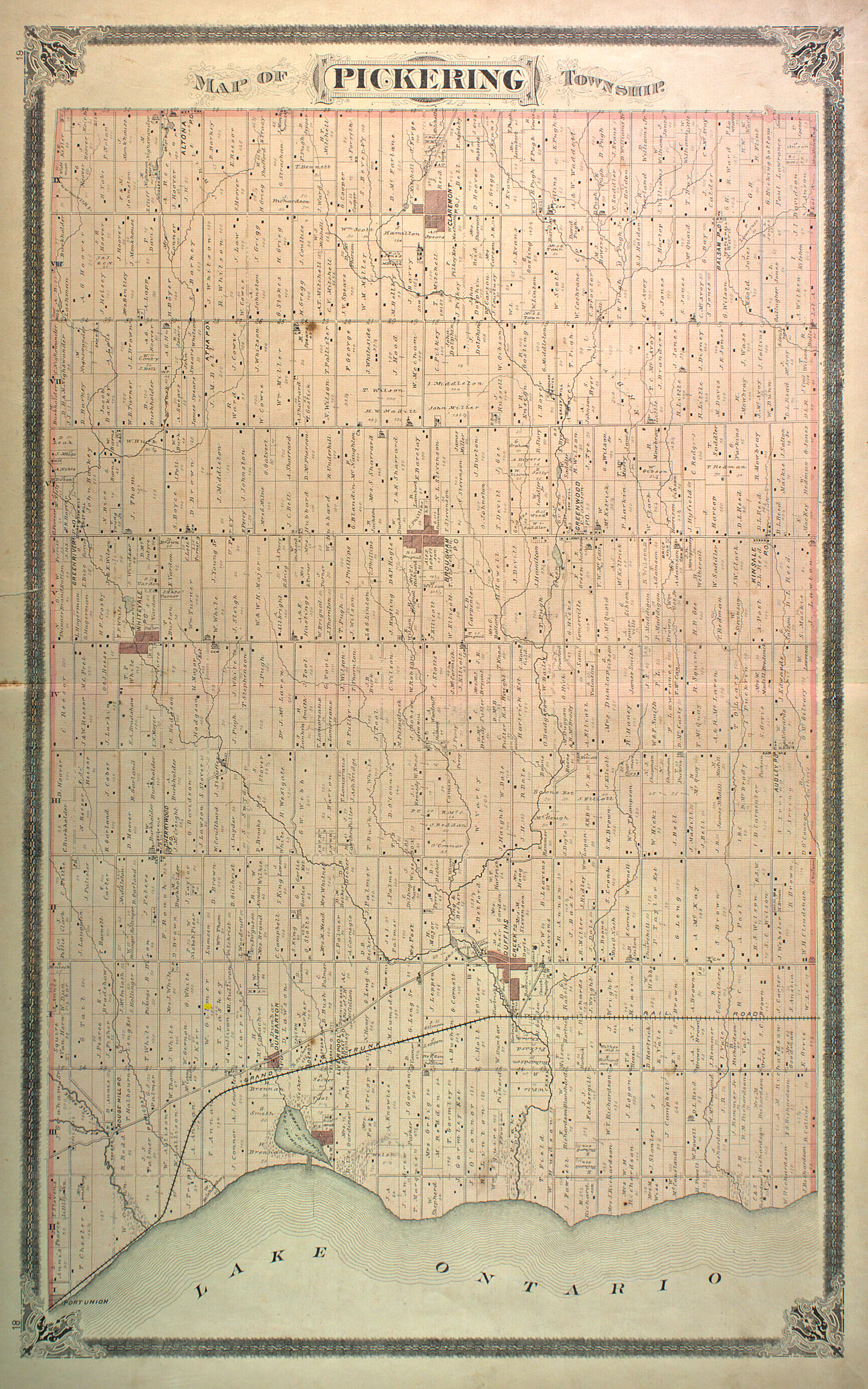
Claremont is an unincorporated community in Southern Ontario in the north part of Pickering, Ontario, Canada. Historically, Claremont was part of Pickering Township, Ontario County, Ontario until 1974 when Ontario County was amalgamated into the Regional Municipality of Durham, which had just been established.
Ballantrae, Ontario is a hamlet in the Town of Whitchurch–Stouffville. Named after the village of Ballantrae in South Ayrshire, Scotland, the community is centred on the intersection of Aurora Road and Highway 48.
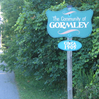
Gormley is a hamlet in York Region, Ontario, Canada that overlaps parts of Richmond Hill, and Whitchurch–Stouffville, two municipalities within the Greater Toronto Area. It was divided into two parts due to the construction of Highway 404. A portion of Gormley situated within Richmond Hill's political boundaries is subject to "Heritage Conservation District" controls. A post office in Gormley (East) serves as the mailing address for the Whitchurch–Stouffville communities of Bethesda, Gormley, Preston Lake, Vandorf, and Wesley Corners.

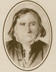
David Reesor was an Ontario businessman and political figure. He was a Liberal member of the Senate of Canada for King's division from 1867 to 1901.
Cedar Grove is a community in Markham, Ontario on the Little Rouge River. It is centred on 14th Avenue and Reesor Road and within the boundaries of the future national Rouge Park.
Dickson Hill is a small community in northeast Markham, Ontario, Canada, located near Highway 48 and 19th Avenue, on the border to Whitchurch-Stouffville.
Vandorf is a hamlet located in the town of Whitchurch–Stouffville, Ontario, in Canada. It is the most westerly settlement within the Town of Whitchurch-Stouffville. With a population of approximately 722, Vandorf consists mainly of estate residential homes and farms.
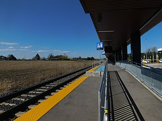
Old Elm GO Station is a train and bus station in the GO Transit network located in Whitchurch-Stouffville, Ontario, Canada. Old Elm is the northeastern terminus of train service on the Stouffville line. The original station opened on September 2, 2008 on the north side of Bethesda Road, adjacent to the GO train storage yard. Old Elm was rebuilt further south on the west side of Tenth Line, and opened on October 17, 2023.
Bethesda is a hamlet in York Region, Ontario, Canada, in the town of Whitchurch-Stouffville. The hamlet is centred at the intersection of Warden Avenue and Bethesda Road in the south-eastern region of Whitchurch-Stouffville; it flourished around 1875.

Locust Hill is a historic community of Markham, Ontario centred on Hwy. 7 and the Canadian Pacific Railway and within the boundaries of the future national Rouge Park.
Mongolia is an historical community in Markham, Ontario centred on 10th Line and Elgin Mills Rd. East, immediately south of the Town of Whitchurch-Stouffville. The hamlet lies completely within the expropriated federal Pickering Airport lands and also within the proposed boundaries of a future national Rouge Park.

Ringwood is a hamlet in York Region, Ontario, Canada, in the Town of Whitchurch–Stouffville. The hamlet is centred at the intersection of Stouffville Road and Highway 48, on the Little Rouge River, a tributary of the Rouge River on the Oak Ridges Moraine. The community originally straddled the townships of Markham and Whitchurch in the County of York. The hamlet was named Ringwood in 1856 by George Sylvester, postmaster and owner of a general store, after the town of Ringwood, in Hampshire, England. It was first settled in the 1790s by George Fockler from Pennsylvania. The Little Rouge River runs along the eastern edge of the hamlet. In 1857, Ringwood had a population of 200 which grew only slightly to 225 by 1910. By 1972, the population had dropped to 172. Between 2008 and 2010, more than 250 homes were constructed in Ringwood's Cardinal Point subdivision north of Main Street. Construction on a new auto mall in Ringwood began in 2009, with Hyundai and Toyota dealerships opening in 2010, and Dodge/Jeep and Nissan dealerships constructed in 2013.
Bloomington is a hamlet in York Region, Ontario, Canada, in the town of Whitchurch-Stouffville. The hamlet is centred at the intersection of Ninth Line and Bloomington Road near the eastern boundary of the town of Whitchurch–Stouffville. Neighbouring communities within Whitchurch–Stouffville include Musselman Lake to the north, Lemonville to the west, and the community of urban Stouffville to the south. The hamlet of Goodwood in the town of Uxbridge lies to the east.
Pine Orchard is a hamlet in York Region, Ontario, Canada, in the town of Whitchurch–Stouffville. It is centred at the intersection of Warden Avenue and Vivian Road in the north-western region of Whitchurch–Stouffville. The original settlers were Quakers who, like the early Mennonites of Whitchurch and Markham townships, were pacifists that came north after the American Revolution. The founder of the hamlet was Isaac Phillips, who arrived from Muncy County, Pennsylvania in 1802. A first post-office was established in 1853, and by 1860 three sawmills were operating in the area. In 1858 the hamlet had a population of 35. The community flourished towards the end of the nineteenth century until township; however at the beginning of the twentieth century the township was almost completely deforested, and the forest industry collapsed. The hamlet's post-office closed in 1914.

Abraham Stouffer is the founder of the town of Stouffville, Ontario.
Peter Reesor was one of the original settlers of Markham, Ontario.

Duffins Creek is a waterway in the eastern end of the Greater Toronto Area in Ontario, Canada. The watershed of the Duffins Creek is part of the Durham Region and the York Region.

