Alvarado, Indiana | |
|---|---|
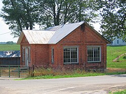
| An old brick house in Alvarado | |
| Coordinates: 41°34′36″N84°50′16″W / 41.57667°N 84.83778°W | |
| Country | United States |
| State | Indiana |
| County | Steuben |
| Township | Richland |
| Elevation | 292 m (958 ft) |
| Time zone | UTC-5 (Eastern (EST)) |
| • Summer (DST) | UTC-4 (EDT) |
| ZIP code | 46742 |
| Area code | 260 |
| GNIS feature ID | 430126 [1] |
Alvarado is an unincorporated community in Richland Township, Steuben County, in the U.S. state of Indiana. [1]
A post office was established at Alvarado in 1855, and remained in operation until 1904. [2] An old variant name of the community was called Richland Center. [3] In 1849, the Alvarado United Methodist Church was built, and is still in service today. [4]
In 1885, the village of Richland Center was described thusly: "Richland Center is a small village, located mostly on the northwest corner of section 20 [of Richland Township]. It is a convenient postoffice for the township, has a graded school and a store, the latter kept by John Douglas, who is also Postmaster. The postoffice is known as Alvarado." [5]
In 1890, the population was estimated as around 300 residents. [6]
In 1900, the population was 321. [7] Alvarado School still operated in the early 20th Century. [8]
By 1920, the population had dropped to 30. [9] The population was 5 in 1930. [10]
Alvarado lies 1 mile (1.6 km) north of Indiana State Road 427, 3 miles (4.8 km) south of Metz. [11]