The Deschutes River in central Oregon is a major tributary of the Columbia River. The river provides much of the drainage on the eastern side of the Cascade Range in Oregon, gathering many of the tributaries that descend from the drier, eastern flank of the mountains. The Deschutes provided an important route to and from the Columbia for Native Americans for thousands of years, and then in the 19th century for pioneers on the Oregon Trail. The river flows mostly through rugged and arid country, and its valley provides a cultural heart for central Oregon. Today the river supplies water for irrigation and is popular in the summer for whitewater rafting and fishing.

The Illinois River is a tributary, about 56 miles (90 km) long, of the Rogue River in the U.S. state of Oregon. It drains part of the Klamath Mountains in northern California and southwestern Oregon. The river's main stem begins at the confluence of its east and west forks near Cave Junction in southern Josephine County. Its drainage basin includes Sucker Creek, which rises in the Red Buttes Wilderness, near Whiskey Peak on the California state line. The main stem flows generally northwest in a winding course past Kerby and through the Siskiyou National Forest and Kalmiopsis Wilderness. It joins the Rogue River from the south at Agness on the Curry–Josephine county line, 27 miles (43 km) from the Pacific Ocean.

The North Yamhill River is a 31-mile (50 km) tributary of the Yamhill River in the U.S. state of Oregon. It drains an area of the Northern Oregon Coast Range, as well as part of the Willamette Valley west of the Willamette River.

The Long Tom River is a 57-mile (92 km) tributary of the Willamette River in western Oregon in the United States. It drains an area at the south end of the Willamette Valley between Eugene and Corvallis.
The Middle Santiam River is a tributary of the South Santiam River, 38.5 miles (62.0 km) long, in western Oregon in the United States. It drains a remote area of the Cascade Range east of Sweet Home in the watershed of the Willamette River.

Lost River begins and ends in a closed basin in northern California and southern Oregon in the United States. The river, 60 miles (97 km) long, flows in an arc from Clear Lake Reservoir in Modoc County, California, through Klamath County, Oregon, to Tule Lake in Siskiyou County, California. About 46 mi (74 km) of Lost River are in Oregon, and 14 miles (23 km) are in California.

The Metolius River is a tributary of the Deschutes River in Central Oregon, United States, near the city of Sisters. The river flows north from springs near Black Butte, then turns sharply east, descending through a series of gorges before ending in the western end of the lake. The unincorporated community of Camp Sherman lies astride the southern end of the river. The name of the river comes from the Warm Springs or Sahaptin word mitula, meaning white salmon and referring to a light colored Chinook salmon and not a whitefish.

Tumalo Creek is a tributary, about 20 miles (32 km) long, of the Deschutes River, located in Deschutes County in Central Oregon, United States. It rises in the Cascade Range at 44.04706°N 121.598647°W, where Middle Fork Tumalo Creek and North Fork Tumalo Creek meet, and forms several waterfalls, including the 97-foot (30 m) Tumalo Falls. Its mouth is on the Deschutes at 44.1159506°N 121.3394783°W.
Abiqua Creek is a tributary of the Pudding River in the U.S. state of Oregon. The creek originates near Lookout Mountain in the foothills of the Cascade Range in the northwestern part of the state. It flows northwest for about 29 miles (47 km) to its confluence with the Pudding, about 2 miles (3.2 km) west of Silverton, in the Willamette Valley. About 20 miles (32 km) north of Silverton, the Pudding River meets the Molalla River, which meets the Willamette River less than 1 mile (1.6 km) later near Canby.

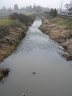
Crab Creek is a stream in the U.S. state of Washington. Named for the presence of crayfish, it is one of the few perennial streams in the Columbia Basin of central Washington, flowing from the northeastern Columbia River Plateau, roughly 5 km (3.1 mi) east of Reardan, west-southwest to empty into the Columbia River near the small town of Beverly. Its course exhibits many examples of the erosive powers of extremely large glacial Missoula Floods of the late Pleistocene, which scoured the region. In addition, Crab Creek and its region have been transformed by the large-scale irrigation of the Bureau of Reclamation's Columbia Basin Project (CBP), which has raised water table levels, significantly extending the length of Crab Creek and created new lakes and streams.

The Crooked River is a tributary, 125 miles (201 km) long, of the Deschutes River in the U.S. state of Oregon. The river begins at the confluence of the South Fork Crooked River and Beaver Creek. Of the two tributaries, the South Fork Crooked River is the larger and is sometimes considered part of the Crooked River proper. A variant name of the South Fork Crooked River is simply "Crooked River". The Deschutes River flows north into the Columbia River.

The Middle Fork Willamette River is one of several forks that unite to form the Willamette River in the western part of the U.S. state of Oregon. It is approximately 115 miles (185 km) long, draining an area of the Cascade Range southeast of Eugene, which is at the southern end of the Willamette Valley.

Mill Creek is a 26-mile (42 km) tributary of the Willamette River that drains a 111-square-mile (290 km2) area of Marion County in the U.S. state of Oregon. Flowing generally west from its source south of Silver Falls State Park, it passes through the cities of Aumsville, Stayton, Sublimity, and Turner before emptying into the Willamette in Salem.
Willow Creek is a tributary, about 26 miles (42 km) long, of the Deschutes River in central Oregon in the United States. Arising near Foley Butte in the western Ochoco Mountains in Crook County, it flows generally northwest into Jefferson County and through the Crooked River National Grassland. The creek continues through the city of Madras and becomes the dividing line between two plateaus, Agency Plains and Little Agency Plains. It then enters the Deschutes above Pelton Dam and its impoundment, Lake Simtustus, about 105 miles (169 km) from the river's confluence with the Columbia River.

Little Butte Creek is a 17-mile-long (27 km) tributary of the Rogue River in the U.S. state of Oregon. Its drainage basin consists of approximately 354 square miles (917 km2) of Jackson County and another 19 square miles (49 km2) of Klamath County. Its two forks, the North Fork and the South Fork, both begin high in the Cascade Range near Mount McLoughlin and Brown Mountain. They both flow generally west until they meet near Lake Creek. The main stem continues west, flowing through the communities of Brownsboro, Eagle Point, and White City, before finally emptying into the Rogue River about 3 miles (5 km) southwest of Eagle Point.
Conotton Creek is a tributary of the Tuscarawas River, 38.7 miles (62.3 km) long, in eastern Ohio in the United States. Via the Tuscarawas, Muskingum and Ohio Rivers, it is part of the watershed of the Mississippi River, draining an area of 286 square miles (741 km²) in Carroll, Harrison and Tuscarawas County, Ohio. The source is at 1240 feet and the mouth is at 874 feet. Dover Dam, downstream on the Tuscarawas river, is normally dry, but can impound a reservoir on Conotton and tributaries to a pool elevation of 916 feet for downstream flood control by the Corps of Engineers. From its source in eastern Harrison County, Ohio the creek flows west northwest through Jewitt, Scio, Conotton, Bowerston, Leesville, Sherrodsville, New Cumberland and Somerdale before reaching its mouth in central Tuscarawas County, Ohio. The Wheeling and Lake Erie Railway is situated in the valley. Ohio State Route 151 runs in the valley from near the source to Bowerston. Ohio State Route 212 run along the valley from Bowerston to the mouth. The Conotton Creek Trail runs from Bowerston to Jewett.
Smith River is a tributary of the McKenzie River in Linn County in the U.S. state of Oregon. It begins near Browder Ridge in the Cascade Range and flows generally south through the Willamette National Forest to meet the larger river at Trail Bridge Reservoir, about 82 miles (132 km) upstream of the McKenzie's mouth on the Willamette River.

Coyote Creek is a tributary of the Long Tom River via Fern Ridge Reservoir in Lane County in the U.S. state of Oregon. Beginning in hills south of Eugene, it meanders generally north through Gillespie Corners and Crow before entering the reservoir east of Veneta.