Ambergris Cay Limestone

Last updated
Ambergris Caye Limestone
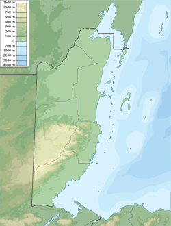
Stratigraphic range: Late Pleistocene
Type Formation
Lithology
Primary Limestone
Location
Coordinates 18°06′N87°48′W / 18.1°N 87.8°W / 18.1; -87.8 Coordinates: 18°06′N87°48′W / 18.1°N 87.8°W / 18.1; -87.8
CountryFlag of Belize.svg  Belize
Type section
Named for Ambergris Caye
Belize physical map.svg
Yellow ffff80 pog.svg
Ambergris Cay Limestone (Belize)

The Ambergris Caye Limestone is a geologic formation in Belize. It preserves fossils dating back to the Late Pleistocene period. [1]

Contents

See also

Related Research Articles

Geography of Belize

Belize is a small Central American nation, located at 17°15' north of the equator and 88°45' west of the Prime Meridian on the Yucatán Peninsula. It borders the Caribbean Sea to the east, with 386 km of coastline. It has a total of 542 km of land borders—Mexico to the north-northwest (272 km) and Guatemala to the south-southwest (266 km). Belize's total size is 22,966 km2 (8,867 sq mi), of which 22,806 km2 (8,805 sq mi) is land and 160 km2 (62 sq mi) is water.

Belize District District of Belize

Belize District is a district of the nation of Belize. Its capital is Belize City.

San Pedro Town Town in Belize, Belize

San Pedro is a town on the southern part of the island of Ambergris Caye in the Belize District of the nation of Belize, in Central America. According to the 2015 mid-year estimates, the town has a population of about 16,444. It is the second-largest town in the Belize District and largest in the Belize Rural South constituency. The once sleepy fishing village was granted the status of a town in 1984.

Ambergris Caye Island in Belize

Ambergris Caye, pronounced am-BUR-gris KEE, is the largest island of Belize, located northeast of the country's mainland, in the Caribbean Sea. It is about 40 kilometres (25 mi) long from north to south, and about 1.6 kilometres (1 mi) wide. Where it has not been modified by humans, it is mostly a ring of white sand beach around mangrove swamp in the centre. Though administered as part of the Belize District, the closest point on the mainland is part of the Corozal District.

There are several ports of Belize through which boats enter.

Ambergris Today is an English-language weekly newspaper published in San Pedro Town, Ambergris Caye, Belize. It is a free newspaper, marketed to tourists.

<i>The San Pedro Sun</i> Newspaper in Belize

The San Pedro Sun is a newspaper published continuously since 1991 and serves the community of San Pedro Town located on Ambergris Caye in Belize, Central America. The editors are Ron and Tamara Sniffin, assisted by Mary Gonzalez, Dennis and Natalie Manuel. The Sun also publishes a "Visitor's Guide" each week that features tourism interests in San Pedro and Belize. The Visitor Guide is inserted inside each issue of The San Pedro Sun.

John Greif II Airport Airport in Belize

John Greif II Airport is an airport that serves San Pedro and Ambergris Caye, Belize. The airport has maintenance and terminal facilities as well as a paved and marked runway.

The 2007–08 season of the Belize Premier Football League, otherwise known as the RFG Insurance Cup, began on September 30, 2007 and concluded in April 2008. FC Belize of Belize City entered as defending champions.

San Pedro Seadogs is a Belizean football team which currently competes in the Premier League of Belize of the Football Federation of Belize.

Ambergris Stadium is a multi-purpose sporting field in San Pedro Town, Belize. It is home to the San Pedro Pirates FC of the Premier League of Belize.

Yucatan yellow bat Species of bat

The Yucatan yellow bat is a species of bat found in the Yucatán Peninsula in Mexico, and possibly also in Belize and Guatemala. These small insectivorous bats forage on flying insects at dawn and dusk.

Ambergris Museum is a Mesoamerican archaeology museum in Belize. It houses ancient Mayan civilization artifacts.

Bacalar Chico National Park and Marine Reserve

Bacalar Chico National Park and Marine Reserve (BCNPMR) is a protected area and UNESCO World Heritage Site on the northern part of Ambergris Caye in Belize.

Mexico Rocks is a shallow patch reef complex located off the far northern tip of Ambergris Caye, and is part of the Belize Barrier Reef system in the Caribbean Sea. The site consists of approximately 100 Holocene patch reefs clustered on a Pleistocene ridge of limestone and is composed predominantly of boulder star corals. The reef has accumulated in shallow water, about 2.5 to 5 metres deep, over the last 420 years, under static sea level conditions. The site was recommended for designation as a marine preserve in 1978, and was approved in 2015 as a part of the Hol Chan Marine Reserve. The reef is popular among snorkelers and SCUBA divers, and it is seen as an important addition to Ambergris Caye's ecotourism attractions.

Marco Gonzalez is a Maya archaeological site located near the southern tip of Ambergris Caye off the coast of Belize. It was first recorded in 1984 by Drs. Elizabeth Graham and David M. Pendergast, and was named by them after their local guide.

Maritime trade in the Maya civilization

The extensive trade networks of the Ancient Maya contributed largely to the success of their civilization spanning three millennia. The Maya royals control and wide distribution of foreign and domestic commodities for both population sustenance and social affluence are hallmarks of the Maya visible throughout much of the iconography found in the archaeological record. In particular, moderately long distance trade of foreign commodities from the Caribbean and Gulf Coasts provided the larger inland Maya cities with the resources they needed to sustain settled population levels in the several thousands. Though the ruling class essentially controlled the trade economy, a middle merchant class supervised import and export from cities and trade ports. Not much is known of the Maya merchant class; however, merchants of royal lineage are sometimes represented in the iconography. Notably, a canoe paddle often accompanies the royal merchant depictions, signifying their association with marine resources. Water lilies are also a recognizable feature of Maya iconography, appearing on ceramics and murals in landlocked cities like Palenque where the lilies cannot grow, further indicating the important political symbolism of water connections. The dugout style canoes of the Maya and other small watercraft are also represented in various codices, sometimes ferrying royal figures or deities. The rich tradition of maritime trade has continued into the modern era, exemplified by the resource exploitation of the coastal lagoons and cay locations along the Caribbean coast of Mexico, Belize, Guatemala, and Honduras. Eventually, the intensification of maritime trade reliance aided in the collapse of interior Maya power regimes, shifting political influence to coastal polities such as Uxmal and Chichen Itza in the Terminal Classic. A seaborne trade economy would continue to dominate the Maya civilization until the period of European Contact.

San Pedro Pirates Football Club is a Belizean football team.

Elizabeth Graham is a Professor of Mesoamerican Archaeology at UCL. She has worked, for decades, on the Maya civilization, both in prehispanic and colonial times, specifically in Belize. She has recently turned her attention to Maya Dark Earths, and conducts pioneering work in the maya region as dark earths have mostly been studied in the Amazonia. She particularly focuses on how human occupation influences soil formation and production.

References

Further reading