Ambilombe is a town and commune in Madagascar. It belongs to the district of Mandritsara, which is a part of Sofia Region. The population of the commune was estimated to be approximately 6,000 in 2001 commune census.

Miarinarivo is a town and commune in Madagascar, north east of Antananarivo It belongs to the district of Andilamena, which is a part of Alaotra-Mangoro Region. The population of the commune was estimated to be 14,000 in the 2001 commune census.
Andranomafana is a town and commune in Madagascar. It belongs to the district of Ankazoabo, which is a part of Atsimo-Andrefana Region. The population of the commune was estimated to be approximately 6,000 in 2001 commune census.
Mangarivotra(formerly named: Beparasy) is a rural municipality in Madagascar. It belongs to the district of Moramanga, which is a part of the Alaotra-Mangoro Region. The population of the commune was estimated to be approximately 9,000 in the 2001 commune census.
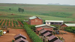
Mandialaza is a rural municipality in Madagascar. It belongs to the district of Moramanga, which is a part of Alaotra-Mangoro Region. The population of the municipality was 15835 in 2018.
Miary Taheza is a town and commune in Madagascar. It belongs to the district of Sakaraha, which is a part of Atsimo-Andrefana Region. The population of the commune was estimated to be approximately 10,000 in 2001 commune census.
Ambano is a town and commune in Madagascar. It belongs to the district of Antsirabe II, which is a part of Vakinankaratra Region. The population of the commune was estimated to be approximately 32,000 in the 2001 commune census.
Ambohibary is a municipality in Madagascar. It belongs to the district of Antsirabe II, which is a part of Vakinankaratra Region. The population of the commune was estimated to be approximately 52,000 in 2001 commune census.
Satrokala is a town and commune in Madagascar. It belongs to the district of Ihosy, which is a part of Ihorombe Region. The population of the commune was estimated to be approximately 10,000 in 2001 commune census.
Ianapera is a town and commune in Madagascar. It belongs to the district of Benenitra, which is a part of Atsimo-Andrefana Region. The population of the commune was estimated to be approximately 10,000 in 2001 commune census.
Vohitsaoka is a rural commune in the Central Highlands of Madagascar. It belongs to the district of Ambalavao, which is a part of Haute Matsiatra Region. The population of the commune was estimated to be approximately 10,000 in 2001 commune census.
Ambohinamboarina is a town and commune in Madagascar. It belongs to the district of Ambohimahasoa, which is a part of Haute Matsiatra Region. The population of the commune was estimated to be approximately 12,000 in 2001 commune census.
Ankerana is a town and commune in Madagascar. It belongs to the district of Ambohimahasoa, which is a part of Haute Matsiatra Region. The population of the commune was estimated to be approximately 10,000 in 2001 commune census.
Soaindrana is a town and commune in Madagascar. It belongs to the district of Fianarantsoaii, which is a part of Haute Matsiatra Region. The population of the commune was estimated to be approximately 8,000 in 2001 commune census.

Talata Ampano is a rural municipality in Madagascar. It belongs to the district of Vohibato District, which is a part of Haute Matsiatra Region. The population of the commune was estimated to be approximately 15,000 in 2001 commune census.
Marofarihy is a rural municipality in Madagascar. It belongs to the district of Manakara-Atsimo_(district), which is a part of Fitovinany. The population of the commune was estimated to be approximately 7,000 in 2001 commune census.
Beapombo II is a town and commune in Madagascar. It belongs to the district of Betroka, which is a part of Anosy Region. The population of the commune was estimated to be approximately 5,000 in 2001 commune census.
Betsimisotra is a town and commune in Madagascar. It belongs to the district of Fandriana, which is a part of Amoron'i Mania Region. The population of the commune was estimated to be approximately 8,000 in 2001 commune census.

Ihadilanana is a town and commune in Madagascar. It belongs to the district of Ambositra, which is a part of Amoron'i Mania Region. The population of the commune was estimated to be approximately 9,000 in 2001 commune census.
Sahatsiho Ambohimanjaka is a rural municipality in Madagascar. It belongs to the district of Ambositra, which is a part of Amoron'i Mania Region. The population of the commune was estimated to be approximately 9,000 in 2001 commune census.

