Ambia, Ihosy

Last updated
Ambia
Madagascar location map.svg
Red pog.svg
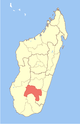
Ambia
Location in Madagascar
Coordinates: 22°22′S46°11′E / 22.367°S 46.183°E / -22.367; 46.183
CountryFlag of Madagascar.svg  Madagascar
Region Ihorombe
District Ihosy
Elevation [1] 699 m (2,293 ft)
Population (2001) [2]
  Total 5,000
Time zone EAT (UTC3)

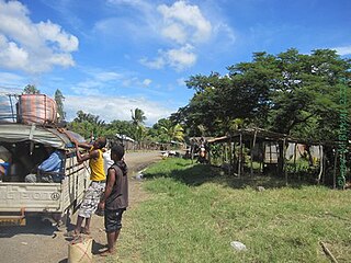
Ambia is a town and commune in Madagascar. It belongs to the district of Ihosy, which is a part of Ihorombe Region. The population of the commune was estimated to be approximately 5,000 in 2001 commune census. [2]

Madagascar island nation off the coast of Southeast Africa, in the Indian Ocean

Madagascar, officially the Republic of Madagascar, and previously known as the Malagasy Republic, is an island country in the Indian Ocean, approximately 400 kilometres off the coast of East Africa. The nation comprises the island of Madagascar and numerous smaller peripheral islands. Following the prehistoric breakup of the supercontinent Gondwana, Madagascar split from the Indian subcontinent around 88 million years ago, allowing native plants and animals to evolve in relative isolation. Consequently, Madagascar is a biodiversity hotspot; over 90% of its wildlife is found nowhere else on Earth. The island's diverse ecosystems and unique wildlife are threatened by the encroachment of the rapidly growing human population and other environmental threats.

Districts of Madagascar

Districts are second-level administrative divisions of Madagascar below the regions. There are 114 districts in Madagascar. Districts are in their turn divided into communes; while some of the districts in urban areas and offshore islands each consist of only one commune, most of the districts are divided typically into 5–20 communes.

Ihosy District District in Ihorombe, Madagascar

Ihosy is a district in south-eastern Madagascar. It is a part of Ihorombe Region and borders the districts of Ikalamavony in north, Ambalavao in northeast, Ivohibe in east, Iakora in southeast, Betroka in south, Benenitra in southwest, Sakaraha and Ankazoabo Sud in west and Beroraha in northwest. The area is 17,358 km2 (6,702 sq mi) and the population was estimated to be 106,591 in 2001. The district is further divided into 17 communes.

Only primary schooling is available. The majority 90% of the population of the commune are farmers, while an additional 9% receives their livelihood from raising livestock. The most important crop is rice, while other important products are vegetables and tomato. Services provide employment for 1% of the population. [2]

Rice cereal grain and seed of Oryza sativa

Rice is the seed of the grass species Oryza sativa or Oryza glaberrima. As a cereal grain, it is the most widely consumed staple food for a large part of the world's human population, especially in Asia. It is the agricultural commodity with the third-highest worldwide production, after sugarcane and maize.

Tomato Edible berry of the tomato plant, originating in South America

The tomato is the edible, often red, berry of the nightshade Solanum lycopersicum, commonly known as a tomato plant. The species originated in western South America. The Nahuatl word tomatl gave rise to the Spanish word tomate, from which the English word tomato derived. Its use as a cultivated food may have originated with the indigenous peoples of Mexico. The Spanish encountered the tomato from their contact with the Aztec during the Spanish colonization of the Americas and brought it to Europe. From there, the tomato was introduced to other parts of the European-colonized world during the 16th century.

References and notes

  1. Estimated based on DEM data from Shuttle Radar Topography Mission
  2. 1 2 3 "ILO census data". Cornell University. 2002. Retrieved 2008-04-24.

Coordinates: 22°22′S46°11′E / 22.367°S 46.183°E / -22.367; 46.183

Geographic coordinate system Coordinate system

A geographic coordinate system is a coordinate system that enables every location on Earth to be specified by a set of numbers, letters or symbols. The coordinates are often chosen such that one of the numbers represents a vertical position and two or three of the numbers represent a horizontal position; alternatively, a geographic position may be expressed in a combined three-dimensional Cartesian vector. A common choice of coordinates is latitude, longitude and elevation. To specify a location on a plane requires a map projection.


Related Research Articles

Mahavanona Place in Diana, Madagascar

Mahavanona is a town and commune in Madagascar. It belongs to the district of Antsiranana II, which is a part of Diana Region. It is located at the Besokatra River on the Route nationale 6 between Antsiranana and Anivorano Nord.

Ambohisoa Place in Sofia, Madagascar

Ambohisoa is a town and commune in Madagascar. It belongs to the district of Mandritsara, which is a part of Sofia Region. The population of the commune was estimated to be approximately 5,000 in 2001 commune census.

Ankaraobato, Marovoay Place in Boeny, Madagascar

Ankaraobato is a town and commune in Madagascar. It belongs to the district of Marovoay, which is a part of Boeny Region. The population of the commune was estimated to be approximately 7,000 in 2001 commune census.

Anosinalainolona Place in Boeny, Madagascar

Anosinalainolona is a town and commune in Madagascar. It belongs to the district of Marovoay, which is a part of Boeny Region. The population of the commune was estimated to be approximately 4,000 in 2001 commune census.

Manaratsandry Place in Boeny, Madagascar

Manaratsandry is a town and commune in Madagascar. It belongs to the district of Marovoay, which is a part of Boeny Region. The population of the commune was estimated to be approximately 20,000 in 2001 commune census.

Ankijabe Place in Boeny, Madagascar

Ankijabe is a town and commune in Madagascar. It belongs to the district of Ambato-Boeni, which is a part of Boeny Region. The population of the commune was estimated to be approximately 19,000 in 2001 commune census.

Antanimbary Place in Betsiboka, Madagascar

Antanimbary is a town and commune in Madagascar. It belongs to the district of Maevatanana, which is a part of Betsiboka Region. The population of the commune was estimated to be approximately 3,000 in 2001 commune census.

Tanananifololahy Place in Alaotra-Mangoro, Madagascar

Tanananifololahy or Tanonanifololahy is a town and commune in Madagascar. It belongs to the district of Andilamena, which is a part of Alaotra-Mangoro Region. The population of the commune was estimated to be approximately 5,000 in 2001 commune census.

Ambohijanahary Place in Alaotra-Mangoro, Madagascar

Ambohijanahary is a town and commune in Madagascar. It belongs to the district of Amparafaravola, which is a part of Alaotra-Mangoro Region. The population of the commune was estimated to be approximately 28,000 in 2001 commune census.

Sabotsy Namatoana Place in Vakinankaratra, Madagascar

Sabotsy Namatoana is a town and commune in Madagascar. It belongs to the district of Ambatolampy, which is a part of Vakinankaratra Region. The population of the commune was estimated to be approximately 8,000 in 2001 commune census.

Ampary Place in Itasy, Madagascar

Ampary is a town and commune in Madagascar. It belongs to the district of Soavinandriana, which is a part of Itasy Region. The population of the commune was estimated to be approximately 9,000 in 2001 commune census.

Marerano Place in Atsimo-Andrefana, Madagascar

Marerano is a town and commune in Madagascar. It belongs to the district of Beroroha, which is a part of Atsimo-Andrefana Region. The population of the commune was estimated to be approximately 4,000 in 2001 commune census.

Fenoarivo, Ambalavao Place in Haute Matsiatra, Madagascar

Fenoarivo is a town and commune in Madagascar. It belongs to the district of Ambalavao, which is a part of Haute Matsiatra Region. The population of the commune was estimated to be approximately 8,000 in 2001 commune census.

Fanjakana, Fianarantsoa II Place in Haute Matsiatra, Madagascar

Fanjakana is a town and commune in Madagascar. It belongs to the district of Fianarantsoa II, which is a part of Haute Matsiatra Region. The population of the commune was estimated to be approximately 10,000 in 2001 commune census.

Mahazoarivo, Fianarantsoa II Place in Haute Matsiatra, Madagascar

Mahazoarivo is a town and commune in Madagascar. It belongs to the district of Fianarantsoa II, which is a part of Haute Matsiatra Region. The population of the commune was estimated to be approximately 12,000 in 2001 commune census.

Mahasolo Place in Bongolava, Madagascar

Mahasolo is a town and commune in Madagascar. It belongs to the district of Tsiroanomandidy, which is a part of Bongolava Region. The population of the commune was estimated to be approximately 30,000 in 2001 commune census.

Sihanamaro Place in Androy, Madagascar

Sihanamaro is a town and commune in Madagascar. It belongs to the district of Ambovombe, which is a part of Androy Region. The population of the commune was estimated to be approximately 10,000 in 2001 commune census.

Anandravy Place in Atsimo-Atsinanana, Madagascar

Anandravy is a town and commune in Madagascar. It belongs to the district of Vondrozo, which is a part of Atsimo-Atsinanana Region. The population of the commune was estimated to be approximately 4,000 in 2001 commune census.

Antokonala Place in Atsimo-Atsinanana, Madagascar

Antokonala is a town and commune in Madagascar. It belongs to the district of Vondrozo, which is a part of Atsimo-Atsinanana Region. The population of the commune was estimated to be approximately 4,000 in 2001 commune census.

Mahavelo, Vondrozo Place in Atsimo-Atsinanana, Madagascar

Mahavelo is a town and commune in Madagascar. It belongs to the district of Vondrozo, which is a part of Atsimo-Atsinanana Region. The population of the commune was estimated to be approximately 7,000 in 2001 commune census.