Bogdańczew is a village in the administrative district of Gmina Góra Świętej Małgorzaty, within Łęczyca County, Łódź Voivodeship, in central Poland. It lies approximately 9 kilometres (6 mi) east of Łęczyca and 30 km (19 mi) north of the regional capital Łódź.
Orszewice is a village in the administrative district of Gmina Góra Świętej Małgorzaty, within Łęczyca County, Łódź Voivodeship, in central Poland. It lies approximately 9 kilometres (6 mi) north-east of Łęczyca and 35 km (22 mi) north of the regional capital Łódź.
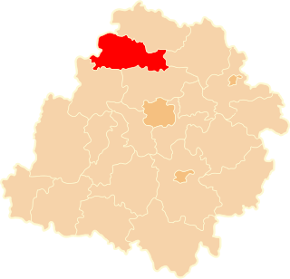
Błonie is a village in the administrative district of Gmina Łęczyca, within Łęczyca County, Łódź Voivodeship, in central Poland. It lies approximately 6 kilometres (4 mi) north-west of Łęczyca and 40 km (25 mi) north-west of the regional capital Łódź.
Bronno is a village in the administrative district of Gmina Łęczyca, within Łęczyca County, Łódź Voivodeship, in central Poland. It lies approximately 8 kilometres (5 mi) west of Łęczyca and 40 km (25 mi) north-west of the regional capital Łódź.
Chrząstówek is a village in the administrative district of Gmina Łęczyca, within Łęczyca County, Łódź Voivodeship, in central Poland. It lies approximately 6 kilometres (4 mi) north of Łęczyca and 40 km (25 mi) north-west of the regional capital Łódź.
Dąbie is a village in the administrative district of Gmina Łęczyca, within Łęczyca County, Łódź Voivodeship, in central Poland. It lies approximately 7 kilometres (4 mi) north-west of Łęczyca and 41 km (25 mi) north-west of the regional capital Łódź.
Dobrogosty is a village in the administrative district of Gmina Łęczyca, within Łęczyca County, Łódź Voivodeship, in central Poland. It lies approximately 6 kilometres (4 mi) north-east of Łęczyca and 38 km (24 mi) north-west of the regional capital Łódź.
Garbalin is a village in the administrative district of Gmina Łęczyca, within Łęczyca County, Łódź Voivodeship, in central Poland. It lies approximately 6 kilometres (4 mi) north of Łęczyca and 41 km (25 mi) north-west of the regional capital Łódź.
Kozuby is a village in the administrative district of Gmina Łęczyca, within Łęczyca County, Łódź Voivodeship, in central Poland. It lies approximately 5 kilometres (3 mi) north-east of Łęczyca and 38 km (24 mi) north-west of the regional capital Łódź.

Leźnica Mała is a village in the administrative district of Gmina Łęczyca, within Łęczyca County, Łódź Voivodeship, in central Poland. It lies approximately 9 kilometres (6 mi) west of Łęczyca and 39 km (24 mi) north-west of the regional capital Łódź.

Siedlec is a village in the administrative district of Gmina Łęczyca, within Łęczyca County, Łódź Voivodeship, in central Poland. It lies approximately 9 kilometres (6 mi) north-west of Łęczyca and 44 km (27 mi) north-west of the regional capital Łódź.
Siemszyce is a village in the administrative district of Gmina Łęczyca, within Łęczyca County, Łódź Voivodeship, in central Poland. It lies approximately 8 kilometres (5 mi) north-west of Łęczyca and 42 km (26 mi) north-west of the regional capital Łódź.
Wilczkowice Górne is a village in the administrative district of Gmina Łęczyca, within Łęczyca County, Łódź Voivodeship, in central Poland. It lies approximately 5 kilometres (3 mi) west of Łęczyca and 38 km (24 mi) north-west of the regional capital Łódź.
Wilczkowice nad Szosą is a village in the administrative district of Gmina Łęczyca, within Łęczyca County, Łódź Voivodeship, in central Poland. It lies approximately 5 kilometres (3 mi) west of Łęczyca and 38 km (24 mi) north-west of the regional capital Łódź.
Wilczkowice Średnie is a village in the administrative district of Gmina Łęczyca, within Łęczyca County, Łódź Voivodeship, in central Poland. It lies approximately 3 kilometres (2 mi) west of Łęczyca and 36 km (22 mi) north-west of the regional capital Łódź.
Zduny is a village in the administrative district of Gmina Łęczyca, within Łęczyca County, Łódź Voivodeship, in central Poland. It lies approximately 6 kilometres (4 mi) west of Łęczyca and 37 km (23 mi) north-west of the regional capital Łódź.
Śladków Podleśny is a village in the administrative district of Gmina Piątek, within Łęczyca County, Łódź Voivodeship, in central Poland. It lies approximately 9 kilometres (6 mi) south-west of Piątek, 13.9 km (9 mi) east of Łęczyca, and 27 km (17 mi) north of the regional capital Łódź.
Śladków Rozlazły is a village in the administrative district of Gmina Piątek, within Łęczyca County, Łódź Voivodeship, in central Poland. It lies approximately 8 kilometres (5 mi) south-west of Piątek, 16 km (10 mi) east of Łęczyca, and 27 km (17 mi) north of the regional capital Łódź.
Sypin is a village in the administrative district of Gmina Piątek, within Łęczyca County, Łódź Voivodeship, in central Poland. It lies approximately 7 kilometres (4 mi) south of Piątek, 18 km (11 mi) east of Łęczyca, and 26 km (16 mi) north of the regional capital Łódź.
Wola Świniecka is a village in the administrative district of Gmina Świnice Warckie, within Łęczyca County, Łódź Voivodeship, in central Poland. It lies approximately 3 kilometres (2 mi) south-east of Świnice Warckie, 18 km (11 mi) west of Łęczyca, and 44 km (27 mi) north-west of the regional capital Łódź.