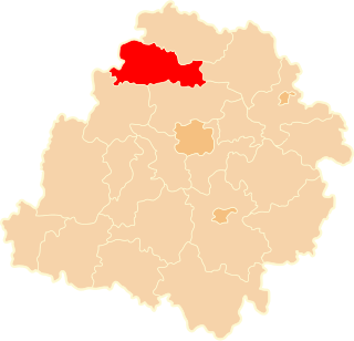
Błonie is a village in the administrative district of Gmina Łęczyca, within Łęczyca County, Łódź Voivodeship, in central Poland. It lies approximately 6 kilometres (4 mi) north-west of Łęczyca and 40 km (25 mi) north-west of the regional capital Łódź.
Bronno is a village in the administrative district of Gmina Łęczyca, within Łęczyca County, Łódź Voivodeship, in central Poland. It lies approximately 8 kilometres (5 mi) west of Łęczyca and 40 km (25 mi) north-west of the regional capital Łódź.
Chrząstówek is a village in the administrative district of Gmina Łęczyca, within Łęczyca County, Łódź Voivodeship, in central Poland. It lies approximately 6 kilometres (4 mi) north of Łęczyca and 40 km (25 mi) north-west of the regional capital Łódź.
Dąbie is a village in the administrative district of Gmina Łęczyca, within Łęczyca County, Łódź Voivodeship, in central Poland. It lies approximately 7 kilometres (4 mi) north-west of Łęczyca and 41 km (25 mi) north-west of the regional capital Łódź.
Dobrogosty is a village in the administrative district of Gmina Łęczyca, within Łęczyca County, Łódź Voivodeship, in central Poland. It lies approximately 6 kilometres (4 mi) north-east of Łęczyca and 38 km (24 mi) north-west of the regional capital Łódź.
Garbalin is a village in the administrative district of Gmina Łęczyca, within Łęczyca County, Łódź Voivodeship, in central Poland. It lies approximately 6 kilometres (4 mi) north of Łęczyca and 41 km (25 mi) north-west of the regional capital Łódź.
Gawrony is a village in the administrative district of Gmina Łęczyca, within Łęczyca County, Łódź Voivodeship, in central Poland. It lies approximately 8 kilometres (5 mi) north of Łęczyca and 41 km (25 mi) north-west of the regional capital Łódź.
Kozuby is a village in the administrative district of Gmina Łęczyca, within Łęczyca County, Łódź Voivodeship, in central Poland. It lies approximately 5 kilometres (3 mi) north-east of Łęczyca and 38 km (24 mi) north-west of the regional capital Łódź.
Krzepocin Drugi is a village in the administrative district of Gmina Łęczyca, within Łęczyca County, Łódź Voivodeship, in central Poland. It lies approximately 8 kilometres (5 mi) north-west of Łęczyca and 42 km (26 mi) north-west of the regional capital Łódź.
Leszcze is a village in the administrative district of Gmina Łęczyca, within Łęczyca County, Łódź Voivodeship, in central Poland. It lies approximately 3 kilometres (2 mi) north-west of Łęczyca and 37 km (23 mi) north-west of the regional capital Łódź.
Mikołajew is a village in the administrative district of Gmina Łęczyca, within Łęczyca County, Łódź Voivodeship, in central Poland. It lies approximately 8 kilometres (5 mi) north-west of Łęczyca and 42 km (26 mi) north-west of the regional capital Łódź.
Pilichy is a village in the administrative district of Gmina Łęczyca, within Łęczyca County, Łódź Voivodeship, in central Poland. It lies approximately 10 kilometres (6 mi) north-west of Łęczyca and 45 km (28 mi) north-west of the regional capital Łódź.
Prusinowice is a village in the administrative district of Gmina Łęczyca, within Łęczyca County, Łódź Voivodeship, in central Poland. It lies approximately 11 kilometres (7 mi) west of Łęczyca and 42 km (26 mi) north-west of the regional capital Łódź.

Siedlec is a village in the administrative district of Gmina Łęczyca, within Łęczyca County, Łódź Voivodeship, in central Poland. It lies approximately 9 kilometres (6 mi) north-west of Łęczyca and 44 km (27 mi) north-west of the regional capital Łódź.
Siemszyce is a village in the administrative district of Gmina Łęczyca, within Łęczyca County, Łódź Voivodeship, in central Poland. It lies approximately 8 kilometres (5 mi) north-west of Łęczyca and 42 km (26 mi) north-west of the regional capital Łódź.
Szarowizna is a village in the administrative district of Gmina Łęczyca, within Łęczyca County, Łódź Voivodeship, in central Poland. It lies approximately 8 kilometres (5 mi) north-west of Łęczyca and 43 km (27 mi) north-west of the regional capital Łódź.
Topola Szlachecka is a village in the administrative district of Gmina Łęczyca, within Łęczyca County, Łódź Voivodeship, in central Poland. It lies approximately 4 kilometres (2 mi) north of Łęczyca and 38 km (24 mi) north-west of the regional capital Łódź.
Wilczkowice Górne is a village in the administrative district of Gmina Łęczyca, within Łęczyca County, Łódź Voivodeship, in central Poland. It lies approximately 5 kilometres (3 mi) west of Łęczyca and 38 km (24 mi) north-west of the regional capital Łódź.
Zawada Górna is a village in the administrative district of Gmina Łęczyca, within Łęczyca County, Łódź Voivodeship, in central Poland. It lies approximately 8 kilometres (5 mi) north-west of Łęczyca and 42 km (26 mi) north-west of the regional capital Łódź.
Zduny is a village in the administrative district of Gmina Łęczyca, within Łęczyca County, Łódź Voivodeship, in central Poland. It lies approximately 6 kilometres (4 mi) west of Łęczyca and 37 km (23 mi) north-west of the regional capital Łódź.