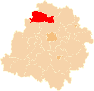
Jarochówek is a village in the administrative district of Gmina Daszyna, within Łęczyca County, Łódź Voivodeship, in central Poland. It lies approximately 3 kilometres (2 mi) west of Daszyna, 14 km (9 mi) north of Łęczyca, and 48 km (30 mi) north-west of the regional capital Łódź.
Skrzynki is a village in the administrative district of Gmina Daszyna, within Łęczyca County, Łódź Voivodeship, in central Poland. It lies approximately 7 kilometres (4 mi) south-west of Daszyna, 12 km (7 mi) north-west of Łęczyca, and 47 km (29 mi) north-west of the regional capital Łódź.
Upale is a village in the administrative district of Gmina Daszyna, within Łęczyca County, Łódź Voivodeship, in central Poland. It lies approximately 8 kilometres (5 mi) south of Daszyna, 6 km (4 mi) north of Łęczyca, and 40 km (25 mi) north-west of the regional capital Łódź.
Chorki is a village in the administrative district of Gmina Grabów, within Łęczyca County, Łódź Voivodeship, in central Poland. It lies approximately 11 kilometres (7 mi) north-west of Łęczyca and 45 km (28 mi) north-west of the regional capital Łódź.
Błonie is a village in the administrative district of Gmina Łęczyca, within Łęczyca County, Łódź Voivodeship, in central Poland. It lies approximately 6 kilometres (4 mi) north-west of Łęczyca and 40 km (25 mi) north-west of the regional capital Łódź.
Bronno is a village in the administrative district of Gmina Łęczyca, within Łęczyca County, Łódź Voivodeship, in central Poland. It lies approximately 8 kilometres (5 mi) west of Łęczyca and 40 km (25 mi) north-west of the regional capital Łódź.
Chrząstówek is a village in the administrative district of Gmina Łęczyca, within Łęczyca County, Łódź Voivodeship, in central Poland. It lies approximately 6 kilometres (4 mi) north of Łęczyca and 40 km (25 mi) north-west of the regional capital Łódź.
Dąbie is a village in the administrative district of Gmina Łęczyca, within Łęczyca County, Łódź Voivodeship, in central Poland. It lies approximately 7 kilometres (4 mi) north-west of Łęczyca and 41 km (25 mi) north-west of the regional capital Łódź.
Dobrogosty is a village in the administrative district of Gmina Łęczyca, within Łęczyca County, Łódź Voivodeship, in central Poland. It lies approximately 6 kilometres (4 mi) north-east of Łęczyca and 38 km (24 mi) north-west of the regional capital Łódź.
Garbalin is a village in the administrative district of Gmina Łęczyca, within Łęczyca County, Łódź Voivodeship, in central Poland. It lies approximately 6 kilometres (4 mi) north of Łęczyca and 41 km (25 mi) north-west of the regional capital Łódź.
Gawrony is a village in the administrative district of Gmina Łęczyca, within Łęczyca County, Łódź Voivodeship, in central Poland. It lies approximately 8 kilometres (5 mi) north of Łęczyca and 41 km (25 mi) north-west of the regional capital Łódź.
Kozuby is a village in the administrative district of Gmina Łęczyca, within Łęczyca County, Łódź Voivodeship, in central Poland. It lies approximately 5 kilometres (3 mi) north-east of Łęczyca and 38 km (24 mi) north-west of the regional capital Łódź.
Krzepocin Drugi is a village in the administrative district of Gmina Łęczyca, within Łęczyca County, Łódź Voivodeship, in central Poland. It lies approximately 8 kilometres (5 mi) north-west of Łęczyca and 42 km (26 mi) north-west of the regional capital Łódź.
Mikołajew is a village in the administrative district of Gmina Łęczyca, within Łęczyca County, Łódź Voivodeship, in central Poland. It lies approximately 8 kilometres (5 mi) north-west of Łęczyca and 42 km (26 mi) north-west of the regional capital Łódź.
Pilichy is a village in the administrative district of Gmina Łęczyca, within Łęczyca County, Łódź Voivodeship, in central Poland. It lies approximately 10 kilometres (6 mi) north-west of Łęczyca and 45 km (28 mi) north-west of the regional capital Łódź.
Siemszyce is a village in the administrative district of Gmina Łęczyca, within Łęczyca County, Łódź Voivodeship, in central Poland. It lies approximately 8 kilometres (5 mi) north-west of Łęczyca and 42 km (26 mi) north-west of the regional capital Łódź.
Szarowizna is a village in the administrative district of Gmina Łęczyca, within Łęczyca County, Łódź Voivodeship, in central Poland. It lies approximately 8 kilometres (5 mi) north-west of Łęczyca and 43 km (27 mi) north-west of the regional capital Łódź.
Topola Szlachecka is a village in the administrative district of Gmina Łęczyca, within Łęczyca County, Łódź Voivodeship, in central Poland. It lies approximately 4 kilometres (2 mi) north of Łęczyca and 38 km (24 mi) north-west of the regional capital Łódź.
Zawada Górna is a village in the administrative district of Gmina Łęczyca, within Łęczyca County, Łódź Voivodeship, in central Poland. It lies approximately 8 kilometres (5 mi) north-west of Łęczyca and 42 km (26 mi) north-west of the regional capital Łódź.
Rogaszyn is a village in the administrative district of Gmina Piątek, within Łęczyca County, Łódź Voivodeship, in central Poland. It lies approximately 4 kilometres (2 mi) north of Piątek, 22 km (14 mi) east of Łęczyca, and 36 km (22 mi) north of the regional capital Łódź.