
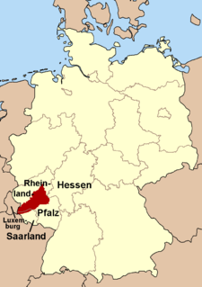
The Amseldell is a former park-like leisure area about two kilometres west of the German town of Trippstadt in the Palatine Forest in the state of Rhineland-Palatinate.
The Amseldell is a former park-like leisure area about two kilometres west of the German town of Trippstadt in the Palatine Forest in the state of Rhineland-Palatinate.
The Amseldell lies in field parcel (Gewann) of the same name in the middle of the forest, to the left of and above the near-natural valley of the Karlstal through which the Moosalb stream flows. The paths climbing from the valley are barely discernable today. One of them begins diagonally opposite the lower entrance to the Karlstal gorge.
This narrow track runs past a rock cave on the left-hand side. The rock, which acts as the roof of the cave, was sealed by a rough outer wall with door and window openings at the front. A woman, known locally as the "Rock Woman" (Felsenweib) lived here until 1843. [1] [2] This is one of the many cave dwellings that existed in the Palatinate region, the Alsace and the Harz Mountains (for example, in Langenstein) until about the middle of the 19th century.
A spur branches off one of the forest and cultural-historical footpaths and leads to the Amseldell. The path starts in the hamlet of Johanniskreuz and was waymarked in 1997 under the motto "track search" (Spurensuche). A flyer about the route, which is 21 km long and with orange and yellow waymarks, contains additional information about the Amseldell; the flyer is available in Trippstadt and Johanniskreuz.
The name Amseldell means "Blackbird Hollow" and suggests it was a hollow where blackbirds could be seen. It probably relates, therefore, to a time when the blackbird was still a shy, woodland bird, i.e. before the 19th century.
The leisure park in the Amseldell was created in the 19th century under Lord (Freiherr) Carl von Gienanth (1818–1890), whose family managed an ironworks in Trippstadt and, from 1833, also owned Trippstadt House. Its aim was to enhance the walk through the Karlstal valley, which had already been landscaped in the 1780s by garden architect, Friedrich Ludwig Sckell. [3] In 1890, after the death of Carl von Gienanth, his estate in Karlstal and Amseldell was donated to the Trippstadt tourist association, who looked after both sites until the 1930s. [2] In May 1914, the Amseldell site was the venue for a regional gymnastics festival in which about 250 gymnasts took part.
The park was conceived as a site for various leisure pursuits. Today it is very run down and in need of significant restoration. Recognisable remains are a maze made of hedges, a firing range made of wood and stone, and a hut.

Franconia is a region in Germany, characterised by its culture and language, and may be roughly associated with the areas in which the East Franconian dialect group, colloquially referred to as "Franconian", is spoken. There are several other Franconian dialects, but only the East Franconian ones are colloquially referred to as "Franconian".
The Hunsrück is a low mountain range in Rhineland-Palatinate, Germany. It is bounded by the river valleys of the Moselle (north), the Nahe (south), and the Rhine (east). The Hunsrück is continued by the Taunus mountains on the eastern side of the Rhine. In the north behind the Moselle it is continued by the Eifel. To the south of the Nahe is the Palatinate region.

Sequoia National Park is an American national park in the southern Sierra Nevada east of Visalia, California. The park was established on September 25, 1890 to protect 404,064 acres of forested mountainous terrain. Encompassing a vertical relief of nearly 13,000 feet (4,000 m), the park contains the highest point in the contiguous United States, Mount Whitney, at 14,505 feet (4,421 m) above sea level. The park is south of, and contiguous with, Kings Canyon National Park; both parks are administered by the National Park Service together as the Sequoia and Kings Canyon National Parks. UNESCO designated the areas as Sequoia-Kings Canyon Biosphere Reserve in 1976.

Bad Dürkheim is a spa town in the Rhine-Neckar urban agglomeration, and is the seat of the Bad Dürkheim district in Rhineland-Palatinate, Germany.

The Palatinate Forest, sometimes also called the Palatine Forest, is a low-mountain region in southwestern Germany, located in the Palatinate in the state of Rhineland-Palatinate. The forest is a designated nature park covering 1,771 km2 and its highest elevation is the Kalmit.

Elmstein is an Ortsgemeinde – a municipality belonging to a Verbandsgemeinde, a kind of collective municipality – in the Bad Dürkheim district in Rhineland-Palatinate, Germany.

The Soonwald is a forested, low mountain region, up to 657.5 m above sea level (NN), which forms part of the Hunsrück mountains in the German Central Uplands. It lies within the counties of Rhein-Hunsrück-Kreis and Bad Kreuznach in the state of Rhineland-Palatinate.
Stein Castle in Stein an der Traun is the most important cave castle in Germany.

The Moosalb is a stream in West Palatinate in the German state of Rhineland-Palatinate. The upper Moosalb valley is also called the Hammertal on account of the many witnesses, in the form of ruined buildings and structures, to the iron smelting and working industries of the 18th and 19th centuries.
The Eiswoog is a reservoir, roughly six hectares in area, on the Eisbach stream, locally also called die Eis, in the German state of Rhineland-Palatinate. It is oriented from south to north in the water meadows near the source of the stream in part of the northern Palatinate Forest known as the Stumpfwald.
The Wasgau is a Franco-German hill range in the German state of Rhineland-Palatinate and the French departments of Bas-Rhin and Moselle. It is formed from the southern part of the Palatine Forest and the northern part of the Vosges mountains, and extends from the River Queich in the north over the French border to the Col de Saverne in the south.

The Karlstal is the valley of the Moosalb stream located near Trippstadt in the Palatine Forest in the German state of Rhineland-Palatinate. It is registered as a nature reserve - number 335 055 - under the name of Karlstalschlucht.

The Drachenfels is a hill in the northern part of the Palatine Forest in the German state of Rhineland-Palatinate) on the forest estate of the county town of Bad Dürkheim. At 570.8 m above sea level (NHN), it is the highest point of the Palatine Forest north of the Hochspeyerbach - Speyerbach line. The Drachenfels area has been designated as a nature reserve.

Walking routes in the Palatine Forest fall into two categories. The first are longer walking routes, most of which are maintained by the Palatine Forest Club, or PWV, and which are linked to the national and international network of long distance paths. The second category are those local circular walks and themed walking routes, some of which are of wider regional importance, and which are maintained by municipal authorities. The Palatine Forest, as part of the Palatine Forest-North Vosges Biosphere Reserve, is an important conservation area. As a result, the Palatine Forest, the bunter sandstone landscape of the Palatine Forest Nature Park, the castles in the Dahner Felsenland and the cross-border paths into Alsace and the Vosges make the region particularly popular with ramblers and walkers.

Johanniskreuz is a tiny hamlet in the middle of the Palatine Forest in Germany and belongs to the municipality of Trippstadt in the district of Kaiserslautern in the state of Rhineland-Palatinate.

The Waterway trail on the Moosalbe is one of seven themed walks on the subject of hydrology in the German state of Rhineland-Palatinate. The path runs for over 33 km along the Moosalbe and Hirschalbe streams through the Palatine Forest and has 23 way stations.

The Palatine Ways of St. James are those sections of the Way of St. James in the Palatinate region of Germany and part of the historic pilgrimage route to the northwest Spanish town of Santiago de Compostela. It was there that, according to Christian tradition, the Apostle Saint James the Greater was buried.

The Sickingen Heights form a landscape in the western part of the German state of Rhineland-Palatinate. The region was named after the family of imperial knight, Franz von Sickingen (1481–1523), because most of the area belonged to the territory of the House of Sickingen in the Middle Ages.

Trippstadt House is an 18th-century, baroque schloss or manor house in the eponymous village in the German state of Rhineland-Palatinate.

The burgstall of the Altes Schloss is the site of an old castle near the village of Affalterthal in Bavaria, that was probably built in the High Middle Ages for the nobility. It lies within the municipality of Egloffstein in the Upper Franconian county of Forchheim.