
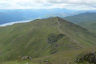
Stob Coire Sgreamhach is a mountain in Lorn, south of Glen Coe in the Scottish Highlands. Its height is 1,072 metres (3,517 ft). It is part of the Bidean nam Bian massif and is often considered a subsidiary peak of Bidean, though since the 1997 revision of Munros Tables it has been classified as a separate Munro. To the northeast is the ridge of Beinn Fhada.

Beinn Ìme is the highest mountain in the Arrochar Alps of Argyll, in the Southern Highlands of Scotland. It reaches 1,011 metres (3,317 ft), making it a Munro.

Meall a' Bhùiridh (IPA:[ˈmauɫ̪ˈaˈvuːɾʲɪʝ]) is a mountain on the edge of Rannoch Moor in the Highlands of Scotland. It lies near the top of Glen Coe and Glen Etive, overlooking the Kings House Hotel inn and the A82 road. The Glencoe Ski area is located on the northern slopes of the peak.
Beinn Ghlas is a mountain in the Breadalbane region of the Scottish Highlands. It lies on the north shore of Loch Tay and is part of the Ben Lawers Range. It is a Munro with a height of 1,103 metres (3,619 ft).

Maol Cheann-Dearg is a mountain in the Northwest Highlands of Scotland, between Upper Loch Torridon and Loch Carron, in the Coulags deer forest in Wester Ross. It is one of three Munros in this area and reaches a height of 933 metres (3,060 feet), it is slightly isolated from the other two being separated by a low col of 420 metres and therefore tends to be ascended separately. The mountain is typical of the region in that geologically it is made up of a mixture of sandstone and quartzite, it has a steep flanks and is rock-strewn. The dome shaped summit is littered with red sandstone boulders and lacking in vegetation making its translated name of "red-headed brow" especially appropriate. The mountain is not to be confused with Maol Chinn-dearg, another Munro on the south Glen Shiel ridge.

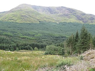
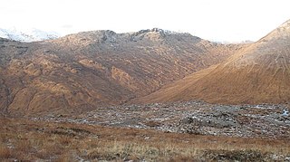
Beinn Sgulaird or Beinn Sguiliaird is a mountain in the Lorn region of the Scottish Highlands, between Glen Creran and Glen Etive. It has a height of 937 m (3074 ft) and is classed as a Munro. The mountain takes the form of a long ridge which runs from southwest to northeast, three kilometres of which lie above 800 m. Hillwalkers commonly traverse the ridge from north to south, as this gives the best views of the Hebrides to the west, in particular the Isle of Mull. While most walkers start from Glen Creran to the west, an ascent from Glen Etive is also possible.

Beinn a' Chreachain is a Scottish mountain, with a conical top, to the north-west of Loch Lyon.

Sgurr Mhurlagain is a mountain in the Northwest Highlands, Scotland, west of the village of Spean Bridge in Lochaber.
Fraochaidh is a mountain in the Grampian Mountains, located between Glen Coe and Oban on the west coast of Scotland. It lies on the border of Highland and Argyll and Bute.

A' Ghlas-bhienn is a mountain in the Northwest Highlands of Scotland. It lies in the Kintail area of Ross-shire, close to the settlement of Morvich.

An Sgarsoch is a mountain in the Grampian Mountains of Scotland. It lies north in a very remote part of the Highlands, on the border of Aberdeenshire and Perthshire.
Ruadh-stac Beag is a mountain in the Northwest Highlands of Scotland. An outlier of the Munro Beinn Eighe but a mountain in its own right, it is located in the Torridon Hills of Wester Ross.

Ruadh Stac Mor or Ruadh-Stac Mòr (Gaelic) is a mountain with a height of 919 metres (3,015 ft) in the Northwest Highlands of Scotland. It is located in the Dundonnell and Fisherfield Forest in Wester Ross.
Meall nan Eun is a mountain in the Grampian Mountains of Scotland. It is located east of Glen Etive in Argyll and Bute.

Beinn na h-Uamha is a mountain in the Northwest Highlands of Scotland. It lies in the Ardgour area of Lochaber, west of the village of Corran.

Creag Ghuanach is a mountain in the Grampian Mountains of Scotland. It is located in Lochaber, at the southern head of Loch Treig.

Sgurr a' Gharaidh is a mountain in the Northwest Highlands of Scotland. It lies in Wester Ross, north of Loch Carron.
Braigh nan Uamhachan is a mountain in the Northwest Highlands of Scotland. It is located north of Glenfinnan in Lochaber.

Glas Bheinn (792 m) is a mountain in the Grampian Mountains of Scotland, northeast of the village of Kinlochleven in Lochaber.

Creach Bheinn is a mountain in the Grampian Mountains of Scotland. It rises above the head Loch Creran in Argyll.
