
Chittoor is a city and district headquarters in Chittoor district of the Indian state of Andhra Pradesh. It is also the mandal and divisional headquarters of Chittoor mandal and Chittoor revenue division respectively. The city has a population of 153,756 and that of the agglomeration is 175,647.

Vizianagaram district is one of the six districts in the Uttarandhra region of the Indian state of Andhra Pradesh with its headquarters located at Vizianagaram. The district was once the part of ancient Kalinga.Saripilli Dibbilingeswara temple, Jayathi Mallikarjuna Temple are the finest examples of ancient Eastern Ganga Dynasty built monuments in the district. The district is bounded on the east by the district of Srikakulam, north by Parvathipuram Manyam south by Visakhapatnam, Anakapalli, southeast by the Bay of Bengal, and west by Alluri Sitharama Raju district. It was formed on 1 June 1979, with some parts carved from the neighbouring districts of Srikakulam and Visakhapatnam. The district is named after the princely state of Vizianagaram. In 2011, it was the least populous district in Andhra Pradesh.

Nizamabad district is a district located in the north-western region of the Indian state of Telangana. The city of Nizamabad is the district headquarters. The district share boundaries with Jagtial, Sircilla, Nirmal, Kamareddy districts and with Nanded district of the state boundary of Maharashtra.

Visakhapatnam district is one of the six districts in the Uttarandhra region of the Indian state of Andhra Pradesh, headquartered at Visakhapatnam. It is one of the twenty-six districts in Andhra Pradesh state. The district shares borders within the north and east, Vizianagaram district and South Anakapalli district in the south-west and Bay of Bengal in the south.

Gajuwaka is a major residential area of Visakhapatnam City, India. This neighborhood of Visakhapatnam is considered the biggest shopping district in Andhra Pradesh by revenue. Though conceived as a residential locality, it is now one of the principal shopping districts of the city. The Gajuwaka area of Visakhapatnam has the highest per capita income in Andhra Pradesh.

Tadepalligudem is a city in West Godavari district of the Indian state of Andhra Pradesh. Tadepalligudem is the judicial headquarter of West Godavari. It is a Selection Grade municipality and the mandal headquarters of Tadepalligudem mandal and Tadepalligudem Revenue Division. Tadepalligudem is one of the biggest cities in West Godavari district

Anakapalli is a residential neighborhood in the city of Visakhapatnam, also the headquarters of Anakapalli district of Andhra Pradesh. In 2015 Anakapalli municipality was merged with the Greater Visakhapatnam Municipal Corporation. It falls under zone 7 of GVMC. It contains India's second largest jaggery market.
{{Infobox settlement | name = Kandukur | native_name = | native_name_lang = | other_name = | settlement_type = Town | image_skyline = | image_alt = | image_caption = | nickname = | pushpin_map = India Andhra Pradesh#India | pushpin_label_position = right | pushpin_map_alt = | pushpin_map_caption = Location in Andhra Pradesh, India | pushpin_mapsize = 200 | coordinates = 15.2166650°N 79.9042°E | subdivision_type = Country | subdivision_name = India | subdivision_type1 = State | subdivision_type2 = District | subdivision_name1 = Andhra Pradesh | subdivision_name2 = SPSR Nellore | established_title = | established_date = | founder = | named_for = | government_type = Municipal Council | governing_body = Kandukuru Municipal Council | leader_title1 = Chairman | leader_name1 = Vacant | leader_title2 = Deputy Chairman | leader_name2 = Vacant | leader_title3 = MLA | leader_name3 = Inturi Nageswar Rao (TDP) | leader_title4 = MP | leader_name4 = [[Vemireddy Prabakar reddy]{TDP}]] | unit_pref = Metric | area_footnotes = | area_total_km2 = 33.06 | area_rank = | elevation_footnotes = | elevation_m = | population_total = 57,246 | population_as_of = 2011 | population_footnotes = | population_density_km2 = auto | population_rank = 26th (Towns in AP) | population_demonym = | timezone1 = IST | utc_offset1 = +5:30 | postal_code_type = PIN | postal_code = 523 105 | registration_plate = | website = | footnotes = | image_map = | map_alt = Dynamic map of village | map_caption = Dynamic map }} Kandukur or Kandukuru is a town in SPSR Nellore district of the Indian state of Andhra Pradesh. It is a municipality and the headquarters of Kandukur mandal as well as Kandukur revenue division. Kandukur Mandal is located at the south-east side of the Prakasam District having geographical area around 225 km2.There is only 1 city in the Kandukur Mandal, which is Kandukur Municipality having an area of 37.63 km2.

Kothavalasa is a town in Vizianagaram district of the Indian state of Andhra Pradesh. It is located in Kothavalasa mandal of Vizianagaram revenue division. It is located 30 km from the city of Visakhapatanam

Narsipatnam is a census town in Anakapalle district of the Indian state of Andhra Pradesh. It was upgraded from a gram panchayat into municipality in 2012. The town is spread over an area of 42 km2 (16 sq mi) The resting place of the revolutionary Indian freedom fighter Alluri Sitarama Raju is located in Krishna Devi Peta village of From Narsipatnam to labasingi Village 30 km only.. labasingi most popular winter tourism place..so many Tourists enjoy -2 degree's temparature there.. Narsipatnam town is 43 km away from Tuni. And it is 72 km away from Visakhapatnam.

Tuni is a City in Kakinada district of the Indian state of Andhra Pradesh. It is a second biggest city in Kakinada district. Freedom fighter Alluri Sitaramaraju studied here. It is a major commercial marketing centre for more than 200+ surrounding villages in the district. Tuni is a border point for the district of Kakinada. It is known for mango production, with nearly 250 varieties being exported from the area. Tuni City is also known as "Mango City". Tuni is also famous for the production of betel leaves and jute bags. A variety of cashew nuts are also produced in Tuni.

Pakala is a town in Tirupati district of the Indian state of Andhra Pradesh. It is the mandal headquarters of Pakala mandal. It comes under Tirupati revenue division.
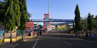
Palasa is one of the twin towns located in the Srikakulam district of Andhra Pradesh, India. The town is situated between Srikakulam and Berhampur. It is categorized as the second grade municipality. Also the town serves as the headquarters of Palasa Mandal.

Payakaraopeta is a City in anakapalli district in the state of Andhra Pradesh in India. Payakaraopeta City is a gate Way of Visakhapatnam. Tuni and Payakaraopeta Cities are Twin Cities in Andhra Pradesh. Payakaraopeta City is fastest growing City in Andhra Pradesh. In the year 2011, The first AC library in united Andhra Pradesh was opened here.

Elamanchili is a town in Anakapalli district of the Indian state of Andhra Pradesh. It is a municipality and also the mandal headquarters of Elamanchili mandal. The town is spread over an area of 39 km2 (15 sq mi), which is under the jurisdiction of Visakhapatnam Metropolitan Region Development Authority. This town has historical importance dating back to 7th Century AD.

Narasingapalli is a village in Anakapalli district of the Indian state of Andhra Pradesh. It is situated in Kasimkota mandal of Anakapalli revenue division.

Podili is a Municipality Town in Prakasam district of the Indian state of Andhra Pradesh. It is the mandal headquarters of Podili mandal. Podili is also known as Prudulapuri. Before British rule its name was "Prudulapuri" meaning "Head quarters of the universe". There is purana reference to this related to Prudhu Chakravarthi.
Anandapuram mandal is one of the 46 mandals in Visakhapatnam district of the Indian state of Andhra Pradesh. It is under the administration of Bhemunipatnam revenue division and the headquarters are located at Anandapuram. Anandapuram mandal is bounded by Bheemunipatnam mandal to the east, Chinagadila to the south, Padmanabham to the north and Kothavalasa to the west.

Visakhapatnam Metropolitan Region is the metropolitan area covered by the city of Visakhapatnam in the Indian state of Andhra Pradesh. The entire region is spread over the districts of Visakhapatnam, Vizianagaram and Anakapalli. Under the jurisdiction of Visakhapatnam Metropolitan Region Development Authority, it covers an area of 7,328.86 km2 (2,829.69 sq mi) and has a population over of 40.7 lakhs according to 2011 census.

Anakapalli district is a district in the Indian state of Andhra Pradesh. It was formed on 4 April 2022 from Anakapalli and Narsipatnam revenue divisions of the old Visakhapatnam district. The administrative headquarters are at Anakapalli. Sankaram, 3 km from Anakapalli is identified to be developed as the headquarters of the new district.

